Imagine that: open streets, people walking, neighbors socially distancing while they get some air — and not a cop in sight.
New York City's "open streets" plan — which starts with 7.14 miles of space reclaimed from automobiles and repurposed for people and is expected to expand to 40 miles by the end of May — began today with a distinctly different approach than an earlier open-space program that collapsed under the weight of massive police staffing requirements. But its future success may depend too much on neighborhood groups and the business community going forward.
Initial response was positive — in fact, two residents of the Upper East Side immediately demanded more.
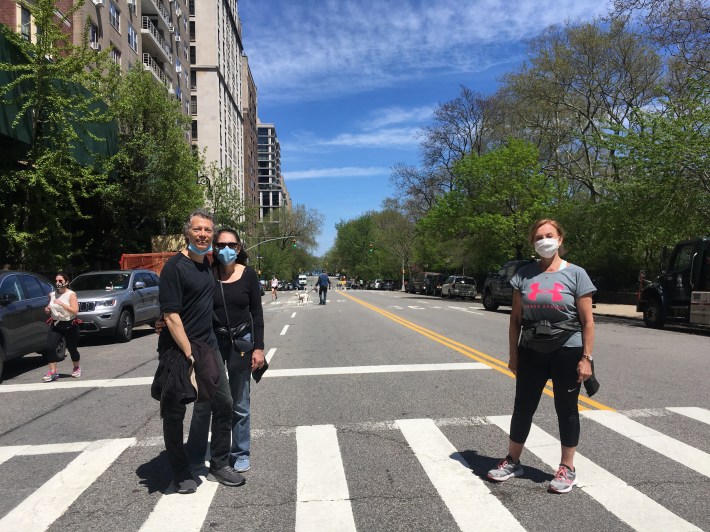
"All of Park Avenue," East End Avenue residents Harry and Nicole said in unison when Streetsblog asked what roadways should be next on the mayor's list for deautomobilization.
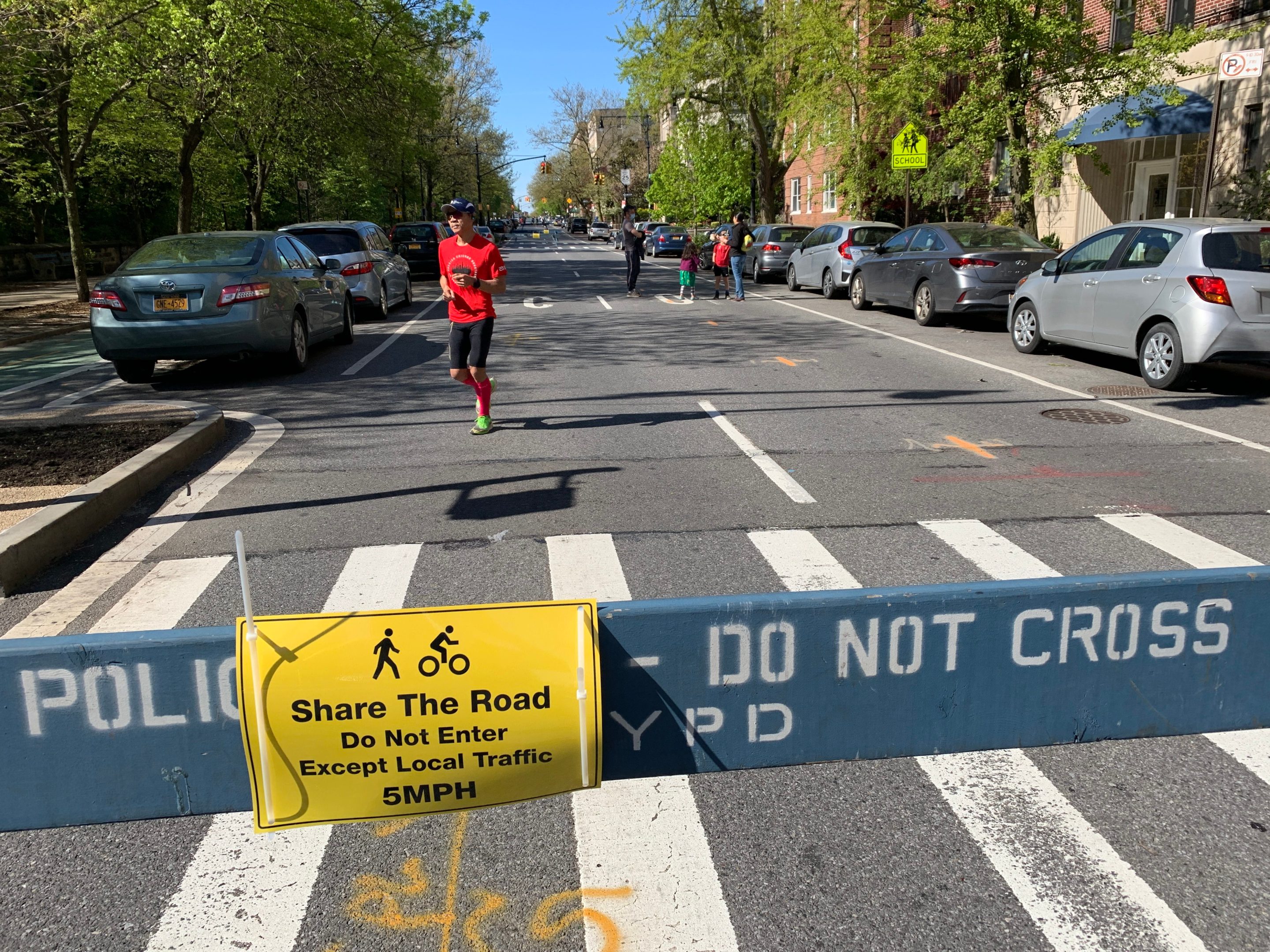
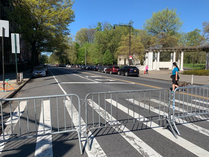
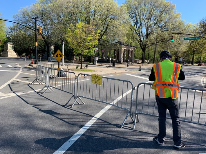
At least on the first day, no cops were manning barricades and sawhorses that are deployed in areas all over the city (full list here) to restrict autos from encroaching on what is now space for socially responsible recreation.
The change in approach came less than eight days after Department of Transportation Commissioner jointly testified at the City Council with NYPD Transportation Bureau Deputy Chief Mike Pilecki that open streets were "not possible" without legions of cops (which became the subject of two Streetsblog editorials).
Under fire from street safety and public health advocates, Trottenberg told Streetsblog this morning that the city's thinking had evolved. She was asked "what changed" between that testimony and Saturday. Here is her full answer:
You can see it with your own eyes. We took a deeper look at that and decided, in consultation with the mayor, to try to evolve our approach. Obviously, we had heard from a lot of folks that the police-heavy approach was potentially not so necessary and that's what we're trying today. PD, DOT, Parks will be monitoring, but we are not manning the barricades all day long. We are certainly looking for community groups and the citizen army to make this program a success. One of the tradeoffs is we're not going to staff it heavily with city officials, we kinda need neighborhood folks to step up and help [application link here].
Trottenberg's answer set up Streetsblog's follow-up question, which centered on a long list of guidelines that the city has created as part of its outreach effort to community groups that city officials claim will be needed if the program is going to reach its initial 40-mile, and eventual 100-mile, goal.
The guidelines suggest that well-organized neighborhoods will benefit sooner than other neighborhoods — especially those without business improvement districts. BIDs do not represent residents; they represent a neighborhood's business community.
Streetsblog's question:
Streetsblog: The city sent an email to community boards with a list under the headline, "GUIDELINES: Basic requirements for Open Streets” that asks "responsible neighbors, block associations, BIDS, local non-profits” etc to provide a "staffing plan” that involves setting up barriers and "monitoring" throughout the day. I wonder though, there are some communities in town — including those that the mayor says would most benefit from open space — that may not be as organized as neighborhoods like Park Slope, indeed, where essential workers may simply be trying to survive on a daily basis, going to work, etc. What provisions does the city have for helping those neighborhoods, if indeed they need help or don't have a business improvement district.
Trottenberg: Right right. It's going to be a combination. As soon as the word got out about this we are starting to hear from all kinds of groups. As you know [a reference to our coverage of Broadway], there are a lot of business improvement districts that have been excited about this, and we're hearing from elected officials and we hope in the coming weeks to roll out a bunch of different places. Neighborhoods, though, where we think we really need to do this, but maybe there isn't a local partner, those may be places where you will see more city staff stepping in to make sure it will happen.
Many activists did not see a big problem going forward.
"NYPD is concerned that the barrier be moved over and thru traffic starts to use the street and put people at risk, and we should be equally concerned about that. That's fair," said Christine Berthet, a member of Manhattan Community Board 4 and the founder of the Clinton-Hells Kitchen group CHEKPEDS.
“'Staffing' is probably the price to pay to get NYPD out of the picture. So I envision that people who live close to the entrance, or the corner store owner, or anyone for that matter, can go and move back the barrier if displaced. This will happen organically. There are always eyes on the street."
But some residents are beginning to question the involvement of business improvement districts.
"Neighborhood groups shouldn’t be expected to do the city’s work!" said one Streetsblog reader who requested anonymity. "Regulating traffic is not the duty and purpose of neighborhood groups. This is all car privilege. And it empowers BIDs. BIDs are essentially privatizing public services."
A city official later told Streetsblog that the administration is aware that "we have a lot more work to do."
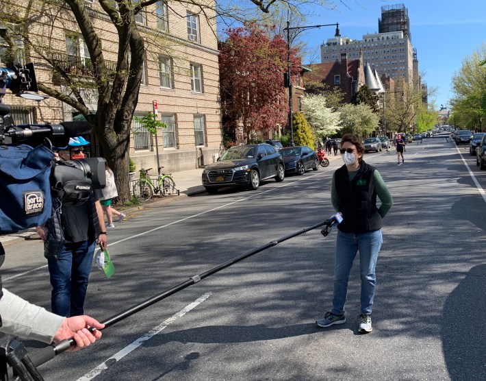
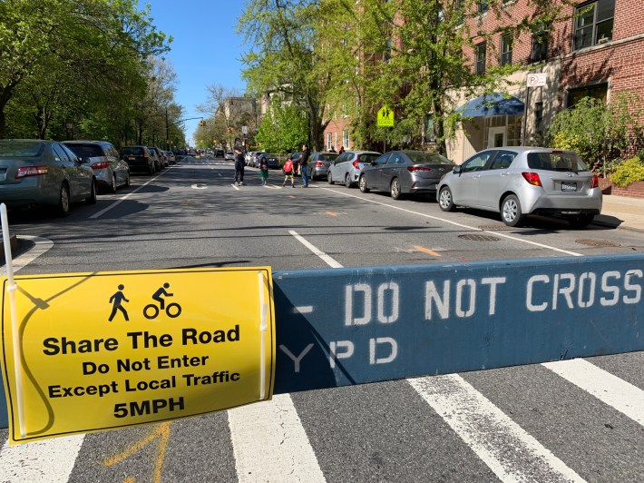
Logistics aside, the first day of open streets provided a small number of city residents a chance to access more public space that has long been surrendered to car drivers. Very few residents of Prospect Park West between Garfield Place and Third Street in Park Slope or Parkside Avenue between Park Circle and Ocean Avenue were aware what was going on, and only tentatively took advantage of the space, with many asking reporters what was "going on."
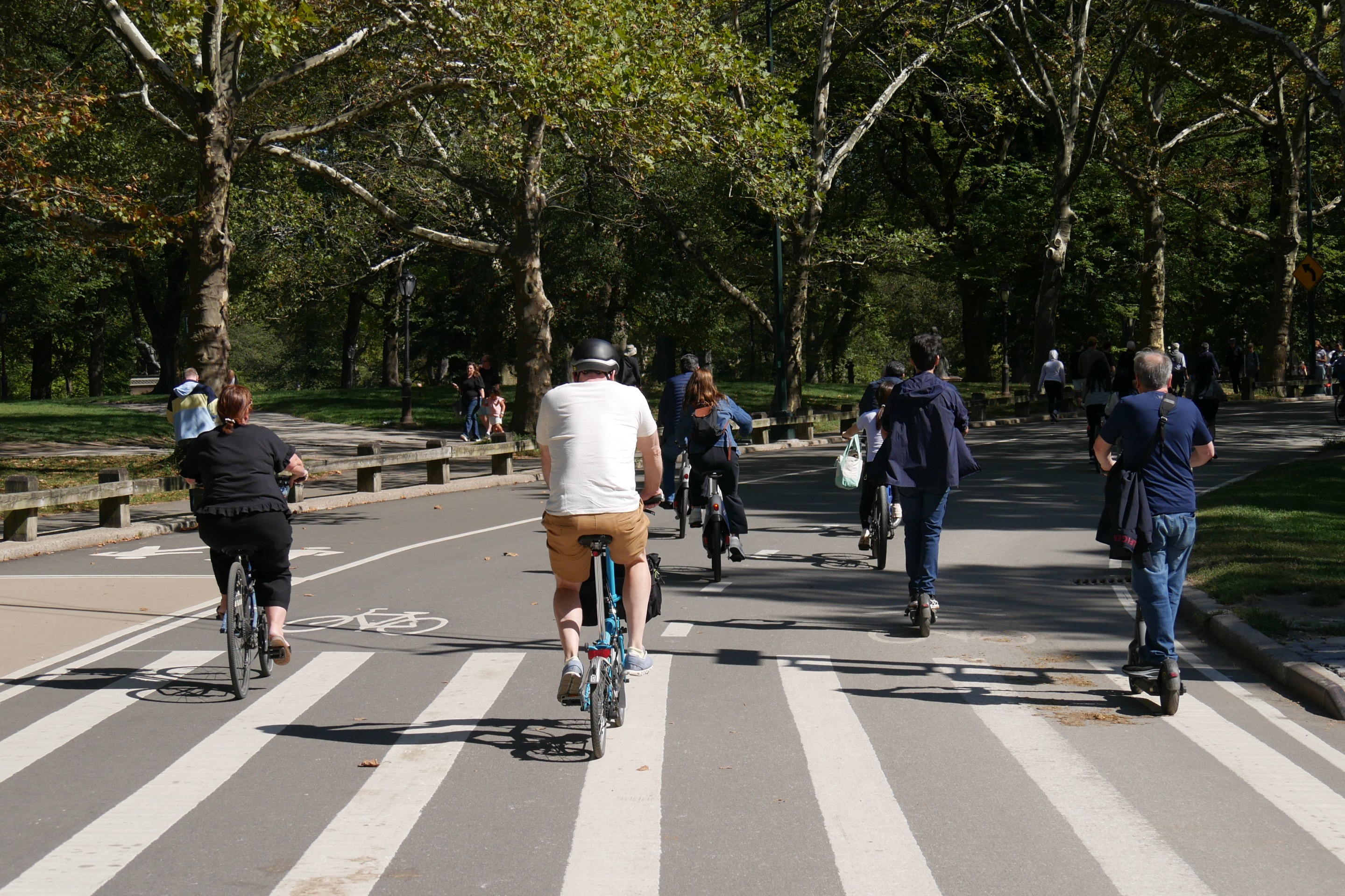
Within a few hours, however, the road space was being enjoyed by the public.
Residents of Queens were disappointed at how little public space they received in the first round, including a tiny portion of Court Square and a larger segment of Flushing Meadows Corona Park where residents have long complained that cars should not even be allowed.
For context, here's a snap of @NYCParks desert, #Queens. At least 3 miles of this have hundreds of people waiting in food lines! @jessicaramos @Grace4NY @CMPeterKoo @GershKuntzman @LAShepard221 @Adrian_Benepe pic.twitter.com/MWWqAHkjep
— Make Queens Safer (@MakeQueensSafer) May 2, 2020
And former city Parks Commissioner Adrian Benepe suggested that the mayor needs to think more broadly.
The whole idea of open streets is to help neighborhoods that lack large parks and open space—not immediately next door to a 580-acre park! It’s a nice thing here, but vital in places like Brownsville and Borough Park! @NYCMayorsOffice @GershKuntzman @TransAlt @BrooklynSpoke
— Adrian Benepe (@Adrian_Benepe) May 2, 2020
Transportation Alternatives spokesman Joe Cutrufo said the group was cautiously optimistic, even though it has long pushed for more open space.
"It's easy to forget where we were just a week ago, so it's good to see these first seven miles taking shape," said Cutrufo. "Clearly, streets within and abutting parks ... is the low-hanging fruit, and the sorts of streets the city would be able to close relatively quickly. Moving forward, the priority has to be streets in neighborhoods hit hardest by the pandemic, where air pollution is high, where parks are few, and where sidewalks are narrow."
Former DOT official Jon Orcutt is also looking for the mayor to act more boldly in the future.
“Today we’re seeing the lowest of the low-hanging fruit," said Orcutt, of Bike New York. "In the 93 miles still to come, we expect bigger stretches of city streets, which require more work to set up. Let’s remember, we’re not even a week on from the city saying all this was impossible.”
Here are our reports from the field. First, some photos from Brooklyn:
Streetsblog correspondent Luke Szabados started his day on Laurel Hill Terrace, along Highbridge Park in Upper Manhattan. With side streets free of traffic, kids could play:
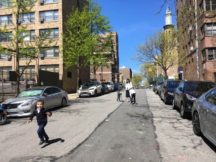
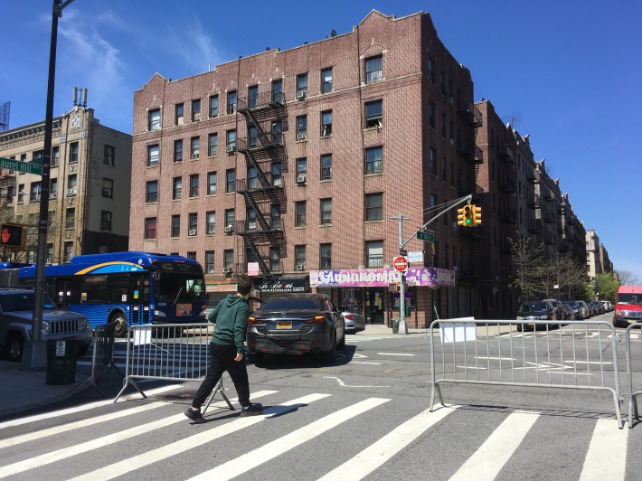
Szabados saw ample evidence that NYPD enforcement is not needed. On Laurel Hill Terrace, residents moved city barricades to allow vehicles to access a given block and then moved them back.
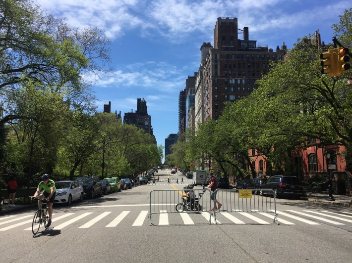
In the mayor's own neighborhood, East End Avenue, next to Gracie Mansion, is a paradise for strollers and cyclists. The roadway, as its own Council Member Ben Kallos pointed out on Friday, was a perfect choice for the removal of cars.
In Queens, a forlorn roadway inside Flushing Meadows Corona Park was being widely used by residents, but the park itself remains filled with cars.
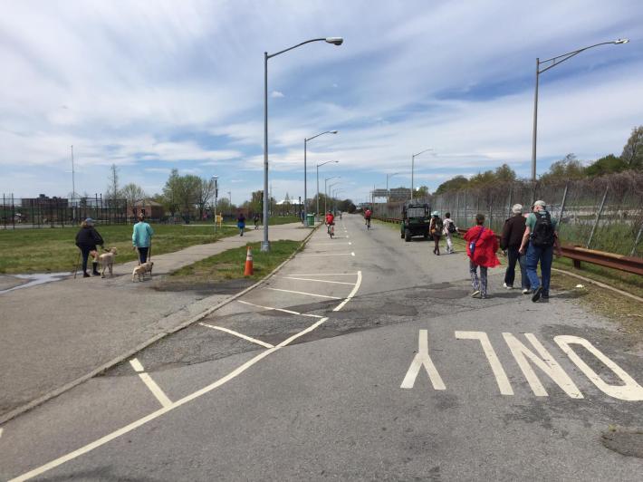
That particular "park," which is sandwiched between the Grand Central Parkway and the Van Wyck Expressway, has always seemed like a civic center with some trees. Technically mapped as parkland, it includes large stadia, museums, ballfields, relics of the 1964 World's Fair, parking lots and roads, roads, roads.
Here, a kid has to wait while drivers use a park roadway to get on a highway.
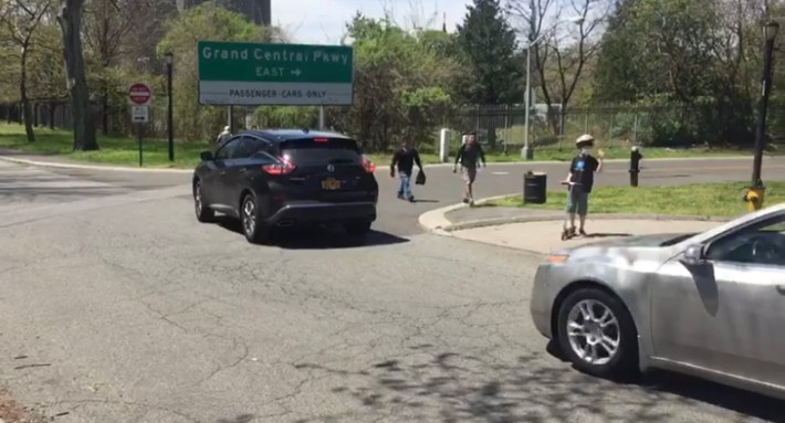
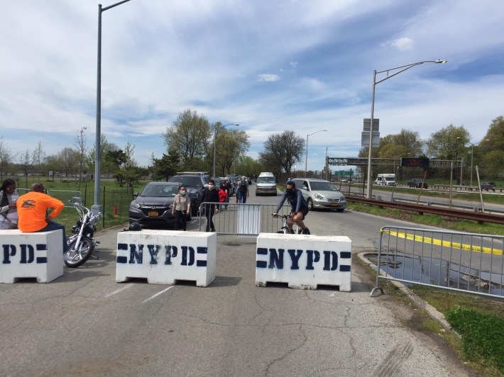
"They really couldn't have been less ambitious with regard to getting cars out of the park," said Friend of Streetsblog, Angela Stach, who also took the following picture of a roadway filled with cars — even though it's the main route to the "open street."
Check back for updates on this story as more reports come in. Or follow the #ThisIsStreetsblog tag on Twitter.
