What The Dickens? DOTs Final Truck Route Map Is A Tale Of Two Cities
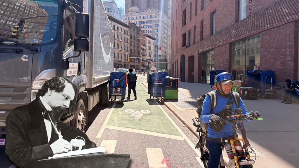
Want to really understand the city’s long-awaited new truck route map? Brush up on “A Tale of Two Cities.“
There’s a Dickensian quality to how two adjoining Brooklyn neighborhoods — Sunset Park and Bay Ridge — ended up looking so different on the Department of Transportation’s new Truck Route Network, the first-such revamp in over 50 years.
Neither neighborhood wanted an additional truck route put on the map, but only one, Bay Ridge, emerged without one. That simple victory might be Pyrrhic in the end, but it underscored the DOT’s challenge in dealing with an intractable truck problem in an age of expanding have-it-now deliveries.
A Charles Dickens-length book could be written about this year’s-long process; this 2,000-word story will have to suffice:
The road to the map
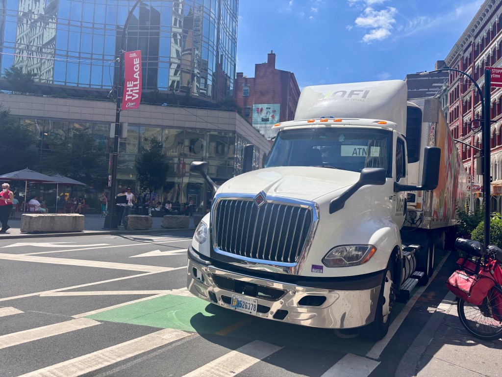
The DOT’s map of through and local routes for trucks is intended to move goods with efficiency, but it’s an imperfect tool to fix some inherent inequities associated with freight, including why so many warehouses are located in low-income neighborhoods.
The dangers, both physical and environmental, of living on or near an official truck route are real. The DOT analyzed safety near truck routes and found roads dedicated for big-rigs were far more dangerous than those which are not.
“Traffic crashes are most frequent along designated truck routes, particularly through truck routes,” and total injuries and fatalities along those routes are “significantly higher,” the report read.
That’s why Council Member Alexa Avilés (D-Sunset Park) introduced legislation forcing the DOT to redraw the map in the first place.
But the department’s initial proposed map, in late 2025, added about 3-percent more miles of truck routes, an increase that shocked many members of the public and their elected representatives. Avilés and others were unimpressed, but DOT argued that it was fighting a losing battle: E-commerce companies opened 21 last-mile warehouses since 2018 with a commensurate increase in trucks, and more of them headed for residential streets, not merely passing through.
“We knew that when we introduced the law that a safer truck route just wasn’t going to be about tweaking miles and routes in the city,” Avilés said. “It also meant that we would need major investment in street safety infrastructure.”
Manhattan residents get the most packages per square mile of any city in the U.S. and the numbers continue to trend up. Citywide, around 80 percent of households receive deliveries weekly, with 20 percent receiving four or more per week, according to DOT.
More at-home deliveries mean more truck traffic.
“Not only are people ordering online, they want something the same day,” said Sandra Rothbard, a former project manager in DOTs Freight Mobility Unit and the Founder of Freight Matters, a logistics planning consultancy. “Well, you can’t have something the same day and not have trucks double-parked and not have trucks on your street. That’s just physically impossible.”
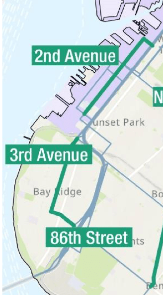
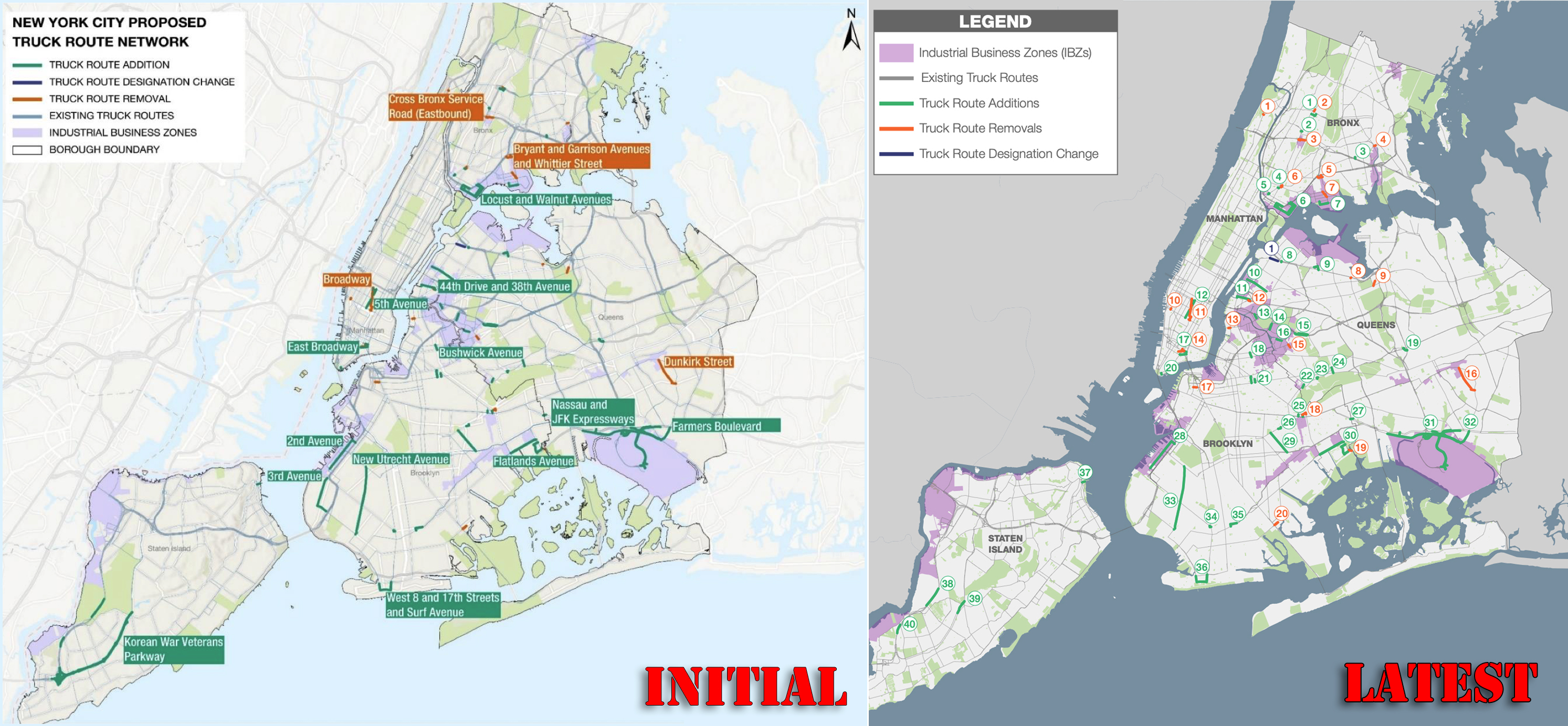
Specifically, the proposed map (right) included a new truck route on Third Avenue in Bay Ridge and a new one on Second Avenue in Sunset Park, which has more truck traffic because part of the neighborhood is set aside as an Industrial Business Zone. Sunset Park already had mapped truck routes on First and Third avenues. Just as Bay Ridge didn’t want its first truck route, Sunset Park didn’t want a third.
But therein lies the problem that DOT was trying to address with a new truck map: trucks are currently everywhere all the time. Putting a new route on a map is merely an effort to control the through movement of trucks — like channeling a river. But today’s truck traffic is a flood that is overwhelming current levies.
“Trucks really do need to be able to travel essentially on any street,” said Rachel Weinberger, a vice president at Regional Plan Association. “The city is basically trying to optimize for the new land-use patterns and the new patterns of demand for goods and freight. I don’t know if it makes me laugh or cry, but New Yorkers really love to complain about the trucks, but don’t realize that the trucks are there to satisfy their needs rather than just to put a thorn in their side.”
The department acknowledges the street-safety issues associated with freight traffic and has made general commitments to street redesigns. DOT also has multiple ongoing initiatives to try and curb freight traffic in general.
“We continue to work to deliver street redesigns to improve safety in environmental justice communities and to reduce the number of truck trips in the city with delivery alternatives through the use of ferry barges, e-cargo bikes, and other smaller, last-mile delivery options,” said spokesperson Mona Bruno.
The new map
In the end, Bay Ridge did not get a mapped truck route for the commercial section of Third Avenue between 65th and 86th street and on 86th Street from Third Avenue to Fort Hamilton Parkway, after Bay Ridge electeds, Council Member Kayla Santosuosso and state Sen. Andrew Gounardes, lobbied DOT to scrap their neighborhood from the map.
Meanwhile, Sunset Park got a new mapped route on a similarly sized section of Second Avenue, parallel to its existing truck routes. Avilés was not successful in blocking the addition.
But the material effect of these decisions is more nuanced than a simple line on a map. More truck route miles don’t mean more trucks — in fact, the routes are meant to restrict where trucks can travel to promote efficiency of movement.
“It’s not like with induced demand [when you] add a lane of highway [and get more traffic], because there are alternatives for cars,” said Rothbard. “Really, if you think about it, suggesting that trucks go on a different street is kind of NIMBYism. We all know trucks have to go somewhere, but saying, ‘They shouldn’t go on my street’ means they have to go on somebody else’s street.”
Regardless of the map, trucks are not going away any time soon. The city still relies on trucks for 90 percent of deliveries, and pilot programs such as ferries and cargo e-bikes are in the early stages.
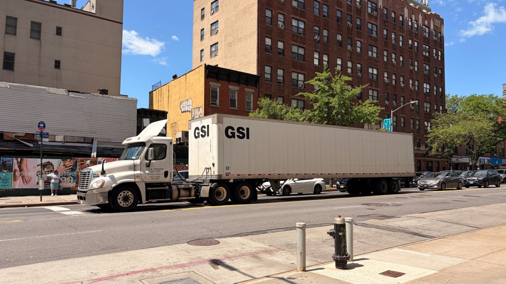
Plus, DOT was supposed to redesign the already-existing and dangerous Sunset Park Third Avenue truck route corridor to promote street safety and still hasn’t (though Mayor Mamdani recently committed to some kind of action there).
“Our community has long been plagued by truck traffic, and with no movement on Third Avenue safety improvements, it doesn’t make sense to add another route without mitigating the issues on Third Avenue,” local district leader Julio Peña said.
Council Member Santosuosso said the department told her the “sheer volume of negative feedback” about extending Third Avenue’s existing truck route into Bay Ridge influenced the decision to pull the proposal. She pushed back on the NIMBYism argument, saying that the issue wasn’t trucks in the neighborhood in general but concentrating them all on two already-congested streets.
“[DOT] tried to create an official truck route so enforcement would be easier and the problem is they chose the most congested avenues in all of Bay Ridge that are already chaotic on a normal day,” she said. “I don’t think of it as NIMBYism at all. People that know our neighborhood know that Fourth Avenue would’ve made a lot more sense [for a truck route]. It’s two lanes of traffic, there isn’t as much double parking. That would’ve been both safer and cleaner for everyone involved.”
The DOT said it kept the Sunset Park section because it is within an Industrial Business Zone and the route should more efficiently lead trucks where they need to get, in turn reducing vehicle miles travelled on side streets in the area.
Santosuosso thinks the initial proposal for a truck route on Third Avenue in Bay Ridge stemmed from pandemic-era complaints of off-route trucks on residential streets, which she thinks has ebbed — but with online orders continuing to surge, trucks will continue to ply the streets of the neighborhood.
The DOT said it is confident its new map will shift truck traffic off of local streets and on to the newly added routes.
“Truck routes are restrictions on where trucks can travel, and DOT designed a network update with the goal of shifting truck traffic off local streets and onto highways or other corridors with the capacity to handle the safe movement of people and freight,” said Bruno.
Everything depends on the NYPD
A truck route is only worth the paper it’s printed on — and in this case, we mean the summons paper. The DOT’s arrangement of lines on a map is meaningless without strong enforcement by the NYPD, which is, on paper, a Vision Zero partner of the DOT.
But enforcement of truck routes has declined dramatically since 2011, according to the DOT report that was released with the initial map:
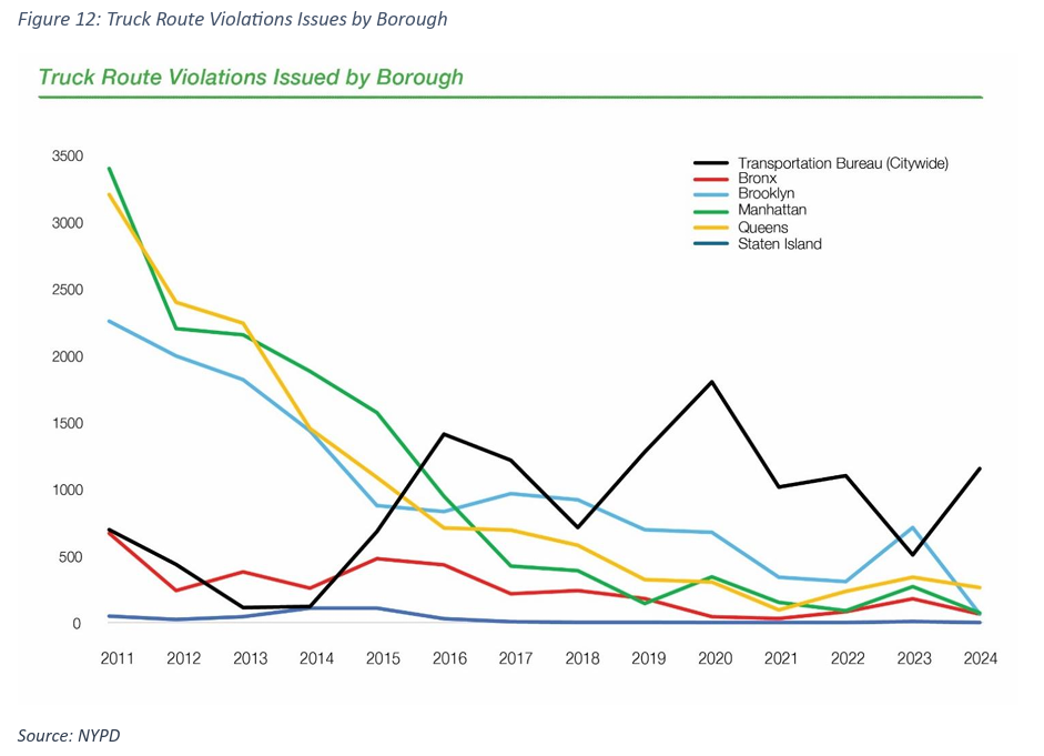
Truckers are legally allowed to leave designated routes in order to make local deliveries, but can be ticketed if they are merely cutting through neighborhoods. Residents have complained of off-route trucks, and the DOT has responded with updated signage. In one instance, a truck driver ran over the newly implemented sign.
As part of the redesign announcement, DOT committed to installing 600 new signs along the updated routes in order to encourage compliance. But in the Victorian-era level of wordsmithing about the new map from the Department of Transportation, there remains no new commitment from NYPD to enforce it.

Read More:
Streetsblog has migrated to a new comment system. New commenters can register directly in the comments section of any article. Returning commenters: your previous comments and display name have been preserved, but you'll need to reclaim your account by clicking "Forgot your password?" on the sign-in form, entering your email, and following the verification link to set a new password — this is required because passwords could not be carried over during the migration. For questions, contact tips@streetsblog.org.