Well, here's one reason to hope Mayor Adams gets a second term.
The city plans to close the gap in Manhattan's waterfront greenway uptown with a protected bike lane on 10th Avenue in Inwood — but construction on the new paths won't happen until 2027.
The future bike lanes will eventually run along nearly a mile of 10th Avenue from W. 201st Street to the Broadway Bridge — a chaotic stretch of roadway mostly beneath the elevated No. 1 subway tracks.
The paths are meant to connect with the Hudson River Greenway, bringing the city one step closer to its decades-in-the-works goal of a continuous bikable ring around Manhattan island.
Officials have not released any designs that specify how the lanes will connect to the West Side paths, but there will also be new bike lanes on W. 207th and W. 218th streets, said Regina Graham, a spokesperson for the city's quasi-public Economic Development Corporation, which is working on the project with the departments of Transportation and Parks.
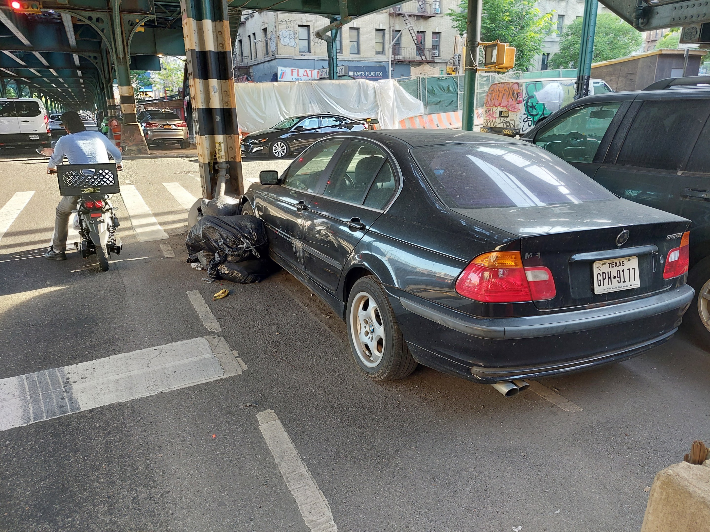
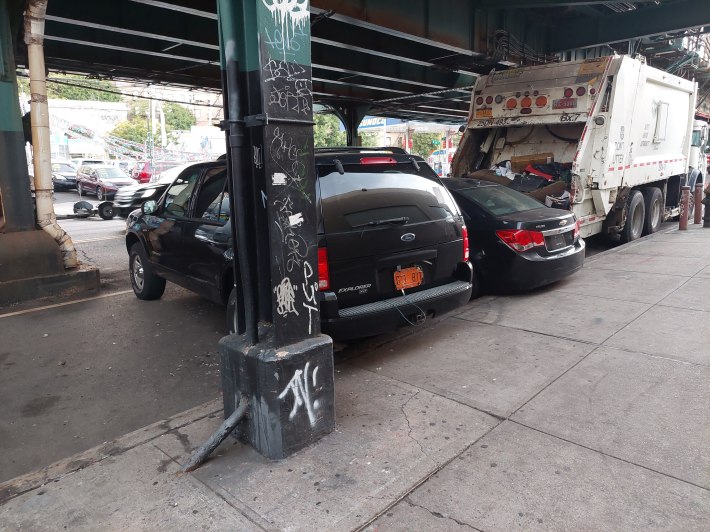
Tenth Avenue is rife with double- and triple-parking, plus sidewalk parking, and is home to auto body shops, used car dealerships, gas stations, a Department of Sanitation garage, and an MTA train yard.
But locals were hopeful that the corridor could work well for bike lanes, because it has a lot of redundant road space between the track pillars, and the service and parking lanes next to the sidewalk.
"It’s an obvious place for a bike lane," Inwood resident and regular bike commuter Allegra LeGrande told Streetsblog, adding that there would need to be enforcement to keep the area clear of illegal parking. "It’s pretty much chaos."
Regulating the streetscape could also help curb traffic violence on the crash-prone corridor, which has had 1,442 reported collisions since the start of 2012, injuring 384 people including 32 cyclists, 99 pedestrians, and 253 motorists, according to Crash Mapper. That's roughly 120 crashes per year on less than a mile stretch of 10th Avenue.
As part of the 2018 Inwood rezoning, EDC is also working with developers to build out an adjacent greenway along roughly eight blocks of the Harlem River waterfront between two inlets at Sherman Creek and North Cove, with two new parks at either end. Officials expects to begin the design process for that to start next year.
DOT will kick off its design for 10th Avenue later next year as well, but both projects are already funded, and LeGrande questioned why they were still years off from becoming a reality in a neighborhood starved for safe street infrastructure.
"It’s kind of a slap in the face, 2027," the uptown resident said.
EDC, DOT, and Parks officials didn't give a reason for the long timeline.
At the northern end of the proposed bike lane, DOT is currently doing a $93-million rehab of the Broadway Bridge, which spans the Spuyten Duyvil Creek between Inwood and the Marble Hill section of Manhattan that is physically part of the Bronx. That overhaul is set to wrap in 2027 and will include some form of a bike lane.
Many of the bridges between Manhattan and the Bronx have miserable bike and pedestrian infrastructure, and DOT in 2018 proposed "buffered" bike lanes for the Broadway Bridge connector as part of the agency's vision for better Harlem River bridges.
DOT also plans to repurpose two vehicle lanes for a two-way bike lane and a bus lane next year on the Washington Bridge between Washington Heights and the West Bronx.
The city aims to eventually have a roughly 32.5-mile greenway around Manhattan, but there are still some five miles of gaps, most of which are in lower-income neighborhoods uptown with the largest in Inwood at 1.7 miles from Sherman Creek to Inwood Hill Park.
Former Mayor Bill de Blasio in 2021 earmarked $723 million to close the remaining gaps.
