DOT Finally Presents its ‘Bike Boulevard’ Vision for 39th Ave. in Sunnyside
The key to the Department of Transportation’s “bike boulevard” design — for 39th Avenue in Queens and, perhaps, for others — is a significant disruption of how drivers use the roadway.
The stretch of 39th Avenue between 45th Street and Woodside Avenue in Sunnyside is, at least on paper, an open street, thanks to signs every block that alert drivers of the 5 mile-per-hour speed limit and shared space mission of the roadway.
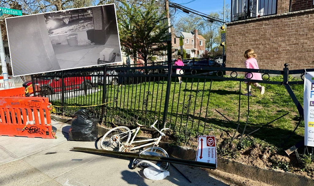
But drivers ignore the signs with impunity. As a result, the 39th Avenue open street is one of the worst in town. Unlike its neighbor to the east on 34th Avenue, no one strolls on the roadway on 39th Avenue. Kids don’t play in the street. People don’t learn how to ride their bikes. It is a roadway for cars in every sense (though a tiny number of drivers do slow down).
To fix the problem, the de Blasio administration announced earlier this year that 39th Avenue would become a “bike boulevard.” Details of what the mayor had in mind have only just become clear, thanks to a DOT presentation to Queens Community Board 2 earlier this month [PDF]. The plan features conversion of some two-way segments of the road to one-way, a protected bike lane and an “enhanced” shared bike path that the city hopes will transform the roadway from a shortcut for speeding drivers between Northern Boulevard and Skillman Avenue into the calm residential street it was before the descent of the Automobile Age. (It is unclear how the “enhanced” shared lane differs from the current shared lane, which is dangerous. Cyclists will still be squeezed between one moving car lane and one parked car lane, where the risk of being doored is omnipresent.)
But the centerpiece of the plan — which is, fittingly, at the midpoint of the strip at 50th Street — is a “diverter”: to discourage thru traffic, the city will require drivers to make a right turn off the roadway at 50th Street. That will send westbound drivers north towards westbound Barnett Avenue, while eastbound drivers will be diverted south towards westbound Skillman and, eventually, eastbound 43rd Avenue.
That’s no small change for a roadway that currently functions as a car funnel. Activists are eager to see the change be implemented on 39th Avenue and beyond.
“If the traffic diverters are robust, this approach to street design could be a game changer for creating bike-friendly corridors across the entire city’s residential street grids,” said Bike New York’s Jon Orcutt.
But what about the rest of the plan? Let’s break it down block by block.
Current conditions
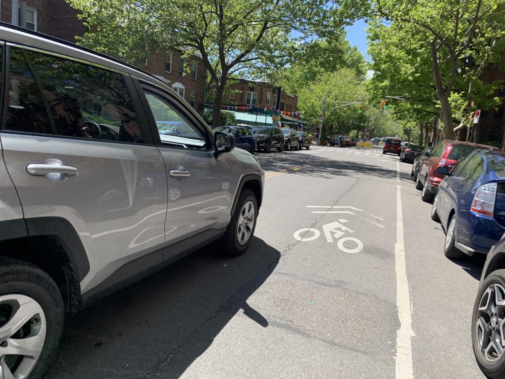
Currently, 39th Avenue is a two-way thoroughfare between 45th Street and Woodside avenues. In that stretch, the 40-foot-wide roadway comprises a 12-foot lane of traffic in each direction, plus eight-foot parking lanes on either side. Drivers tend to ignore the open street barricades. This slideshow reveals a lot about the mayhem on the roadway:
To transform 39th into a bike boulevard, DOT plans to add a protected bike lane on the eastbound side east of that key 50th Street diverter and on the westbound side west of that diverter (the other side of the street will get a shared lane with parking and one lane of car traffic.
“It will be a substantial improvement over what we have now. I do believe these treatments will reduce the number of vehicles on 39th, and reduce the speeds. Without the open street, 39th is a speedway,” said safe-streets advocate Laura Shepard.
Here’s what that looks like (before and after):
Now, let’s look at all the changes, going west to east:
Barnett Avenue at 39th Avenue
Drivers who use 39th Avenue as a shortcut enter the roadway after turning right from 43rd Street onto Barnett Avenue. No changes are planned between 43rd and 45th streets. But at the intersection of Barnett and 45th, a major change is being planned for westbound traffic: Instead of continuing directly onto Barnett, westbound drivers on 39th Avenue will first be diverted by an expanded traffic island onto Barnett, where they will make a left and continue their eastbound trip.
The reason for that change? 39th Avenue between 45th and 47th avenues will no longer have an eastbound lane for cars, but only for cyclists (the eastbound car lane returns after 47th Street until the diverter at 50th). The expanded traffic triangle will also reduce some conflicts between eastbound drivers entering 39th Avenue from Barnett and northbound 45th Street drivers because drivers will not be turning onto 39th Avenue at that spot anymore, but much further east on Barnett.
At 50th Street
The key intersection is at 50th Street, where DOT plans to install the traffic diverter to force eastbound driversto turn south and westbound drivers to turn north off the road. Orcutt believes it will ultimately reduce the number of cars that use 39th Avenue as a through-street.
“I think this is great, I just want to see many many more,” he said.
Here’s what it looks like now. The side streets are already one-way in the proper directions for DOT’s plan.
West of Woodside Avenue
DOT will turn 39th Avenue into one-way westbound street from Woodside Avenue to 52nd Street, eliminating more possibility for drivers to use 39th Avenue as a cut-through.
And throughout the bike boulevard, the design also calls for traffic-calming measures that will provide an opportunity for programming in the street — as seen on the successful 34th Avenue open street in Jackson Heights — including reducing the speed limit, curb extensions, and bike corrals.
What’s missing?
The plan envisions no changes for 39th Avenue east of Woodside Avenue, an unfortunate oversight, given that this dangerous stretch provides an additional missing link (between Roosevelt Avenue and the bike routes to the west).
Most glaringly, the plan includes no fix for the narrow Long Island Rail Road trestle at 58th Street — the scene of many crashes and near-misses because the roadway narrows significantly, yet the DOT still allows parking under the bridge. Here’s what that looks like.
In 2019*, there were 59 reported crashes on the short stretch, injuring three cyclists, four pedestrians and 10 motorists, killing one pedestrian, according to city data compiled by Crashmapper.
Queens Community Board 2 will vote on the bike boulevard plan on June 23 (details below).
Overall notes
Advocates believe the bike boulevard concept will create safer conditions for pedestrians and cyclists, as well as connecting to key routes, like the Skillman Avenue and Northern Boulevard routes to the Queensboro Bridge.
“A lot of people have talked about how to close gaps in the bike network for a long time,” said Shepard. “It’s really a neighborhood-calming initiative for kids going to school or a bus stop; they will be the primary beneficiaries here. And it closes a gap in the bike network, making this a good choice to implement this.”
The four other bike boulevards planned for across the city are slated for portions of 21st Street in South Slope, Jackson Avenue in Mott Haven, University Place in Greenwich Village, and Netherland Avenue in Mariners Harbor on Staten Island. DOT says it will install them all by the end of the year.
The 39th Avenue bike boulevard would be the first in the city, but such configurations are already working elsewhere across the country — from which DOT is taking ideas. In Edmonton, chicanes are used to slow down drivers by forcing them to maneuver; in Portland, diverters and medians also slow drivers; and in Berkeley, a mini round-about also helps slows down drivers. (The DOT tested roundabouts in Staten Island a few years back, but never expanded them.)
Some open streets in the city’s COVID-era open space program turned out to be bike boulevards by another name, without the permanent infrastructure. (See the Streetfilms video below.)
* Streetsblog is using 2019 as its most-recent year for crash statistics, as it is the last full year for which accurate statistics are available due to the pandemic.
Community Board 2 will vote on the DOT’s bike boulevard design on June 23 in a virtual meeting. Click here for details. Click here to offer public testimony.
— with Gersh Kuntzman

Read More:
Streetsblog has migrated to a new comment system. New commenters can register directly in the comments section of any article. Returning commenters: your previous comments and display name have been preserved, but you'll need to reclaim your account by clicking "Forgot your password?" on the sign-in form, entering your email, and following the verification link to set a new password — this is required because passwords could not be carried over during the migration. For questions, contact tips@streetsblog.org.