DOT’s Greenpoint Greenway Project Doesn’t Dream Big Enough
The city will build out a new section of the Brooklyn waterfront greenway on Commercial Street in Greenpoint — but the revamp falls short of the area’s booming demand for pedestrian and bike space, locals said.
The $12-million project, more than a decade in the making, will install a two-way raised bike lane on the street at the northern tip of the borough and make the two-way road one-way for motor vehicles. That’s a start, Brooklynites said, but the city should reclaim more car space for cyclists and pedestrians now that the strip has transformed from an industrial wasteland into a dense residential neighborhood.
“It’s not far enough, and it’s the only change we’ll probably get – ostensibly forever,” said Zach Eisenstat of the neighborhood advocacy group Calm Commercial.
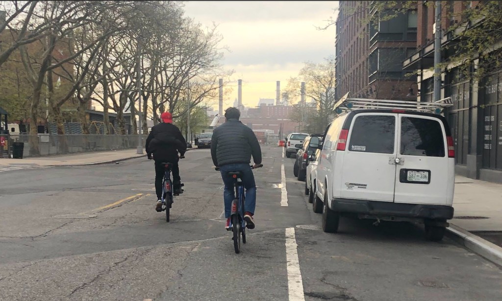
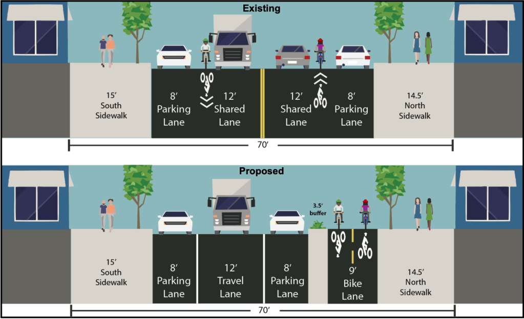
The Department of Transportation’s proposed two-way bike lane will come in at just nine feet wide — four-and-a-half feet in each direction — yet still leaves a 12-foot driving lane and two eight-foot lanes for car storage along the curbs, according to plans the agency showed to Community Board 1’s Transportation Committee on Thursday.
Commercial Street was largely industrial when that work started more than a decade ago, and has since turned into a densely populated neighborhood along the corner of the Newtown Creek and the East River. The street has become busier with foot traffic from those residents and the soaring number of cyclists in north Brooklyn.
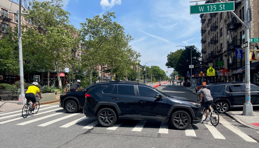
Drivers double- and triple-park all over the road, Eisenstat said, and often block crosswalks, despite the ample parking inside the residential towers.
A new school is set to open this fall and a park on Box Street will open later this year; both will draw even more foot traffic.
The bike lane will extend from West Street to Manhattan Avenue. DOT also plans to build a raised east-bound bike lane for a block on Box Street. The reconstruction includes sidewalk extensions at the corners of Dupont, Franklin and Box Streets, along with a new pedestrian island in the middle of Manhattan Avenue.
Locals were also unimpressed by the plan for still leaving too much room for the movement and storage of dangerous personal motor vehicles.
“We don’t need a 12-foot street for cars to drive down,” said resident Paola Sanchez at the community meeting. “That’s insane. That’s going to encourage speeding.”
The proposed bike lane is only a foot wider than the eight feet “absolute minimum” for a two-way path, per guidelines from the National Association of City Transportation Officials. DOT has rolled out bike lanes nearly twice that width, such as the 16-foot two-way protected lane on 31st Avenue in Astoria.
“This is going to be part of a giant Brooklyn-Queens superhighway for transit for mostly pedestrians and bikes,” said Wendi Carlock. “This is going to be setting a template for all others to be modeled after. This can’t be the model.”
The proposed greenway is intended to fill a key gap in north Brooklyn’s waterfront. It will connect to the Pulaski Bridge, where bike counters have logged more than a million rides both last year and the year prior. Other parts of the waterfront route, like Kent and Flushing Avenues, are already routinely over-crowded.
“There’s so much development in this particular area, lot of usage throughout the Brooklyn waterfront greenway,” said Hunter Armstrong, executive director at the Brooklyn Greenway Initiative.
Narrow bike and pedestrian infrastructure can be dangerous, as became clear when an illegal e-moto rider and his passenger mowed down and killed a 60-year-old getting off a bus along the busy Flushing Avenue greenway by the Brooklyn Navy Yard in October.
On Tuesday, another crash happened on the same section of the narrow two-way lanes on Flushing Avenue, just a few blocks away, when a scooter rider and a person on an e-bike collided.
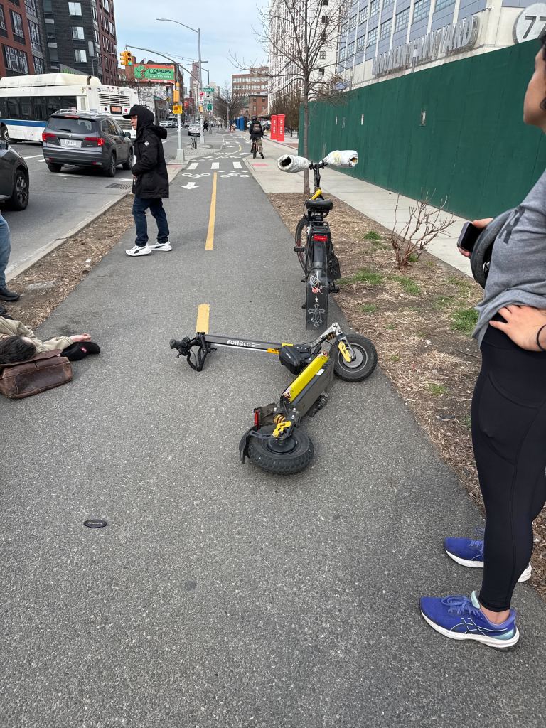
The heavily used path also narrows by about half in the warmer months when DOT neglects to trim the bushes lining its side.
The city has long struggled to maintain and expand its network of greenways, which are both vital transportation and recreational infrastructure.
The city began working on the project back in the early-to-mid 2010s, but construction won’t start until 2028 and last until 2030, DOT officials said. The revamp belongs to a larger capital project that will install new sewers and water mains, and is managed by the delay-prone Department of Design and Construction.
The city should work on a temporary redesign with less money and redraft the permanent build-out before dropping seven figures on the overhaul, members of the CB 1 committee said.
“This plan looks like it was designed before Hurricane Sandy – and it was,” said Transportation Committee member Bronwyn Breitner. “That’s not appropriate for anywhere in New York City anymore, and it’s certainly not appropriate for this location which has transformed 180 degrees from what it was.”
An agency rep acknowledged to the civic panel that its capital work is playing “catch-up.”
“I share the frustration that these capital projects take so long, and our design standards outpace them at a very rapid clip, and we’re always trying to play catch-up on these major investments,” said Michael Pedron, a DOT assistant director for cycling and micromobility.
“Capital projects everywhere take a really long time in New York City,” Pedron added. “That’s also a reason why we have such a robust in-house program, is that we do so many changes without capital projects, because they take such a long time.”
After the meeting, DOT said in a statement that it will review “the feedback shared.”
Additional reporting by Emily Lipstein

Read More:
Streetsblog has migrated to a new comment system. New commenters can register directly in the comments section of any article. Returning commenters: your previous comments and display name have been preserved, but you'll need to reclaim your account by clicking "Forgot your password?" on the sign-in form, entering your email, and following the verification link to set a new password — this is required because passwords could not be carried over during the migration. For questions, contact tips@streetsblog.org.