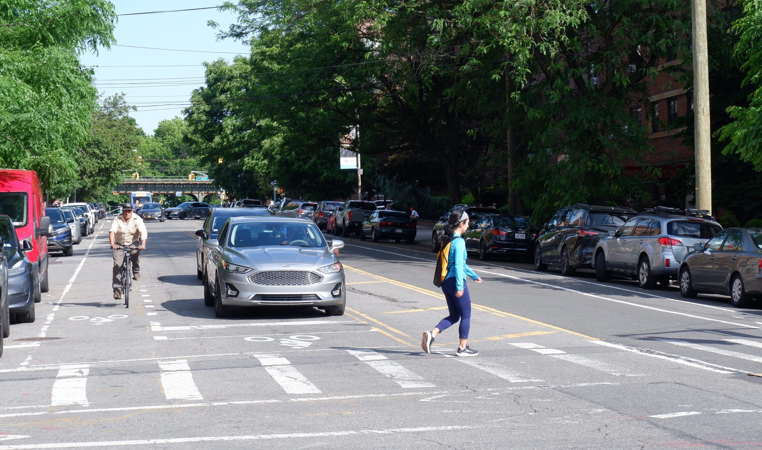
The city will install a bike boulevard on 1.1 miles of 31st Avenue in Astoria this year, adding a much-needed safe east-west corridor for cyclists and pedestrians in the western Queens neighborhood, officials revealed Thursday.
Under the Department of Transportation proposal, presented at a town hall on Thursday, a two-way protected bike lanes will run from Steinway Street to Vernon Boulevard at the waterfront, while the roadway will go from two-way to one-way for car drivers, with directional changes to divert autos off the strip.
"I love that they’re emphasizing that pedestrians and cyclists matter on the street," neighborhood resident Alana Herlands said during the town hall event at the Variety Boys & Girls Club of Queens. "It doesn’t say, ‘Cars can’t go here,’ but it makes people in cars think more heavily about pedestrians and cyclists."
The redesign [PDF] follows similar DOT overhauls on corridors in Queens and Brooklyn that aim to reduce car traffic and make streets more welcoming for people on foot or bike.
DOT will install the changes this summer and fall. The agency plans to put forward redesign for another half-mile of 31st Avenue between Steinway Street to 51st Street next year.
The revamp comes in response to recent mobilization by Astorians — including via online forum Reddit — to bring safer street infrastructure to their neighborhood, which has lots of cyclists but few safe routes for them to get around.
The Queens nabe has no east-west bike routes physically separated from cars, except for 20th Avenue all the way at its northern edge, even though more than one-in-three locals ride bikes for daily trips, while 53 percent walk, and only 11 percent drive a car, according to 2023 DOT survey data.
The bulk of the proposed 31st Avenue redesign converts the road from a two-way street to one-way for drivers, with a parking-protected two-way bike path along the curb on the north side of the street from Vernon Boulevard to 31st Street, and on the south side from 35th Street to Steinway Street, echoing the design of the much-used north-south bike paths on Crescent Street.
A four-block stretch in the middle — between 31st and 35th Streets, which includes two blocks that are an open street — will feature "shared streets" that are one-way for cars and two-way for bikes, with a cycle path running against the direction of car traffic, officials said Thursday.
DOT may also include a car-free plaza between 33rd and 34th Streets.
The plan adds safer pedestrian infrastructure too, like painted islands and curb extensions to shorten crossing distances, while providing more visibility and space for walkers, bolstered by planters and bike racks to keep cars from parking in those areas.
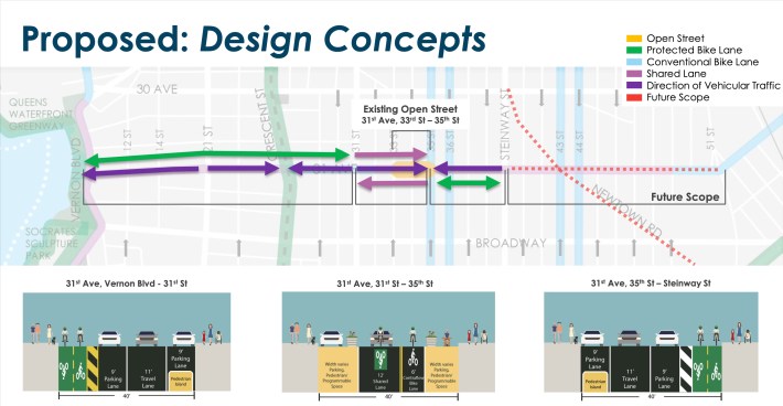
The agency plans to switch the direction of car traffic several times along the corridor to funnel out through-traffic, a scheme the agency also implemented on Berry Street to cut down the number of automobiles.
"We’re trying to lessen the number of vehicles on the street to make it safer for people to walk and bike along one of the corridors throughout the neighborhood," said DOT's Director of Bicycle and Greenway Programs Ted Wright. "There’s not a lot of people using the whole corridor, there’s some people speeding on the whole corridor, but it’s not a major traffic route."
The agency has installed other bike boulevards on 39th Avenue in Sunnyside, and on Underhill Avenue in Prospect Heights, Brooklyn. But DOT watered down the latter plan by maintaining two-way car traffic on more of the roadway after local pushback. The Underhill project also suffered several delays due to interference by the top officials in Mayor Adams's City Hall.
In Astoria, residents showed up en masse to a meeting last year to demand a transformational project, galvanized by a spate of high-profile crashes in the area. On Thursday, locals eagerly welcomed DOT's new plan.
"Even though [31st Avenue] is a quieter street, I’ve been almost run over several times, just like by people trying to speed through a light. So, yeah, [a] welcome addition to the neighborhood," said Alice Thum.
Organizers with the 31st Avenue Open Street, which extends from 33rd to 35th Streets, hoped DOT would truly cement car-free space by opting for the pedestrian plaza design on one of those blocks.
"We are going to advocate for the most ambitious plan that not only adds more space for the community in an area that’s particularly space-starved, but also reduces traffic violence that’s seen a lot of tragedies in the last couple of years," said John Surico, who chairs the 31st Avenue Open Street Collective and is also a contributor to Streetsblog.
The city should swap out the parking spots closer to the water for absorbing materials, since it's in a flood zone, said local Alex Duncan, who founded the popular Reddit forum — or subreddit — called r/MicromobilityNYC.
"What we need there is actually not parking… we need tree pits and bioswales," said Duncan, better known by his online handle "Miser."
Duncan welcomed the overall design of reducing vehicle traffic on 31st Avenue.
"It becomes safer the minute you remove the bulk of the cars," he said. "You don’t have to remove all of them, you just gotta remove most of them."
