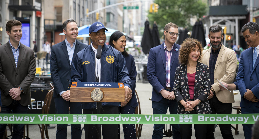
Pedestrians, cyclists, and Mickey Mice can all feel safer navigating Broadway — one of Manhattan’s most famous streets — following the modifications recently implemented under the city's "Broadway Vision" initiative.
Announced in April 2021, the Department of Transportation project seeks to rebalance the space allocated for cyclists and pedestrians, improve car traffic, strengthen the area’s economic resilience following the pandemic, and decrease the number of crashes along the street.
The majority of the changes have since been completed, with the city cutting the ribbon on the latest efforts last month. Pedestrians now have more space for sights and leisure, and bikes outnumber motor vehicles more often than not on these newly modified blocks, but there are still several less-than-ideal haphazards and design choices dotted down the street.
Streetsblog paid a visit this week to some of the recently redesigned blocks between Times Square and Madison Square Park. Here's what we saw:
Times Square North
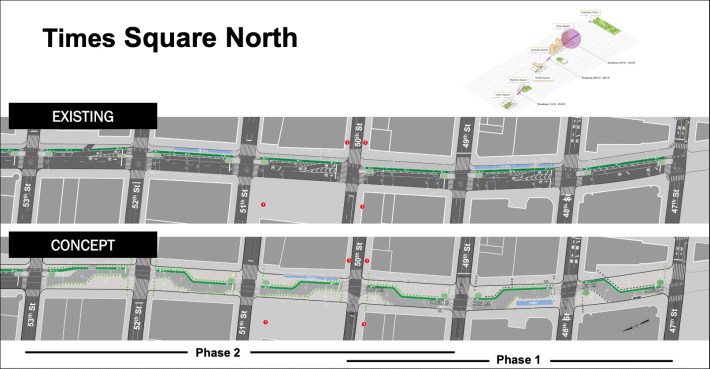
The segment of Times Square included in the proposal is divided into two phases. For Phase 1 DOT has already started to modify the southbound road between West 47th and West 50th streets, extend the pedestrian space off the curb, and create a "shared street" featuring adjacent car and (unprotected) bike lanes from West 47th Street to West 49th Street. The city also plans to expand the size of the pedestrian plaza north of West 49th Street, while merging the car and bike lanes into a single, shared lane near the south end of the block.
Phase 2 — which has yet to begin — will take West 49th to West 50th a step further by converting it into a block with a similar "shared street" unprotected bike lane layout to that of the southern segment. The blocks from West 50th to West 53rd will undergo the same redesign at a later unspecified date:
Not every block reflects DOT's initial proposal. West 48th to West 49th echoes the conceptual design — with potted plants and concrete police barricades to separate the roadway from the sidewalk. Streetsblog observed little car traffic, but plenty of pedestrians, on the redesigned strip on a recent afternoon:
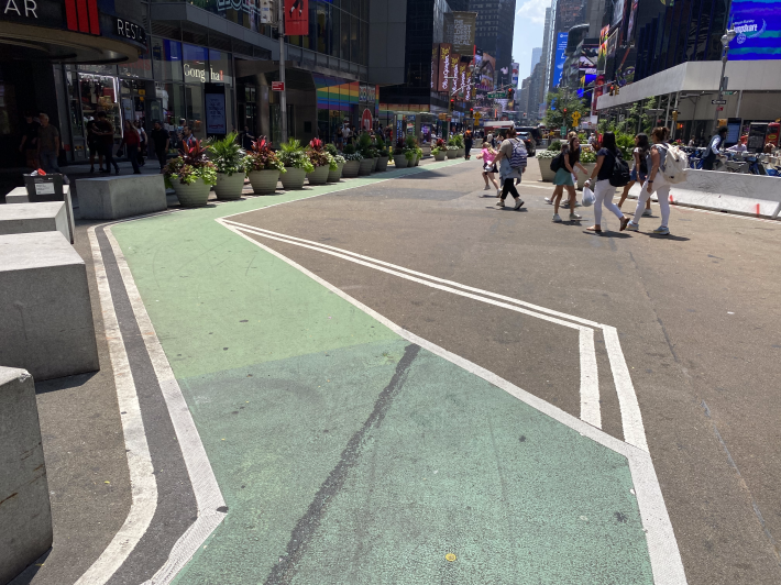
The block between West 47th and West 48th, however, does not reflect the design included in the original Broadway Vision proposal. Instead, the segment features a lane that both cars and bikes share, with speeds limited to 5 mph. The city also expanded the pedestrian zone to include outdoor restaurant seating, plaza space, and a small area for vending. Despite being less ambitious than the DOT's first design, the modifications do offer more comfort to pedestrians and cyclists than the block did a year and a half ago.
The blocks still definitely favor cars, but traffic is few and far between — possible because GPS recommends 6th Ave as the path of least resistance. Just by completing phase 1, the DOT accomplished one of their most important goals for Times Square North: slow traffic speeds.
The Garment District
Prior to the Broadway Vision proposal, the blocks between West 38th Street and West 40th Street in the Garment District featured plaza space that extended 28 feet off the curb, and a bike lane that traveled straight down the middle of a busy vehicle lane. The redesign aimed to convert the block between West 39th and West 40th into a full-blown pedestrian plaza with a bike lane cutting down the edge of the sidewalk, and the segment between West 38th and West 39th into a “slow block” that separates the bike and car lane with a strip of pedestrian space.
When faced with deciding between a two- or a one-way bike lane down Broadway from West 38th to West 40th, the DOT went with the latter — but regardless, pedestrians seem to be satisfied.
“I always feel safe walking around here,” said local Kirk Snyder, as he was finishing up his lunch at one of the plaza's tables between 39th and 40th.
The resident said he would love to see similar sidewalk concepts implemented throughout the city.
“So few of us rely on cars in the city. It would make sense to give more people this space," he said.
The numbers speak for themselves. According to crashmapper.org, there were 11 total crashes (all with resulting injuries) on the tiny, two-block strip between the beginning of 2016 and the end of 2021. There been have none since.
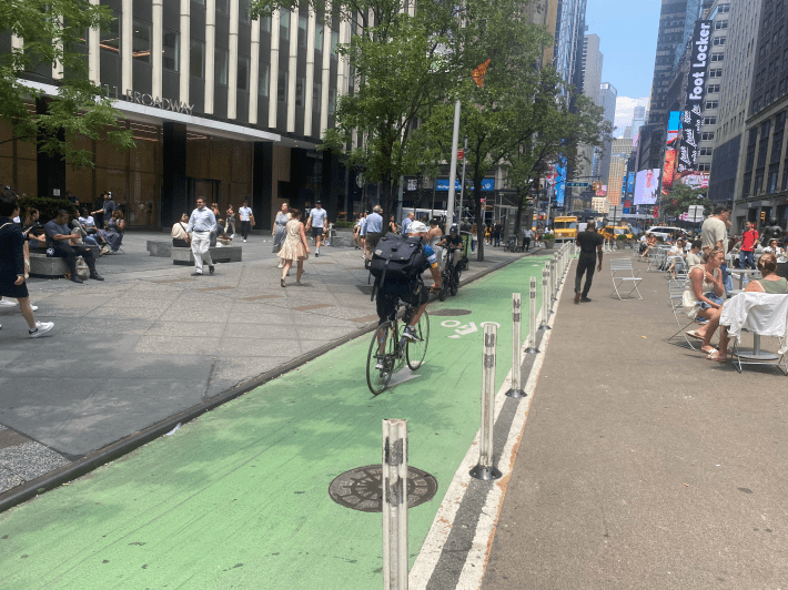
There were cyclists going against the flow of the one-way bike lane, so pedestrians better look both ways before crossing.
West 38th to Herald Square
These three blocks feature a large pedestrian area that occupies half the street. The other half features a southbound car and bike lane, and a row of parking.
Each of these blocks either has a bike share dock on it, or in the immediate vicinity. This helps explain the high number of cyclists that go down these streets. The number of cars remains relatively low. There are no current plans for the DOT to upgrade this segment.
But as Broadway and Sixth Avenue intersect, bikers have a difficult time navigating the roads. Without a direct passage down Broadway, the bike lane wraps down Sixth Avenue, where car traffic is extremely dense. Pedestrians, however, get to enjoy a leisurely stroll through Greeley Square Park, which is a popular tourist hub that on my visit had a bouncy castle.
West 32nd to West 25th
In August of 2022, the Broadway Vision proposal received an update to the corridor running from West 32nd to West 25th. One the blocks of West 25th to West 29th, the new design added additional public space, shorter pedestrian crossings, and a two-way bike lane.
Phase 1 added two plaza blocks between W 25th and W 27th, and two shared blocks between W 27th and W 29th. Phase 2, to be completed by the end of 2023, will transform the remaining four blocks into shared streets.
Currently, between W 32nd and W 27th street, the road narrows and the marked southbound bike lane disappears. The car lane snakes down due to the parking spaces alternating between the left and right side, and the remaining space is left for public seating and various dashes of greenery.
Without a marked bike lane, southbound cyclists are forced to join the cars down this section of the road, and northbound cyclists often come head-to-head with southbound travelers. Fortunately, there are very few drivers who use this road, but clearer road markings would give this spot more structure.
The southbound car lane disappears at W. 27th Street, and doesn’t return until W 24th street. The segment from W. 27th to W. 25th is a popular plaza block with a two-way bike lane.
The Flatiron District
The DOT knew something needed to change with the car-friendly Flatiron District when a survey reported that 90% of people in the area typically walk, 53% bike, and only 11% drive through the segment from W. 23rd to W. 21st on Broadway.
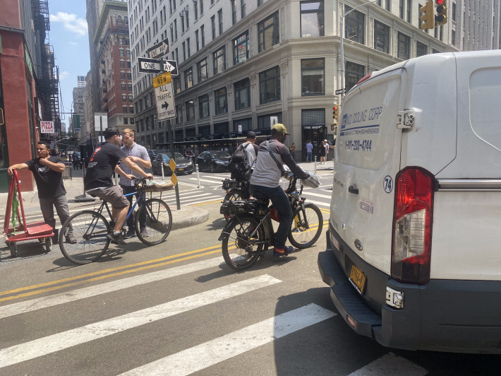
The Broadway Vision project proposed transforming these two city blocks into shared streets similar to other sections of Broadway. The bike lanes are right next to the one-way car lanes, yet sharp turns and illegally parked cars make these stretches harrowing for two-wheelers:
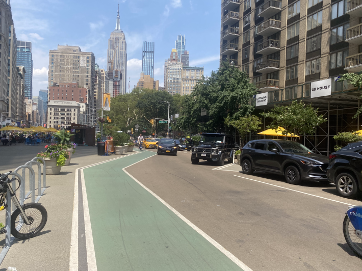
Broadway today still isn't quite the "linear park" some urbanist dreamers envision, but it's been dramatically transformed from what it once was — for the better.
