EXCLU: McGuinness Blvd. to Go On Road Diet for Protected Bike Lanes
McGuinness Boulevard is like a highway cutting through Greenpoint — but not for long, promises the DOT (inset). File photo
The city plans to install protected bike lanes on both sides of deadly McGuinness Boulevard and remove a car lane in each direction as part of a major redesign of the highway-like north Brooklyn road, Streetsblog has learned.
The overhaul will reconfigure the 1.1-mile stretch of the busy boulevard between Meeker Avenue and the Pulaski Bridge in Greenpoint, and comes after local activists and politicians pushed two mayoral administrations for safety upgrades following multiple deaths, including the hit-and-run killing of beloved local teacher Matthew Jensen in 2021.
The lane removals are the most ambitious redesign yet under Mayor Adams, said one advocate, proving that so-called road diets that reallocate space away from cars are politically possible on the city's busiest thoroughfares.
"We’ve seen some bold DOT proposals during the Adams administration, but I think this is the boldest yet," said Jon Orcutt, the advocacy director of Bike New York. "If you can road diet McGuinness Boulevard, you could probably road diet any street in the city, which makes it an interesting case."
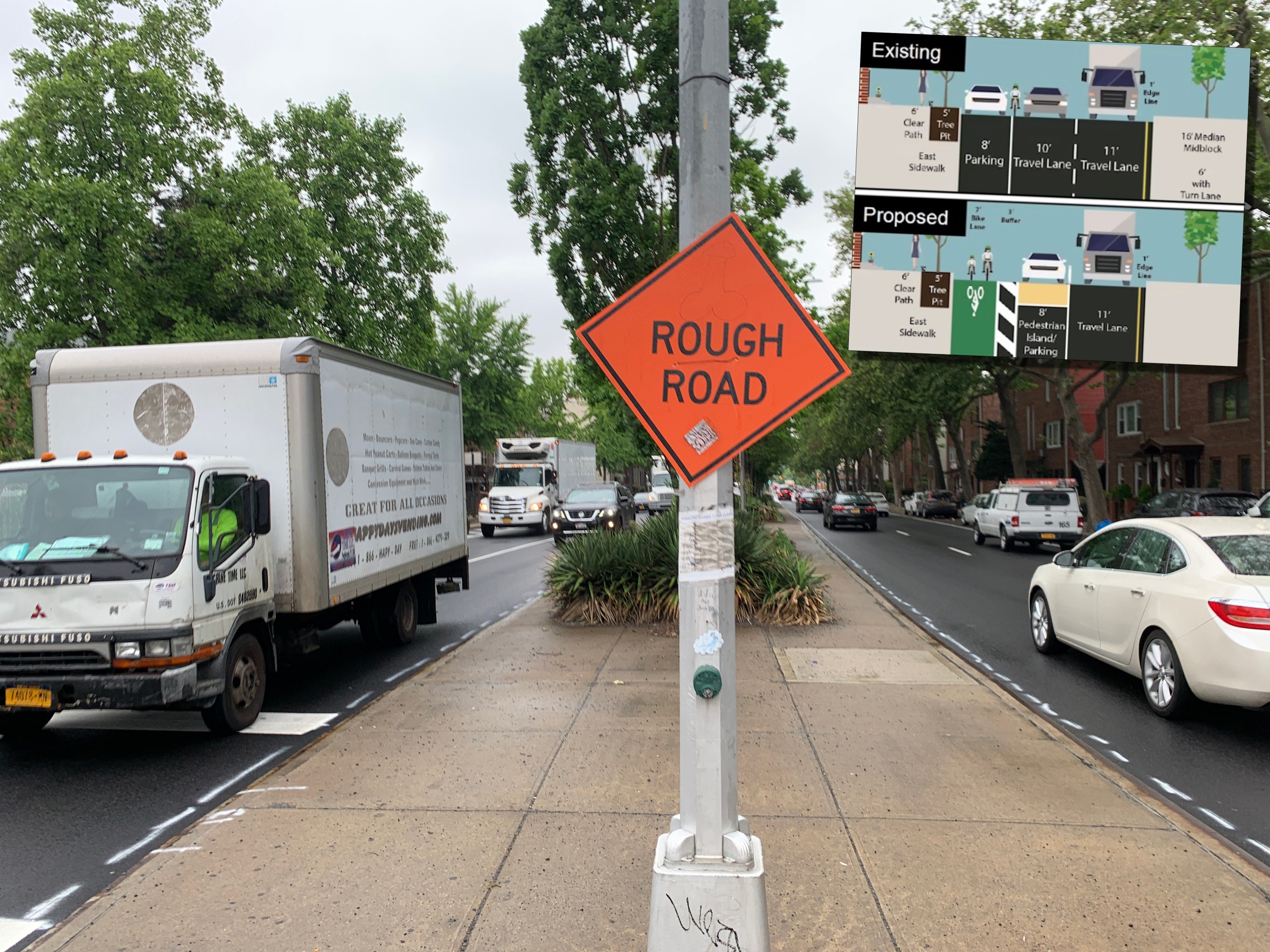
The proposal would replace the current two travel lanes in each direction with just one travel lane and seven-foot bike lanes along the curb, according to a graphic obtained by Streetsblog in advance of Thursday's public presentation by the Department of Transportation.
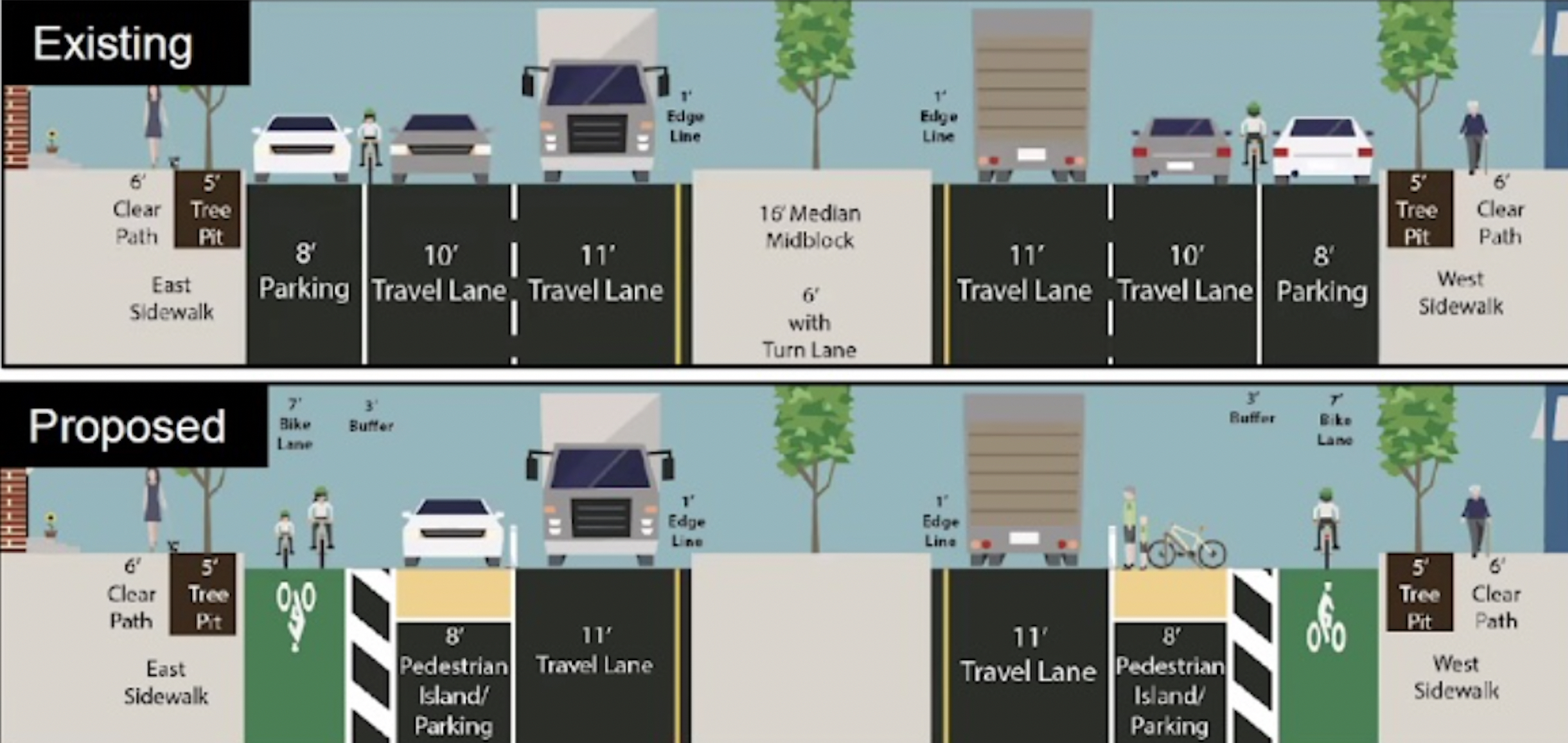
The DOT's preferred design would shorten 25 crosswalks by one-fifth by installing pedestrian islands, while removing an average of two parking spaces per block to improve visibility and maintain clearance for turning vehicles. The overhaul also includes installing neighborhood loading zones on each block and DOT is considering metered parking for drivers patronizing businesses along the strip.
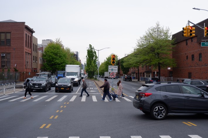
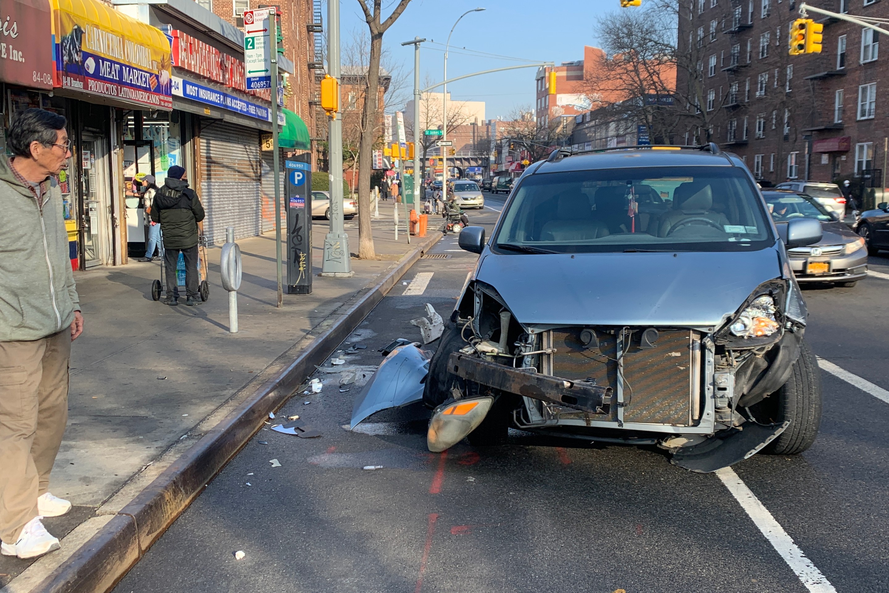
The current four-lane boulevard has long been a deadly corridor cutting through the Brooklyn nabe. Three people died due to traffic violence there over the last decade and a whopping 389 people suffered injuries in 1,690 total reported crashes — nearly one every other day on just a short stretch of one roadway.
The Department of Transportation previously raised concerns about traffic spilling over onto nearby streets, but these kinds of road diets have shown to reduce the number of people killed or seriously injured in crashes by 30 percent, according to agency stats.
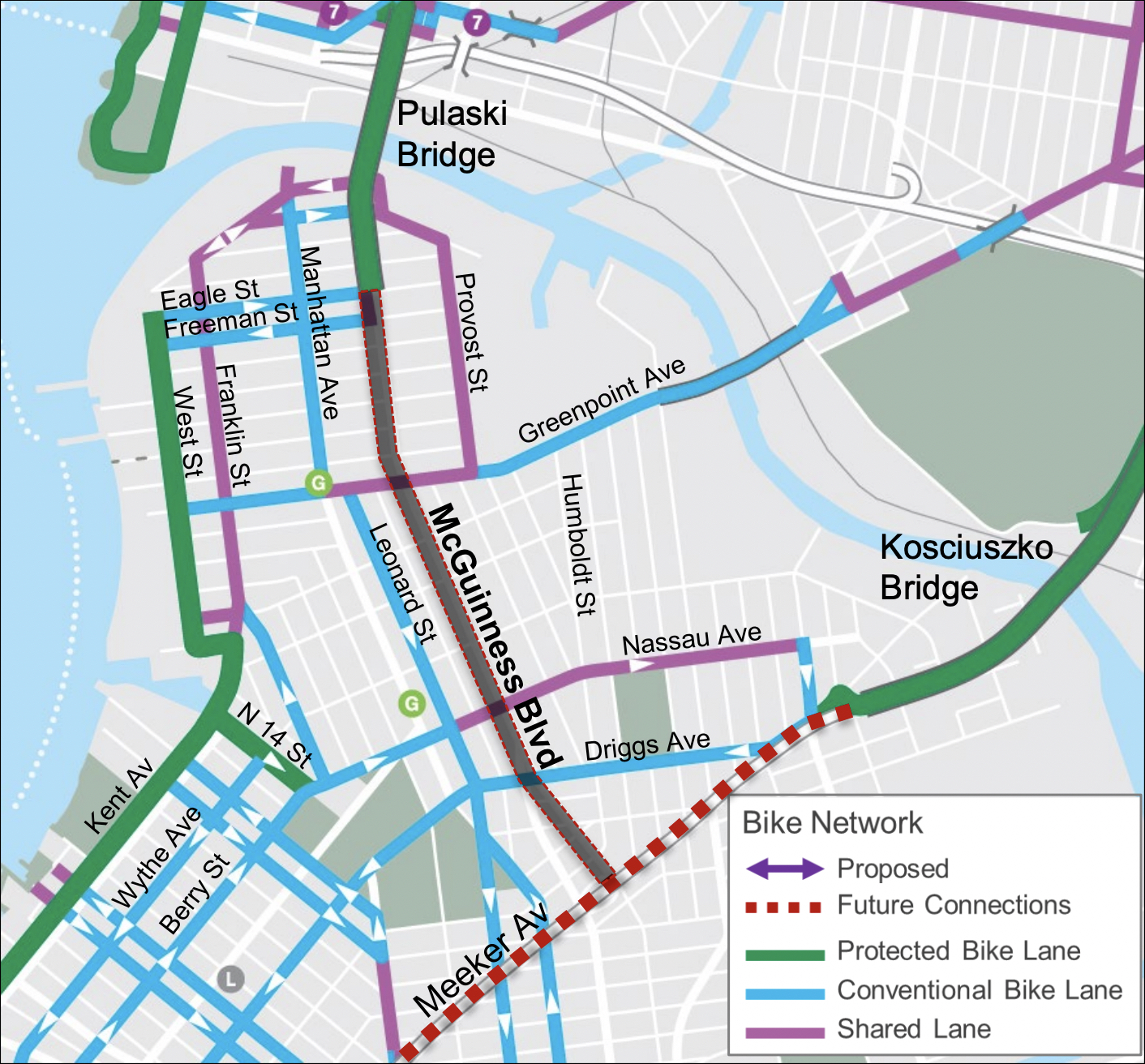
The new protected lane would also provide a much-needed north-south connector to the Pulaski Bridge for cyclists, with few other safe options available in the area. The next-nearest protected bike lane is West Street at the western edge of the neighborhood. And that bike lane is frequently blocked by trucks.
The city's redesign is one of three possible redesigns that DOT presented to Community Board 1 last summer, and officials chose the lane reduction because it got the most support, according to DOT presentation slides obtained by Streetsblog.
The revamp is among a slate of new protected bike lanes DOT plans for the city this year, according to an agency press release last week, including the much-delayed nearby Meeker Avenue and Ashland Place in Fort Greene.
DOT began some smaller-scale fixes to McGuinness last year by banning little-used left turns at three intersections, and getting rid of parking and installing bike corrals at 11 junctions.
Removing a travel lane could lead to 30-40 percent of traffic divert to adjacent roads such as Manhattan Avenue, DOT said during its June presentation. But a similar share of drivers, 30-50 percent, just uses McGuinness as a short cut between the Brooklyn-Queens Expressway and the Long Island Expressway, DOT officials said at the time.
During peak times between 900–1,300 vehicles an hour travel the corridor connecting the two highways, volume that exceeds the capacity of a single lane at 700 vehicles an hour, DOT said at the time. Roughly 100 of those vehicles are trucks.
The agency's press office declined to share specific plans ahead of Thursday's presentation about how officials will manage potential traffic effects on nearby streets.
"DOT looks forward to discussing our plan to bring critical safety improvements to McGuinness Boulevard later this year. We will be monitoring the project closely during and after implementation and will detail those plans to the community board," DOT spokesman Vin Barone said in a statement.
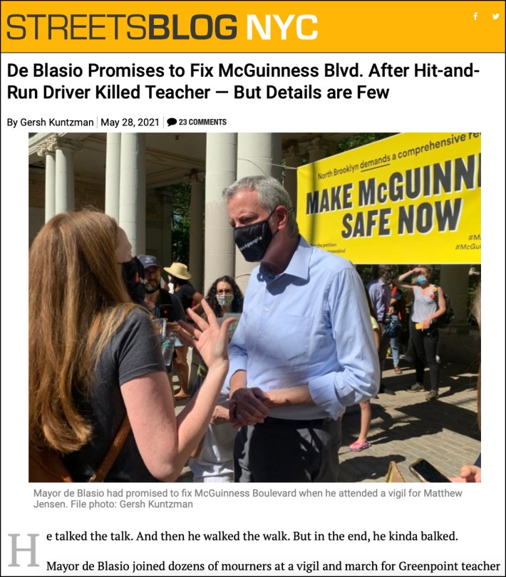
The hit-and-run killing of Jensen, a beloved teacher at P.S. 110 near McGuinness Boulevard, spurred residents and politicians to organize and rally for safety improvements under the banner of "Make McGuinness Safe."
Then-Mayor Bill de Blasio walked the corridor with advocates and pledged to fund nearly $40 million in upgrades to the lethal boulevard.
Those funds will be used for a future capital project, and the current redesign will be done separately in-house by DOT and could be a precursor for the larger changes, according to sources briefed on the plans.
Local electeds applauded the plan as "transformative."
"After a two-year engagement process — during which several more residents were injured in car crashes on McGuinness — the Department of Transportation has put forward the kind of transformative redesign that was promised," said Assembly Member Emily Gallagher and Council Member Lincoln Restler in a joint statement.
"We look forward to hearing the community's feedback and are committed to partnering with DOT in support of the core elements of this proposal for McGuinness that will make Greenpoint safer."
DOT will present the proposal to Community Board 1's Transportation Committee at a virtual meeting this Thursday at 6.30 p.m.
Stay in touch
Sign up for our free newsletter
More from Streetsblog New York City
Report: Road Violence Hits Record in First Quarter of 2024
Sixty people died in the first three months of the year, 50 percent more than the first quarter of 2018, which was the safest opening three months of any Vision Zero year.
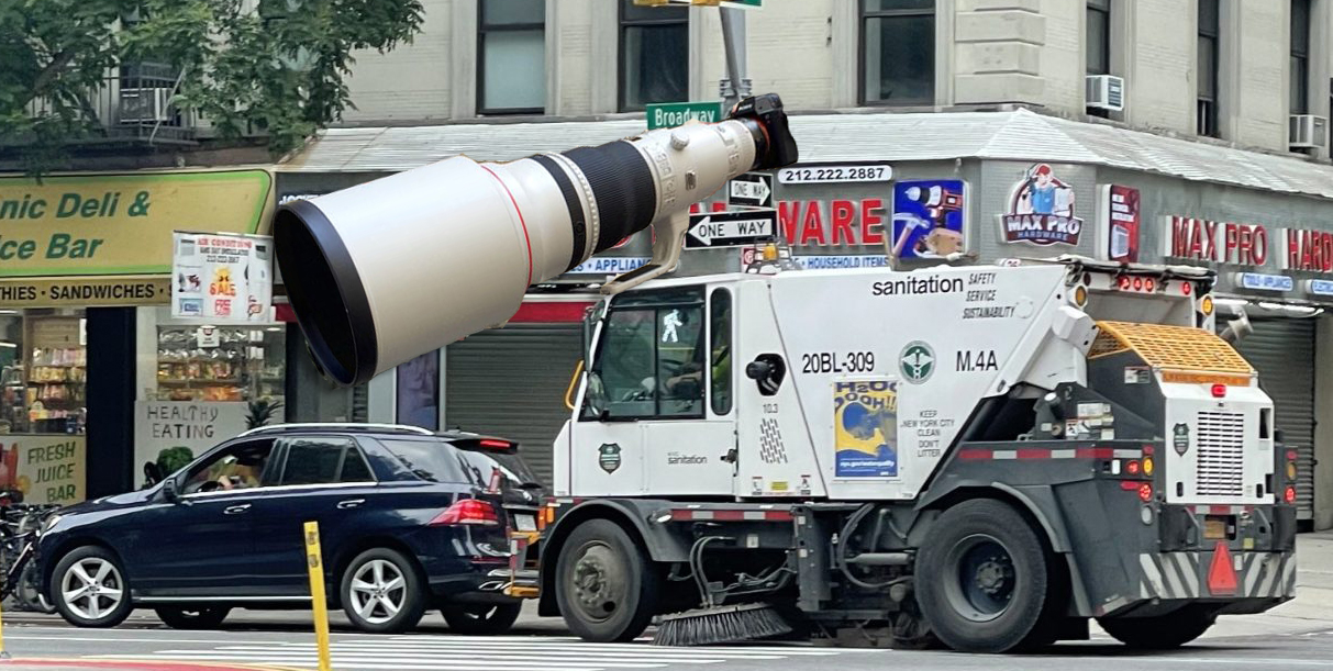
Street Sweepers Could Nab Illegal Parking Under State Bill
Smile for the street-sweeper!
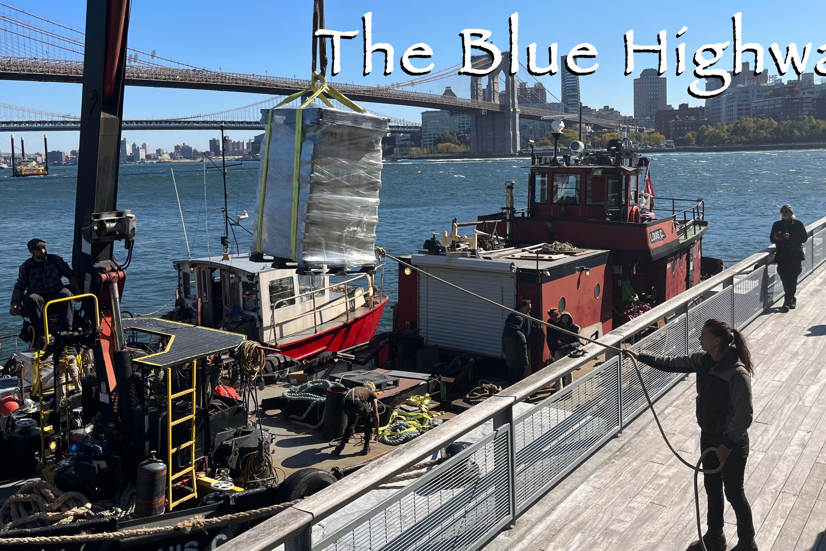
Thursday’s Headlines: The Way of Water Edition
The "Blue Highways" campaign wants the mayor to convert a downtown heliport into a freight delivery hub. Plus more news.
Gotcha-Heimer! Anti-Congestion Pricing Jersey Rep. With a City Speeding Ticket Drove to Manhattan on Wednesday
New Jersey's most vociferous opponent of congestion pricing parked illegally and once got a speeding ticket.