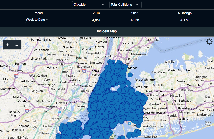
Mayor de Blasio and Police Commissioner James O'Neill announced today that the city will make "TrafficStat," NYPD's tool for mapping and analyzing traffic collision data, available online to the public. It's an improvement over the city's existing crash-mapping tool but lacks one very important type of information -- data about where police are enforcing traffic laws.
The TrafficStat site enables users to track crashes by location, going a few steps further than the city's existing Vision Zero View tool. Collisions can be broken down by type, contributing factor, day of the week, hour of the day, precinct, and patrol borough. The data was previously available on NYC's open data portal, but the TrafficStat site puts it in an easy-to-view format.
The site will also be updated more frequently than Vision Zero View -- once a week on Tuesdays, as opposed to once a month.
Since the late 1990s, NYPD has used TrafficStat to guide traffic enforcement efforts. City officials said today that they want the public to see the role that TrafficStat plays in the mayor's Vision Zero initiative.
"Anytime that we help the public to see where there are particular problems, we make ourselves accountable in the process," de Blasio said. "TrafficStat is about identifying times and places where we have persistent problems, and going at them. We want to public to see that in real time. We want the public to hold us accountable for the changes we have to make."
One glaring omission, however, is data regarding summonses, including location and time of day. That level of detail on summonsing would enable the public to see how NYPD enforcement correlates with dangerous locations, but it is not available on the TrafficStat site -- or anywhere else the public can access. For years NYPD has rebuffed efforts to make geo-tagged data on summonses public, and today's announcement doesn't change that.
The tool has other shortcomings: It groups fatalities under one category (injuries, on the other hand, can be sorted by whether the victims were walking, biking, or in a motor vehicle). And while it includes collision types and contributing factors, NYPD officers are not required to include that information in police reports, so the most common collision type for the year-to-date is "unknown," outpacing the number two type ("head on collision") by more than 5,000 instances.
NYPD Deputy Commissioner of Information Technology Jessica Tisch said the NYPD is "committed to continuing to enhance this tool over the coming months and years" but offered no specifics.
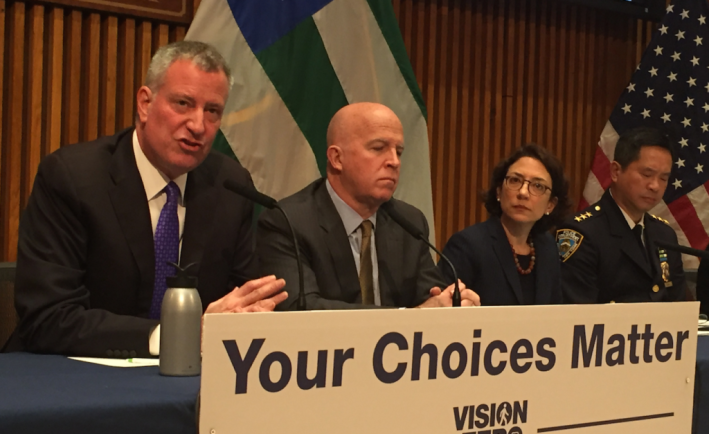
Tisch unveiled the new tool at a press conference at 1 Police Plaza this morning, where de Blasio, O'Neill, and DOT Commissioner Polly Trottenberg trumpeted a decline in traffic deaths since the launch of the "Dusk and Darkness" enforcement initiative on October 27.
The month after that announcement, 13 people were killed in traffic crashes, compared to the five-year average of 24 fatalities over the same period. City officials attribute the improvement to targeted enforcement based on DOT Vision Zero priority maps and TrafficStat data. As part of the initiative, the NYPD ramped up ticketing of failure to yield and speeding at specific hours and locations identified as particularly dangerous.
While these outcomes strongly suggest the "Dusk and Darkness" effort has worked and should continue, it's too early to definitively say how many lives it saved. One month is not a large sample.

Despite the recent improvement, 2016 has still been more dangerous for pedestrians than 2015. Advocates are worried that City Hall will rest on its laurels after one good month.
"While the November drop in traffic deaths is encouraging, the overall trend this year has been anything but, with increases in hit-and-runs and pedestrian and cyclist fatalities," Transportation Alternatives Executive Director Paul Steely White said in a statement. "Instead of brief enforcement blitzes followed by a return to business as usual, however, we need a sustained effort that focuses on these deadly driver behaviors all year long, across the precincts, to save lives in every community."
TA and the City Council have also called on de Blasio repeatedly to increase funding to redesign the city's most dangerous streets. So far, the mayor has rejected those pleas.
Addressing a question today from Politico's Dana Rubinstein about whether his goal of zero traffic fatalities by 2024 meant he was "setting himself up for failure," de Blasio defended his administration's work but said there's still more to do.
"We've all understood that Vision Zero was a radical goal," de Blasio said, citing the impact so far of lowering the speed limit, installing 140 school speed cameras, and street redesigns. "I think it's right to set a very high goal and, as I said, we're only getting started."


