Eyes on the Street: DOT’s Greenway ‘Detour’ is Simply Unsafe for Cyclists
The East River Greenway is going to be under construction until the end of 2026 as part of the East Side and Lower Manhattan Coastal Resiliency Projects.
This vital work will nonetheless eliminate a key part of Manhattan’s protected bikeway network. This is unacceptable.
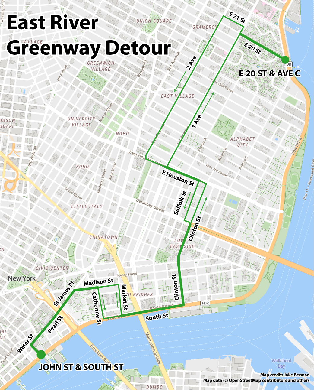
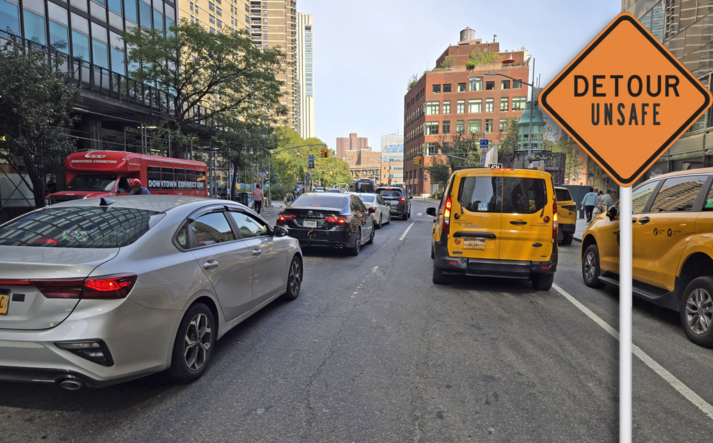
Right now, the Greenway is closed between E. 20th Street and John Street in the Financial District. With a major bike artery like the Greenway closed, one would think that the city Department of Transportation would set up a safe series of detours for cyclists. But I rode the full length of the detour betwee the Financial District and Stuyvesant Town and can say with confidence that the DOT’s replacement route is anything but safe.
Lower Manhattan
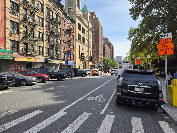
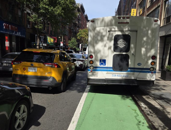
The Greenway detour starts at John Street and South Street in the Financial District. The route through the Financial District and Civic Center has heavy car and truck traffic, and none of this is a proper replacement for the East River Greenway’s protected bike path.
This portion of the detour that takes cyclists on John Street, Water Street, Pearl Street and St. James Place has no bike lanes at all. Instead, riders are forced into mixed traffic, and are expected to brave the sea of cars going to and from the Financial District.
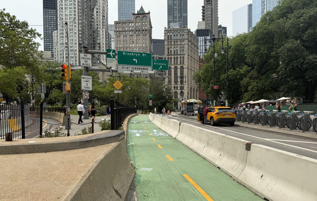
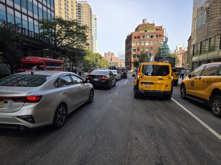
The worst segment is at the Brooklyn Bridge underpass, where the FDR Drive and Brooklyn Bridge ramps merge with city streets. Car traffic is already bad enough there that the NYPD stations traffic control officers for vehicles; it’s downright perilous on a bike.
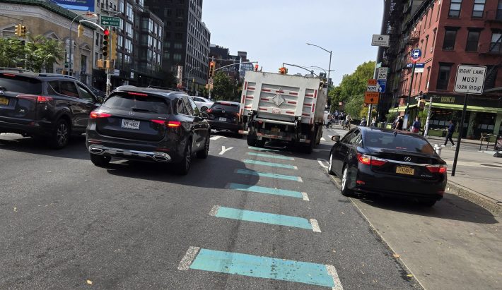
The route through Chinatown and Two Bridges — via Madison, Catherine and South Streets — is marginally safer, mostly because there’s less car traffic. That said, the route is still inadequate. Catherine Street has an unprotected bike lane, forcing cyclists to weave around double-parked cars and delivery vehicles. On Madison and South Streets, there is no bike lane at all, and cyclists are expected to ride in mixed traffic.
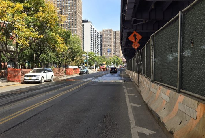
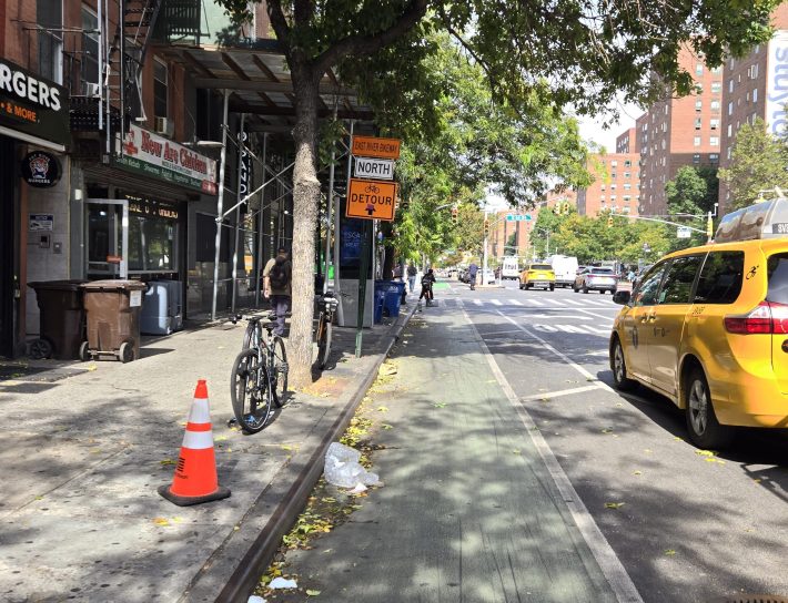
Continuing uptown from South Street to the Lower East Side, the situation is little better. Clinton Street below Delancey Street has a protected bike lane, but the lane was blocked by illegally parked city vehicles.
The Lower East side
North of South Street, the situation is little better. Clinton Street below Delancey Street has a protected bike lane, but the lane was blocked by illegally parked city vehicles.
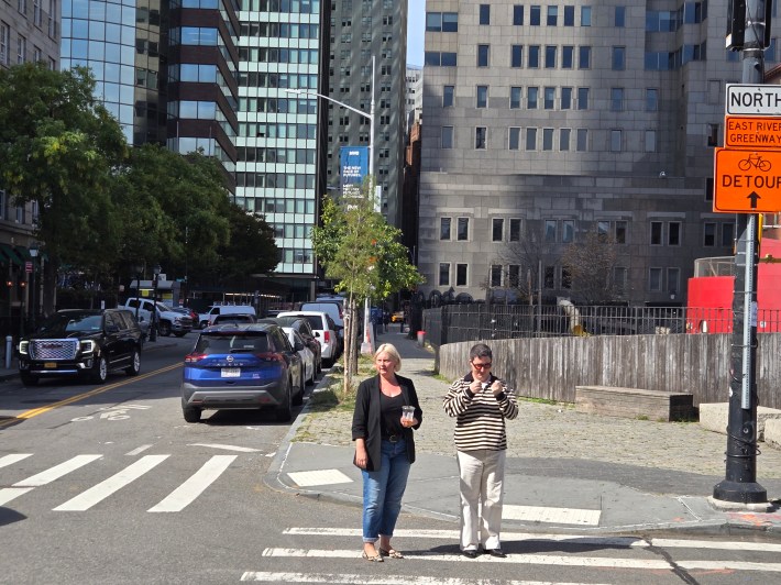
Continuing above Delancey Street on Clinton Street, I was forced into the car lanes by ambulettes, moving vans and Ubers blocking the bike lanes. After that, on Houston Street, the bike lane is squeezed between car lanes, and merging car traffic comes from both sides.
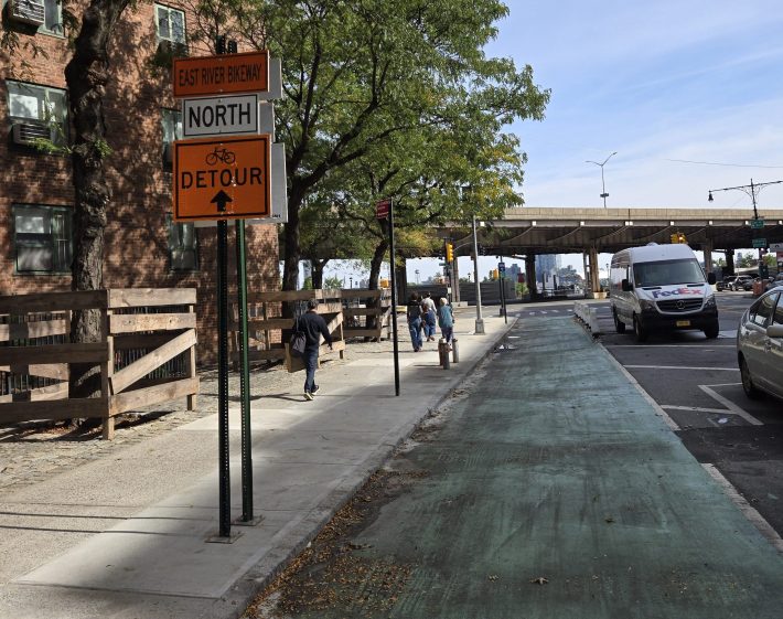
North of Houston
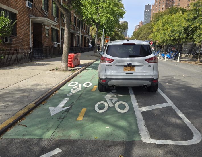
The final stretches of the Greenway detour — First Avenue to East 20th Street — are downright easy to navigate by comparison. Both streets have protected bike lanes with bike signals. While biking on Manhattan’s streets is never easy, it’s significantly less hazardous than the rest of the route.
Before the construction, the East River Greenway was a safe, popular biking route because it has minimal cross traffic and interaction with motor vehicles. The detour created by the DOT is nothing of the sort, and its unsafe routing suggests negligent design, especially below Delancey Street.
Maddeningly, one doesn’t have to go far to see what DOT could have done to create a safe detour. On the other side of the East River, heavy construction is underway on the Williamsburg waterfront. But in Williamsburg, cyclists aren’t asked to detour into heavy traffic. Instead, the temporary Kent Avenue bikeway is separated from car traffic by concrete barriers, temporarily replacing on-street parking. This type of cheap, quick fix is something DOT could and should do for the East River Greenway during construction.

Read More:
Streetsblog has migrated to a new comment system. New commenters can register directly in the comments section of any article. Returning commenters: your previous comments and display name have been preserved, but you'll need to reclaim your account by clicking "Forgot your password?" on the sign-in form, entering your email, and following the verification link to set a new password — this is required because passwords could not be carried over during the migration. For questions, contact tips@streetsblog.org.