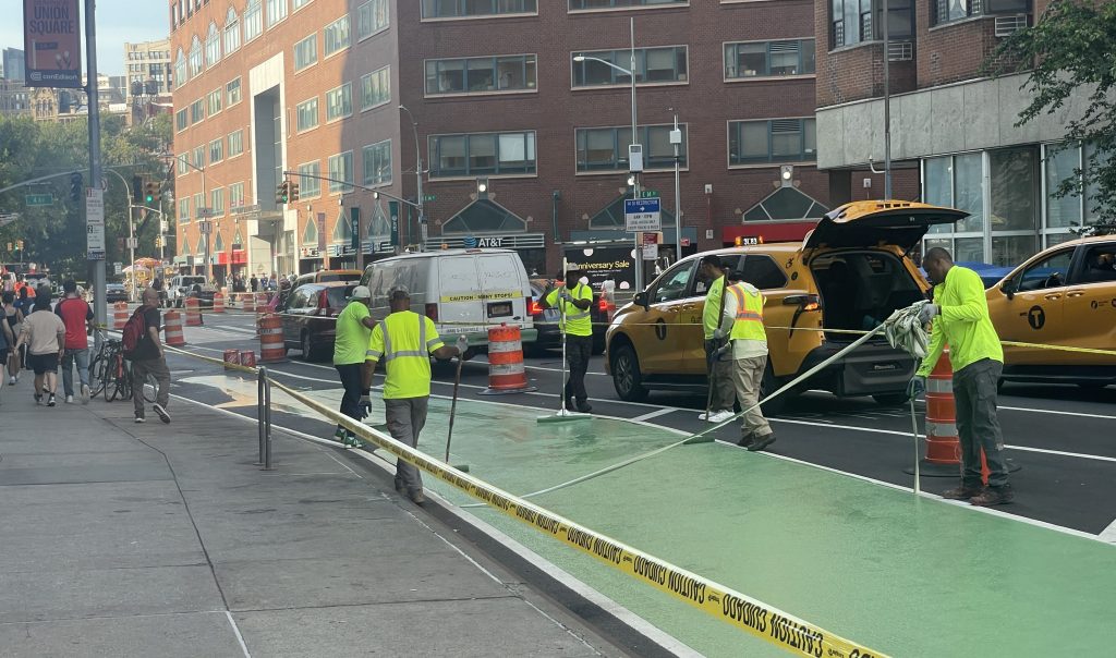
DOT To Add Bike Lanes Under Elevated Tracks in Astoria This Summer
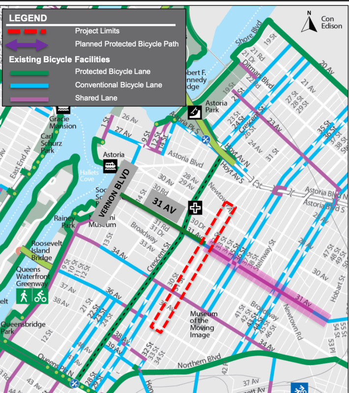
The city plans to install curbside parking-protected bike lanes this summer beneath the subway tracks on 31st Street in Astoria, Queens.
The protected bike lanes [PDF] will run for just under a mile of the north-south corridor, between 36th and Newtown avenues, and it’s one of a handful of cycling paths under elevated train tracks that the Department of Transportation sees as a way to better organize the chaotic roadbeds below the “El.”
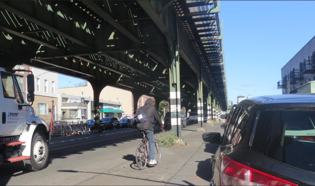
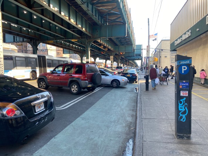
“The space from the [track] column to the curb, or what we like to call the ambiguous space, becomes a grab-bag of different types of activity,” said DOT’s Director of Safety Projects and Programs Chris Brunson told Community Board 1’s Transportation Committee last week. “Double-parking, driving, cycling, loading, and different pedestrian activity — all happening at the same time, making it very unpredictable.”
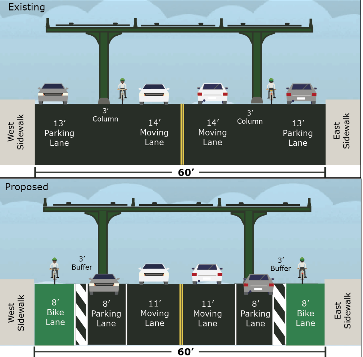
The plan does not remove any of the driving or parking lanes, but organizes the car storage space to be in line with the columns and adds a wide eight-foot bike lane and a three-foot buffer alongside each curb:
DOT also plans to add painted pedestrian islands at intersections to shorten crossing distances for pedestrians, while banning parking at corners for better visibility, also known as daylighting.
The road is 60 feet wide, making for long crossing distances for pedestrians, and the track’s poles block sight lines, while drivers routinely double-park illegally in the wide and ambiguous outer lanes, said DOT planner Rachael Metz.
The new project covers one of the most dangerous roads in Queens, ranking among the top 10 percentile for rates of people killed or seriously injured, according to DOT.
The agency logged a whopping 178 injuries on the stretch between 2020-2024, 13 of them severe, including three pedestrians, a cyclists, and seven people in a car.
The revamps bring more structure to roads under the tracks, and the design mirrors that of White Plains Road in the Bronx, where DOT began installing a protected bike lane in 2022. The agency plans to do the same in Inwood on 10th Avenue in 2027.
Some of the stretches on the Bronx strip still suffer from shoddy parking behavior blocking the paths, Streetsblog found during a visit in 2023.
Western Queens residents have for years clamored for safe north-south bike routes, and 31st Street along with Crescent Street came out as two favorites at a 2020 public workshop.
The agency rolled out a two-way bike lane on the latter street in 2021, which triggered a boom in cycling in the neighborhood, which previously only had protected paths around its edges. Last year, the city installed a bike boulevard on 31st Avenue, which also links to the proposed route.
Locals applauded the city’s plans, urging DOT to go a few blocks further in both directions, which would connect to the Queensborough Bridge in the south to Ditmars Boulevard in the north.
“I feel like I’ve been waiting 30 years for it. It’s way better organized now per the plans,” said Nas Magoutas, a community board member. “I kinda wish this was going all the way north to the Ditmars area, because the Ditmars area is a super chaotic passenger pickup area for similar reasons as the rest of this strip.”
“You’ll just come to a wall coming southbound at 36th Avenue and the Queensboro Bridge is so close … it’s almost a no-brainer to consider to keep it moving,” echoed the transportation committee’s chairperson Dominic Stiller.
DOT plans to redo the strip following resurfacing work sometime after July 1, and the new markings typically take about two months to complete, according to Brunson.

Read More:
Streetsblog has migrated to a new comment system. New commenters can register directly in the comments section of any article. Returning commenters: your previous comments and display name have been preserved, but you'll need to reclaim your account by clicking "Forgot your password?" on the sign-in form, entering your email, and following the verification link to set a new password — this is required because passwords could not be carried over during the migration. For questions, contact tips@streetsblog.org.