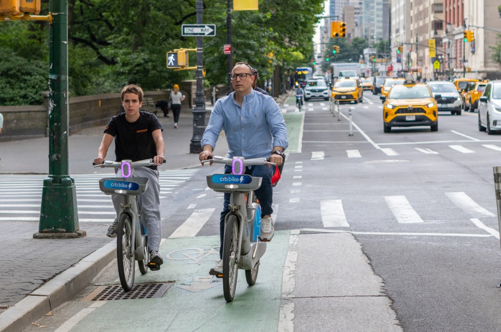
Parking Lot Under the FDR Should Become Public Space: Locals
An underused parking lot below the FDR Drive should finally turn into a community space instead of car storage, according to residents and pols along Manhattan’s East Side.
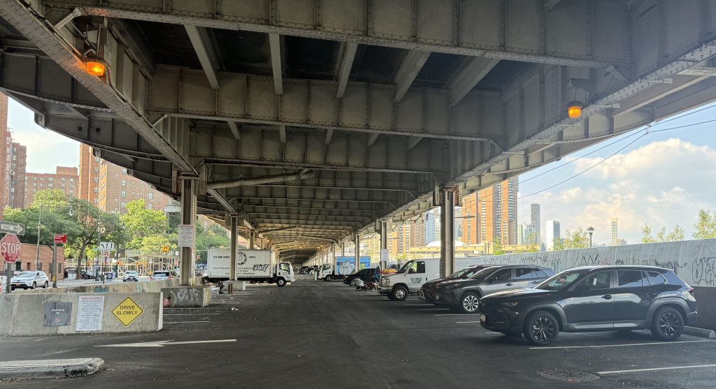
The city closed the paid parking lot below the highway, between E. 18th and E. 23rd streets at Stuyvesant Cove Park, for several years during the construction of a flood wall along the East River. But the parking spaces returned earlier this year as the project wrapped up, despite repeated calls from Manhattanites to turn the waterfront area into an amenity for people, not cars.
“If we took away the cars, it would be a visible connection through to the waterfront,” said Sandy McKee, the chairperson of Community Board 6. “We’ve gone through all this construction, we now have this big [flood] wall between us and the river, and this space has gone back to parking, which makes it extremely uninviting.”
The East River Greenway runs on the other side of that wall, along with a strip of parkland facing the water and a nearby NYC Ferry stop.
The lot adjacent to the Stuyvesant Town and Peter Cooper Village housing developments is not in high demand for drivers, and there’s another parking garage jutting into the East River nearby at the marina at E. 23rd Street.
“It certainly feels underutilized, I walk past it all the time,” said Council Member Keith Powers. “I am very invested in activating spaces like this one and other ones along the waterfront to make them more available to people in this area and have more access to waterfront space.”
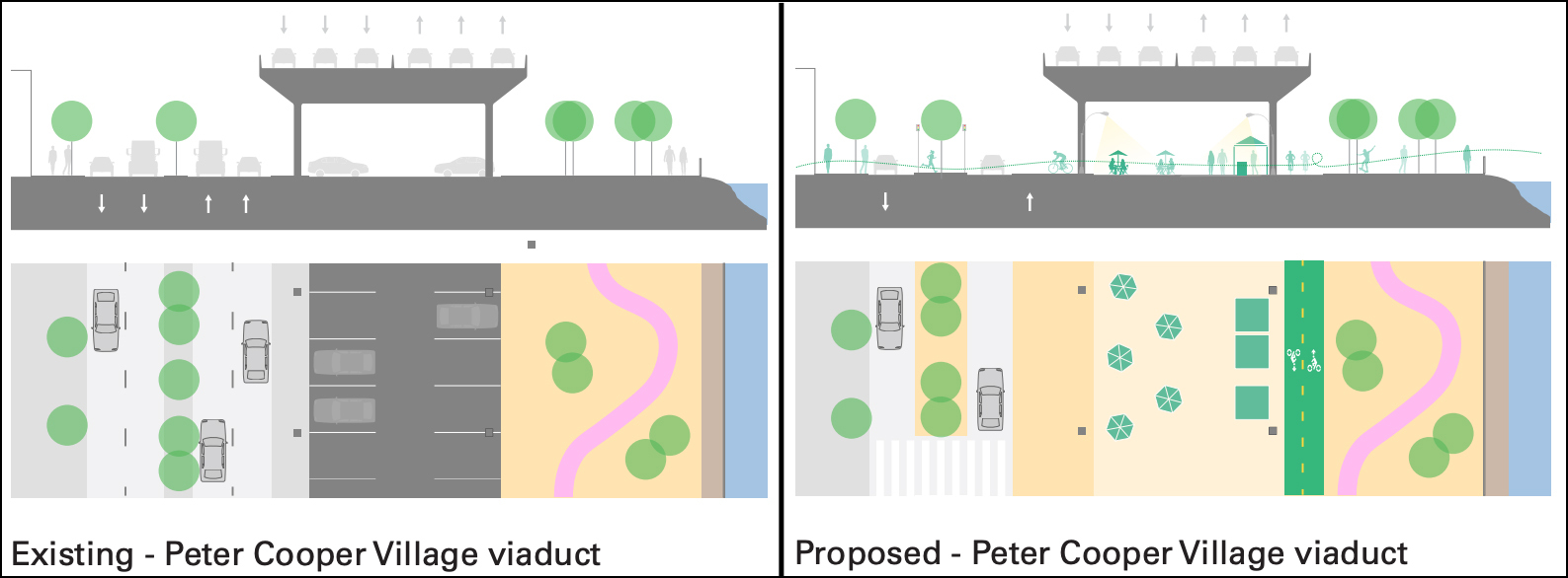
Public space boosters haven’t zeroed in on any one proposal yet, but McKee, who is also an architect, suggested the space would better serve New Yorkers better as an outdoor recreation area, like beneath the FDR further downtown.
A concept drawing by the design firm WXY, which wrote up a report [PDF] for CB6 this spring analyzing improvements for the waterfront in the larger area, shows how that could look.
As the city erected the flood barrier in the area two years ago, as part of a federally funded project known as East Side Coastal Resiliency, CB6 sent a resolution [PDF] to the Economic Development Corporation, which manages the space, asking them to repurpose the lots after the work was done.
The parking spots were shuttered during construction, but as that stretch of the overhauls finished up earlier this year, EDC nevertheless reopened them as car storage.
“It seems like a real lack of vision,” McKee said.
The civic leader said EDC officials claimed they wanted to continue receiving income from the parking, but she noted that the city was able to do without that revenue for several years amid the flood work.
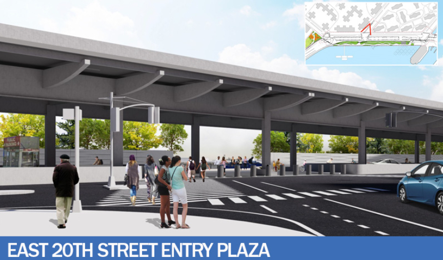
The project has wrapped up for now, but the Department of Design and Construction, which led the the work, will go back finish up utilities and build a new entryway at 20th Street, according to DDC spokesperson Denisse Moreno.
Coastal protection also work continues further south, where construction has created hazardous conditions for pedestrians and cyclists, Streetsblog previously reported.
There are other examples of repurposing no-mans-lands beneath highways.
The WXY study compared the FDR to the Bentway, a sprawling repurposed public space underneath the Gardiner Expressway in Toronto, Canada.
Closer to home, parking lots below the Brooklyn-Queens Expressway are slated to turn into so-called microhubs for deliveries to transfer from trucks onto smaller vehicles like electric cargo bikes, as part of a pilot project by the Department of Transportation.
DOT also turned the former parking lots underneath the BQE in Greenpoint and Williamsburg into a bike and pedestrian path in recent years.
EDC spokesperson Adrien Lesser said the city still needed the area for construction and said the agency “needs to meet the city’s overall needs associated with managing the public right of way.”

Read More:
Streetsblog has migrated to a new comment system. New commenters can register directly in the comments section of any article. Returning commenters: your previous comments and display name have been preserved, but you'll need to reclaim your account by clicking "Forgot your password?" on the sign-in form, entering your email, and following the verification link to set a new password — this is required because passwords could not be carried over during the migration. For questions, contact tips@streetsblog.org.