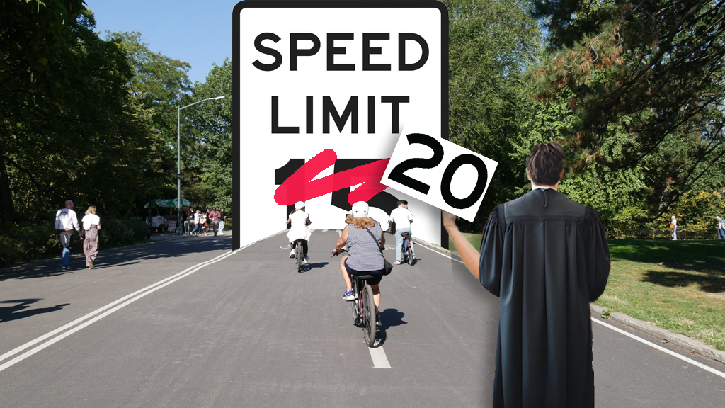
Talk about deliberate speed!
The city Department of Transportation said on Thursday that will use its newly granted power to reduce speed limits by lowering the legal driving rate from 25 to 20 miles per hour on 49 roadway segments in September.
By the end of 2025, another 201 locations will get reduced speeds, the agency said.
The first tranche of slower blocks comprise 8.64 miles, or roughly 0.13 percent of the 6,300 miles of roadway in New York City. If speed reductions roll out across similarly sized groups of roadways through 2025, the roadways would comprise 0.5 percent of city streets.

There is potential for much more, however: In the same announcement, the DOT said it will create a "Regional Slow Zone" in each borough — a zone where "speed limits will be set at 20 miles per hour throughout a set geographic area."
"The first location to be considered will be lower Manhattan south of Canal Street," the agency said, adding that its goal is for implementation by "the end of this year or early next year." A slow zone south of Canal Street could add roughly 20 miles of roadways into the effort to reduce speeding.
So if that all happens, by 2025, roughly 0.8 percent of city streets will have the lower speed limits under the state's "Sammy's Law" that passed this year in Albany.
In this case, don't blame DOT for the slow pace of slowing down drivers; the state law did indeed allow New York City to lower its speed limit on virtually all streets — but "Sammy's Law" gives the DOT the authority to reduce speed limits but only "on individual streets," as the DOT press release makes clear.
Only City Council legislation could create a new citywide 20-mile-per-hour speed limit. But the Council's Transportation Committee Chair, Selvena Brooks-Powers, said through a spokesperson that no member of the Council has yet proposed such a bill.
“Regional slow zones” are just rebranded “neighborhood slow zones” that have existed for over a decade. We didn’t fight for Sammy’s Law for DOT to spend years adjusting speed limits block by block. Lower the default speed limit to 20! https://t.co/48QOmGkEoj
— BrandonWC (@BrandonWC) June 27, 2024
Lower posted speed limits have been shown (repeatedly) to reduce speeding and, as a result, fatalities and serious injuries.
Thursday's announcement
To start, there will be 49 road segments in four boroughs (sorry, Staten Island) where drivers' speed will be capped at 20 miles per hour. Only three of those segments — Walton Avenue between E. 179th and E. 171st streets in The Bronx, Prospect Park West between Grand Army Plaza and 15th Street in Brooklyn, and Audubon Avenue between W. 165th Street and Fort George Avenue — are lengthy.
Activists in Park Slope pointed out that the Prospect Park West stretch was certainly appropriate, given that Sammy Cohen Eckstein, for whom the speed limit law was named, was killed by a driver on that roadway in 2013.
"Sammy’s death ... certainly may have been prevented if the speed limit had been lower in 2013," said Eric McClure, executive director of StreetsPAC. "This feels like an appropriate monument to Sammy, but every city street adjacent to a popular park, or anywhere else’s there’s substantial foot traffic, should get similar treatment, and sooner rather than later.
"We’d certainly like to see the city taking a more aggressive approach to lowering speed limits now that Sammy’s Law is finally an actual law," McClure added.
Without the three longer segments, the average reduced speed zone will be just 617 feet. Brooklyn safety advocate and "War on Cars" podcast co-host Doug Gordon pointed out that making short roadway segments safer is only a tiny step towards the larger goal of a city where no one is killed on the roadways.
"Pedestrians and cyclists don't magically appear on streets with lower speed limits; they come from all over," he said. "Therefore, we need DOT to lower the speed limit not just on a patchwork assortment of streets here and there, but across vast swaths of entire neighborhoods. ... Twenty is plenty wherever you'll find people, and in New York that's everywhere."
The DOT said in a statement that the segments were chosen with "a focus on priority locations such as schools" — and, indeed, many of the 49 locations are one- or two-block stretches next to schools.
"The agency will implement this safety measure utilizing safety data and focusing on equity, implementing speed limit reductions in Priority Investment Areas — defined as areas of the city with larger proportions of non-white and low-income residents, higher population and job density, and without a strong history of previous DOT investments."
On the regional slow zone, the DOT was less forthcoming, saying only that the agency will have more to say — and specify the exact geography — when the public notification process begins. The other four zones have yet to be determined.
Regardless of the lack of details, the area's Council member was ecstatic.
"It's great," said Council Member Christopher Marte. "My district has so much speeding off the Manhattan and Brooklyn bridges, and if drivers know they are going into a 'regional slow zone' south of Canal, maybe they'll think twice about speeding. So I welcome this, and hope we can expand it, even."
It is unclear how the "Regional Slow Zones" program will differ from the DOT's former "Neighborhood Slow Zones" program, which ceased taking applications from communities shortly after the onset of the global Covid pandemic in 2020.
That program created 26 such zones across all five boroughs between 2011 and 2015, but had not been expanded after that.
Slower open streets
The DOT also said on Thursday that will reduce the speed limit to 10 miles per hour on all existing shared and open streets "that have had substantial design upgrades," the agency said.
That list comprises:
Brooklyn
- Willoughby Ave. from Washington Park to Washington Ave .
- Berry St. from Broadway to N. 12th St .
- Underhill Ave. from Pacific St. to Eastern Parkway
- Sharon St. from Olive St. to Morgan Ave .
Manhattan
Broadway between:
- 18th and 23rd streets
- 24th and 25th streets
- 27th and 33rd streets
- 38th and 39th streets
- 48th and 50th streets
Queens
34th Avenue between:
- 69th and 77th streets
- 78th and 93rd streets
- 94th St. to Junction Blvd
Supporters of the bike boulevard on Underhill Avenue in Brooklyn cheered the DOT for formalizing the speed limit on the roadway:
Today @NYC_DOT informed us that the speed limit on the Underhill Bike Boulevard will be reduced to 10 mph.
— Underhill Avenue Bike Blvd & Underhill Plaza (@UnderhillOSCC) June 27, 2024
Underhill has seen >80% reduction in crashes thanks to the bike blvd treatment. Now the new speed limit will also lower the risk of serious injury from a crash to below 10% pic.twitter.com/cVsZxOlQSK
For now, here is the list of roadway segments that will soon have 20 mile-per-hour speed limits (length of segment is approximate):
The Bronx
- E. 139th Street from Willis Avenue to Alexander Avenue , 705 feet
- Courtlandt Ave. from E. 156th St. to E. 157th St ., 369 feet
- E. 151st St. from Courtlandt Ave. to Morris Ave ., 940 feet
- E. 156th St. from Concourse Village W. to Morris Ave., 886 feet
- Gerard Ave. from E. 167th St. to E. 168th St., 580 feet
- St Anns Ave. from E. 149th St. to Westchester Ave., 722 feet
- Tinton Ave. from E. 150th St. to E. 152nd St., 767 feet
- Sheridan Ave. from E. 171st St. to E. 172nd St., 464 feet
- Walton Ave. from E. 179th St. to E. 171st St ., 4,728 feet
- Prospect Ave. from E. 175th St. to E. Tremont Ave., 1,200 feet
- Wallace Ave. from Mace Ave. to Waring Ave ., 663 feet
- E. 225th St. from White Plains Rd. to Barnes Ave., 841 feet
- E. 172nd St. from St. Lawrence Ave. to Beach Ave., 283 feet
- Netherland Ave. from Kappock St. to W. 227th St., 804 feet
- Reeds Mill Ln. from Bivona St. to Steenwick Ave., 603 feet
Brooklyn
- Seventh Ave. from 43rd St. to 44th St., 237 feet
- Dean St. from Saratoga Ave. to Thomas Boyland St., 767 feet
- MacDonough St. from Lewis Ave. to Marcus Garvey Blvd., 812 feet
- Christopher Ave. from Sutter Ave. to Belmont Ave., 476 feet
- Ashford St. from Belmont Ave. to Pitkin Ave ., 469 feet
- Prospect Park West, Grand Army Plaza to Bartel Pritchard Square, 4,825 feet
- E. 94th St. from East New York Ave. to Rutland Rd., 915 feet
- Fenimore St. from Brooklyn Ave. to New York Ave., 620 feet
- Ninth Ave. from 63rd St. to 64th St., 257 feet
- 45th St. from Fort Hamilton Pkwy. to 10th Ave., 561 feet
- Lenox Rd. from E. 39th St. to E. 40th St., 267 feet
- E. 96th St. from Avenue D to Foster Ave ., 774 feet
- Sackman St. from Belmont Ave. to Sutter Ave., 450 feet
- Fort Greene Pl. from Fulton St. to Dekalb Ave., 948 feet
- Lewis Ave. from Hart St. to Willoughby Ave ., 271 feet
Manhattan
- W. 138th St. from Amsterdam Ave. to Broadway, 847 feet
- W. 64th St. from West End Ave. to Amsterdam Ave., 919 feet
- E. 120th St. from Lexington Ave. to Third Ave., 522 feet
- E. 128th St. from Lexington Ave. to Third Ave., 522 feet
- Morningside Ave. from W. 126th St. to W. 127th St., 257 feet
- Audubon Ave. from W. 165th St. to Fort George Ave., 7,708 feet
- E. 112nd St. from Second Ave. to Third Ave., 703 feet
- E. 120th St. from Second Ave. to Third Ave., 703 feet
- E. 120th St. Madison Ave. to Park Ave., 474 feet
- E 128th St. Madison Ave. to Park Ave., 474 feet
Queens
- 112th St. from 37th Ave. to 34th Ave., 958 feet
- 47th Ave. from 108th St. to 111th St ., 900 feet
- 155th St. from 108th Ave. to 109th Ave., 645 feet
- 167th St. from 108th Rd. to 109th Ave., 481 feet
- Union Hall St. from 109th Ave. to 110th Ave., 652 feet
- 144th St. from 88th Ave. to 88th Rd., 205 feet
- 143th St. from Linden Blvd. to 115th Ave., 683 feet
- 105th St. from 35th Ave. to 37th Ave., 536 feet
- 31st Ave. from 60th St. to 61st St., 262 feet
