An abandoned Manhattan park path could become an alternate bike commuter route that avoids the steep climb on the Hudson River Greenway at the George Washington Bridge. All it needs is a little love and some fresh pavement.
Upper Manhattan's greenway paths have a long history of poor stewardship. What's now the Harlem River Esplanade, a two-mile waterfront path from Dyckman Street southward, was abandoned by the city for nearly 40 years — with one end cut off by a highway ramp. In the 1990s, what's now the Hudson River Greenway north of 181st Street was sabotaged by a highway project that narrowed parts of the path and left behind jackhammered pavement and dangerous holes. It took until 2003 for the city to reinvest in these paths and make them bikeable again.
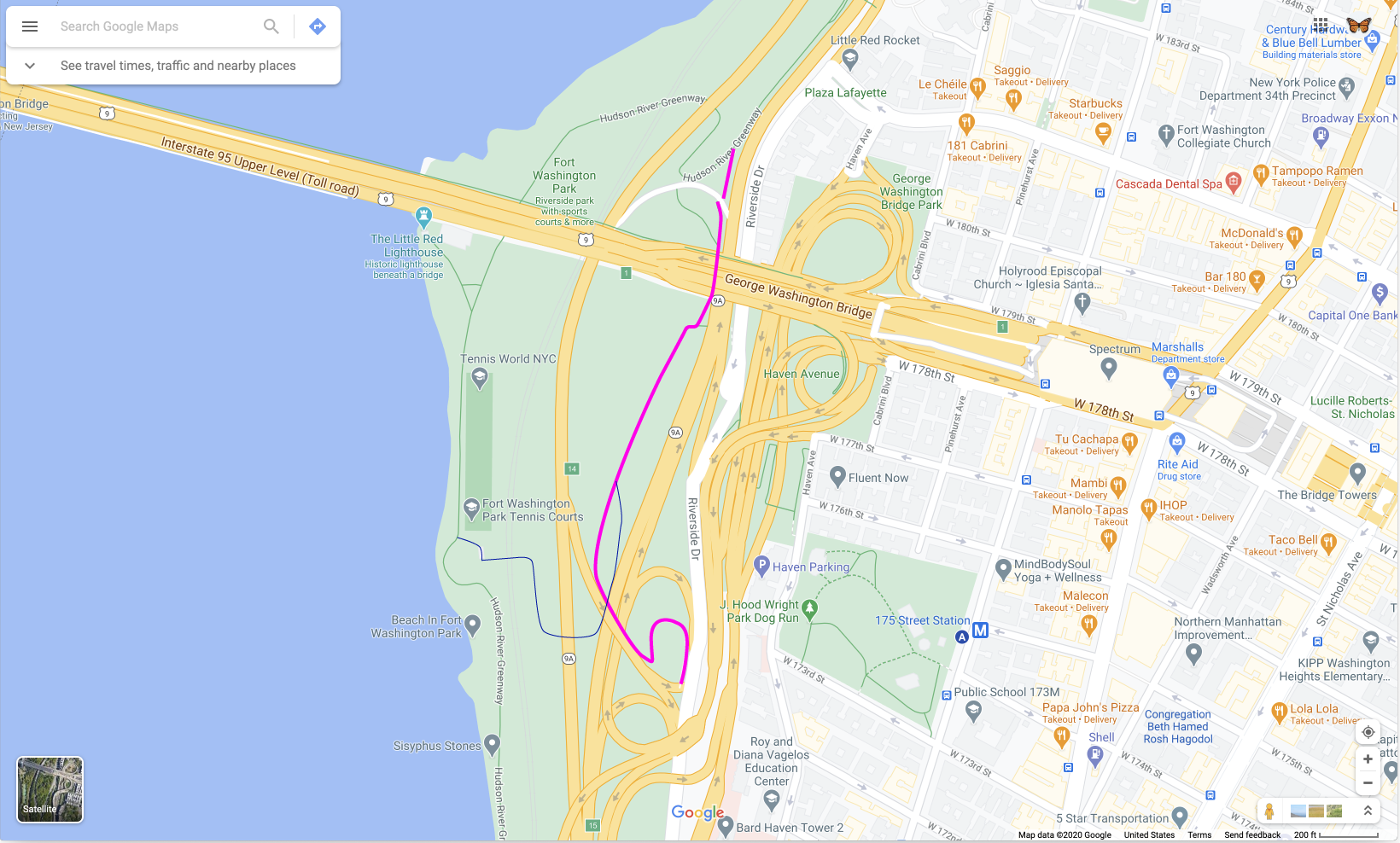
But there's still one Upper Manhattan greenway path that's rotting like it's 1999. This path runs through Fort Washington Park, connecting from the Hudson River Greenway path near West 181st Street to Riverside Drive near West 172nd Street. It neatly weaves through the spaghetti of highway ramps that infest the area, allowing cyclists to travel directly between the greenway and Riverside Drive without climbing steep hills.
Back in 2003, using this path required a bit of risk-taking. Its north side, next to Riverside Drive under the George Washington Bridge, was walled off with concrete barriers, requiring southbound travelers to briefly scurry into highway traffic and clamber back over a guard rail. The intrepid explorer was then met with dead trees and a makeshift berm laying across the path. Thankfully, those barriers were removed by 2018, when the nearby Hudson River Greenway path bridge over the Amtrak tracks was temporarily closed and some greenway users took this path as a detour.
You can visit the path by going to the Hudson River Greenway, just south of the 181st Street pedestrian bridge. The greenway path curves off to the right, but in front of you is a moldering sidewalk that heads directly south, alongside the northbound Riverside Drive.
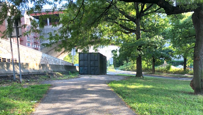
Follow that sidewalk south: You’ll have to navigate around a shipping container blocking most of the path (see above photo) and then carefully cross a little-used road that allows “authorized users” make a U-turn to the southbound Henry Hudson Parkway. Follow the sidewalk southward, under the GWB overpass, and it soon enters a grove of trees.
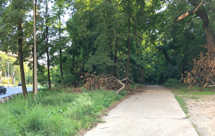
The path has two forks: Take the right-hand fork each time.
Once you get further along on the path, the pavement crumbles away. If you’re on a bicycle it’ll be a rough ride for the next hundred yards or so.
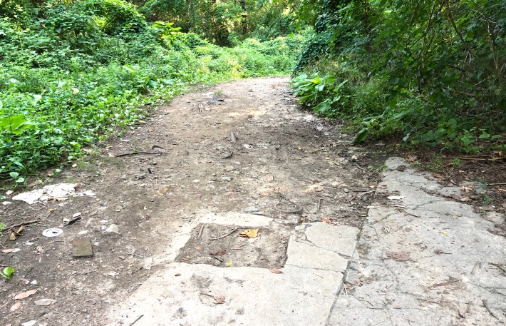
The path weaves through the woods, alongside a highway ramp, the pavement comes back, and we end up at an intersection of Riverside Drive and highway exits from the Henry Hudson Parkway and I-95, a few blocks north of 165th Street.
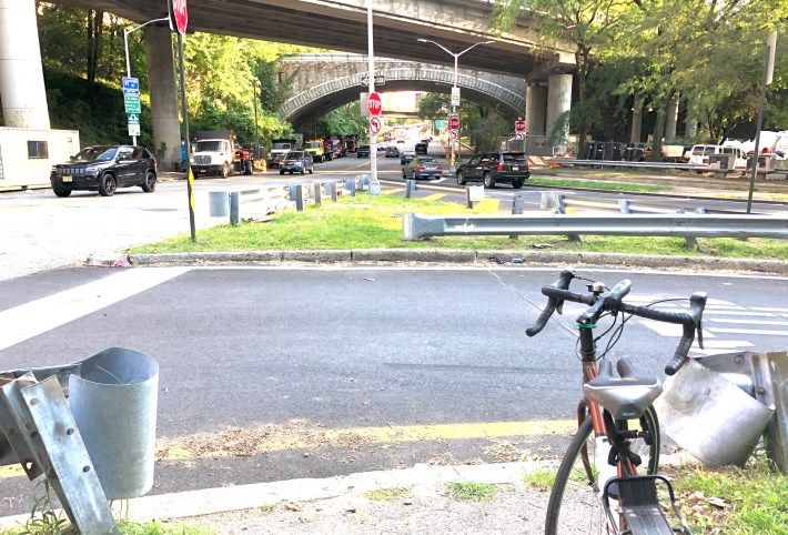
Although there’s no obvious path to keep going southward, a closer look at the traffic islands shows gaps in the guard rail and bits of pavement that show the intersection was originally designed with a crosswalk and a route across the ramps. The exits all have STOP signs protecting them. Cross here and continue south on the sidewalk on the west side of Riverside Drive. In a block or so, you’ll be at another highway ramp, again with no crosswalk, then you get to a traffic light by the New York State Psychiatric Institute building. This is the spot where Riverside Drive changes personality from ugly highway to normal-looking city street. Thanks to the traffic signal, this is also the spot where northbound cyclists on Riverside Drive can cross over and reach the path.
This route could be made bike-friendly with a minimal investment — fix the pavement, restore the crosswalk stripes, designate the little-used sidewalk north of the institute as a shared bike/ped path, add some signs to help people find their way, and maybe adjust the traffic light. This path doesn’t have to be just a backup route for cyclists avoiding the greenway hill — it could let future throngs of Riverside Drive cyclists connect to the north path of the George Washington Bridge without having to compete with drivers on Fort Washington Avenue or cross the traffic sewers of West 178th and 179th Streets. Although it's now closed, the GWB north path will eventually re-open for bicyclists as part of Port Authority upgrades to the bridge. Just like motorists, bicyclists also need secondary routes, especially ones that avoid steep hills.
So how do we keep this park path from rotting for another 40 years? How do we realize its potential as a useful greenway route? Write, call or tweet at Manhattan Borough President Gale Brewer and City Council Member Ydanis Rodriguez. Ask them to find some capital funding to fix this place up. Letting pieces of our park system go to seed is a 20th-century trend that we can do without.
Ed Ravin (@VeloTraveler), a long-time bicycling and livable-streets advocate, is a past board member of the Five Borough Bicycle Club and Transportation Alternatives.
