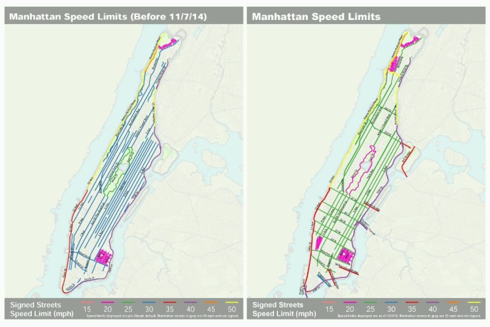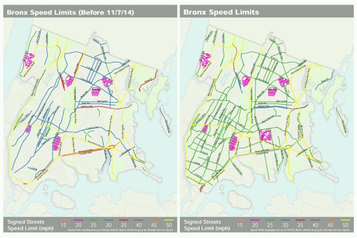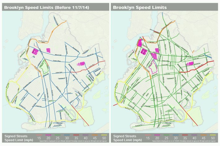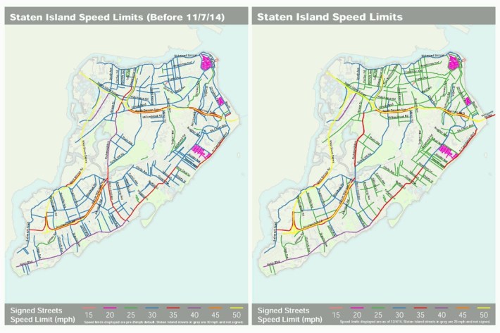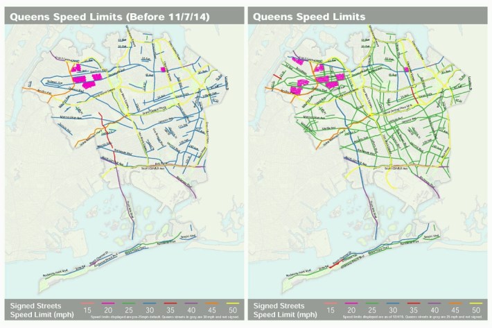
DOT has released before-and-after maps for each borough showing how signed speed limits have changed since Mayor de Blasio lowered the city's default limit to 25 miles per hour in 2014. With the maps, New Yorkers can see which major surface streets are now signed for 25 mph and which have retained higher speed limits.
After the 25 mph default speed limit took effect, DOT left 30 mph signs on some wider streets as it evaluated whether to reduce those speed limits. This caused some uncertainty on streets like Riverside Drive, where new 30 mph signs went up, then were replaced, a year later, with 25 mph signs. Now DOT has wrapped up that process and re-signed 800 miles of streets for 25 mph speed limits.
For the most part, only a few surface streets in each borough are now signed for speed limits higher than 25 mph. There are 200 miles of such streets citywide (about half of them in Queens), compared to 600 miles before the new default limit took effect.
The maps are a useful resource. If you see a 30 mph sign in your neighborhood that you think should have been removed, now you can determine whether the city intended for that street to be signed for that speed or not. The maps can also help people identify streets that still need lower speed limits, or see at a glance which neighborhoods have 20 mph slow zones and which do not.
We've posted the maps below, along with a statement from DOT about the process of re-signing streets for the lower speed limit and how it determined exemptions to the 25 mph default. You can also access speed limit information via NYC Open Data or Vision Zero View.
Here is DOT's statement :
As part of Mayor de Blasio’s Vision Zero initiative, NYC DOT was proud to champion the successful effort to lower New York City’s default speed limit from 30 mph to 25 mph.
Thirty miles per hour was and is an inappropriate speed limit for most residential streets. With the leadership and support of the state legislature, the governor and the City Council, the 2014 legislative change was followed by the safest year on New York City streets.
At the time of the legal change, it was understood that the new law covered streets where speed limits were not posted. Many larger streets, including limited access highways or major arterial streets, continued to have posted speed limits of 30 mph and above. At the time of the speed limit change on November 7, 2014, DOT committed to evaluating these locations over the next year – and making appropriate adjustments to posted speed limits. In its evaluation of these corridors, DOT considered crash history and overall geography to determine the appropriate speed limit.
This initial citywide review along with a significant re-signing effort has been completed.
As part of this review, DOT posted over 4,700 new 25 mph speed limit signs – many more than the initial 3,000 estimated. DOT also removed nearly 2,400 30 mph speed limit signs (about 700 remain). At this point, over 5,000 miles of our streets – or 90% by mileage – have speed limits of 25 mph or lower, with about 12%, or over 800 miles, explicitly posted for 25 mph.
The number of NYC streets with posted speed limits of 30 mph, the prior default speed limit, has declined dramatically, from 9% (about 600 miles) of all streets to 3% (about 200 miles). Of those remaining 200 miles, about half (96 miles) are in Queens, and 25% (52 miles) are on Staten Island.
We believe that along these corridors, typically within less densely populated areas of the City, motorists who comply with the posted speed limit and other traffic rules can drive safely.
DOT now provides current posted speed limits as a layer in Open Data and for public viewing on the Vision Zero View website.
DOT is always open to public feedback and considers public input on posted speed limits.
