This is part four of a five-part series by former NYC DOT policy director Jon Orcutt about the de Blasio administration’s opportunities to expand and improve cycling in New York. Read part one, part two, and part three.
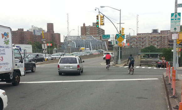
Forging good cycling routes across the Harlem River represents a strong organizing principle for a multi-year program to deliver better cycling to Harlem, Washington Heights, and the Bronx.
Just as many of the bike lanes in Brooklyn north of Prospect Park and Manhattan south of 14th Street emerged around the bikeways on the Brooklyn, Manhattan and Williamsburg Bridges, the Harlem River bridges present natural focal points for bike network development. A comprehensive set of improvements here would be a major contribution to the "Bill de Blasio bike network" I began to outline in part three of this series. It could also go hand-in-hand with Citi Bike expansion into the Bronx.
While most of the pathways on the Harlem River spans are good or at least decent for cycling, connections from the bridges to Manhattan and Bronx streets run the gamut from inconvenient and unwelcoming to very dangerous. A bike network program for the Harlem River bridges would create safer, more attractive access and egress routes, linking the bridges to ongoing bike network development in the southern Bronx and upper Manhattan. A few examples:
- The connection from First Avenue to the Willis Avenue Bridge needs traffic calming, longer crossing times and more room for cyclists and pedestrians to protect them from heavy traffic turning from First Avenue onto 125th Street.
- The Bronx side of the Third Avenue Bridge is characterized by very heavy traffic coming from several directions, with poor design and inadequate signal time for pedestrians and cyclists getting to or from the path. The bridge itself still features "cyclist dismount" signs. Painted bike lanes on Third Avenue in the Bronx are severely worn and require cyclists to negotiate extremely intimidating traffic.
- On the Manhattan side of the Third Avenue Bridge, south of Harlem River Park, no street-level access is provided across 128th Street. People are expected to use an inconvenient and potentially dangerous footbridge, an antiquated approach to accessibility for pedestrians, cyclists, and people with disabilities. Instead of spending on the continued maintenance and eventual replacement of the footbridge, the city should save costs by dismantling it and installing a signalized crossing on 128th.
- The Madison Avenue Bridge path ends in the Bronx at a very busy intersection above the Major Deegan Expressway. The path at this point does not even feature ADA ramps, let alone accommodation or guidance for crossing the intersection on foot or bike.
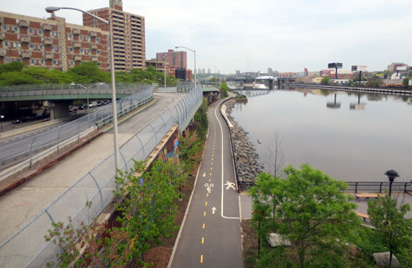
- A pristine section of waterfront greenway has been stranded in Harlem River Park between 145th Street and 133rd Street for years because of construction staging along the riverfront to the south. Now that the replacement of the Willis Avenue Bridge is complete, DOT should clear out so that waterfront park development can resume, and an interim bikeway can be added from 133rd Street to the Triborough Bridge, where it would link to the East River esplanade.
A Harlem River Bridge program would need to address these issues and more, all the way to the Broadway Bridge. The payoff in terms of accessibility and quality of life along the Harlem River, not to mention increased use of the bike network in Upper Manhattan and the Bronx, would be immense.
Tomorrow: Why the current state of local NYC politics is highly conducive to making significant progress on bike policy.
