DOT Rolls Out New Tech To Better Analyze How People Move on City Streets
The Department of Transportation is rolling out new technology to track how people move about the street, whether in a car, on foot, or on two wheels — a significant upgrade from the time-consuming manual work to log traffic that the agency does now, which slows down life-saving upgrades.
The DOT has placed sensors at 12 locations across the city as part of a pilot program with the tech company Viva to better analyze street designs and programs, learn where safety projects work best, and better understand how people are using public space.
“This street activity sensor technology will allow us to make our streets safer more quickly,” Mayor Adams said in a statement. “This technology has the potential to save time, money, and lives. We will be monitoring its effectiveness closely and deploying it strategically to understand how we can best maximize its impact.”
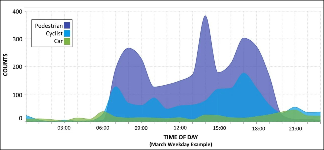
According to preliminary data collected in March from one sensor at 34th Avenue and 77th Street — the heart of the gold standard of open streets, now called Paseo Park — people on foot start flocking to the area as soon as the barricades get set up at about 7 am. The number of pedestrians nearly hits 400 people by around 2 p.m., and 300 around just before 6 p.m. Cyclists steadily use the street throughout the day, with nearly 200 riding the blocks at about 5 p.m., according to the data, which was first published by Curbed.
The sensors will be able to count and identify up to nine different modes of travel, including pedestrians, bicyclists and e-scooters, analyze travel patterns and how they change seasonally, measure how fast each mode of transportation is traveling, and detect near-crashes.
The new technology will be piloted in every borough but Staten Island.
- In Brooklyn, it’ll be at Schermerhorn and Smith streets, Flushing and Vanderbilt avenues, Berry and N. Sixth streets, and Hoyt and Warren streets.
- In the Bronx, there will be one sensor located at Willis Avenue and East 135th Street.
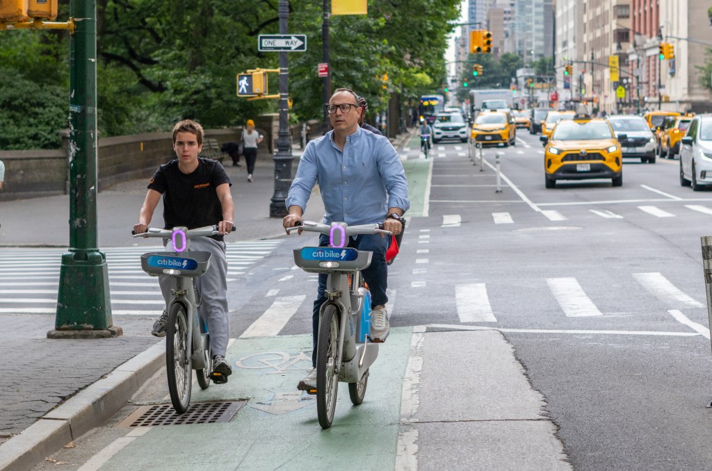
- In Manhattan, the sensors will be located at Central Park West Drive and Columbus Circle, First Avenue and E. 59th Street, Sixth Avenue and W. 23rd Street, and the Brooklyn Bridge.
- And in Queens, they will be stationed at 34th Avenue and 77th Street, Broadway and Vietor Avenue, and 11th Street and 44th Drive.
The DOT says the sensors will be purposely placed in areas with high concentrations of micro mobility users, bikers, and pedestrians in order to provide crucial, real time analytics needed for street redesigns — eliminating the need for a staffer to manually count the vehicles over hours, a time-consuming and inefficient process, according to a spokesperson for the agency.
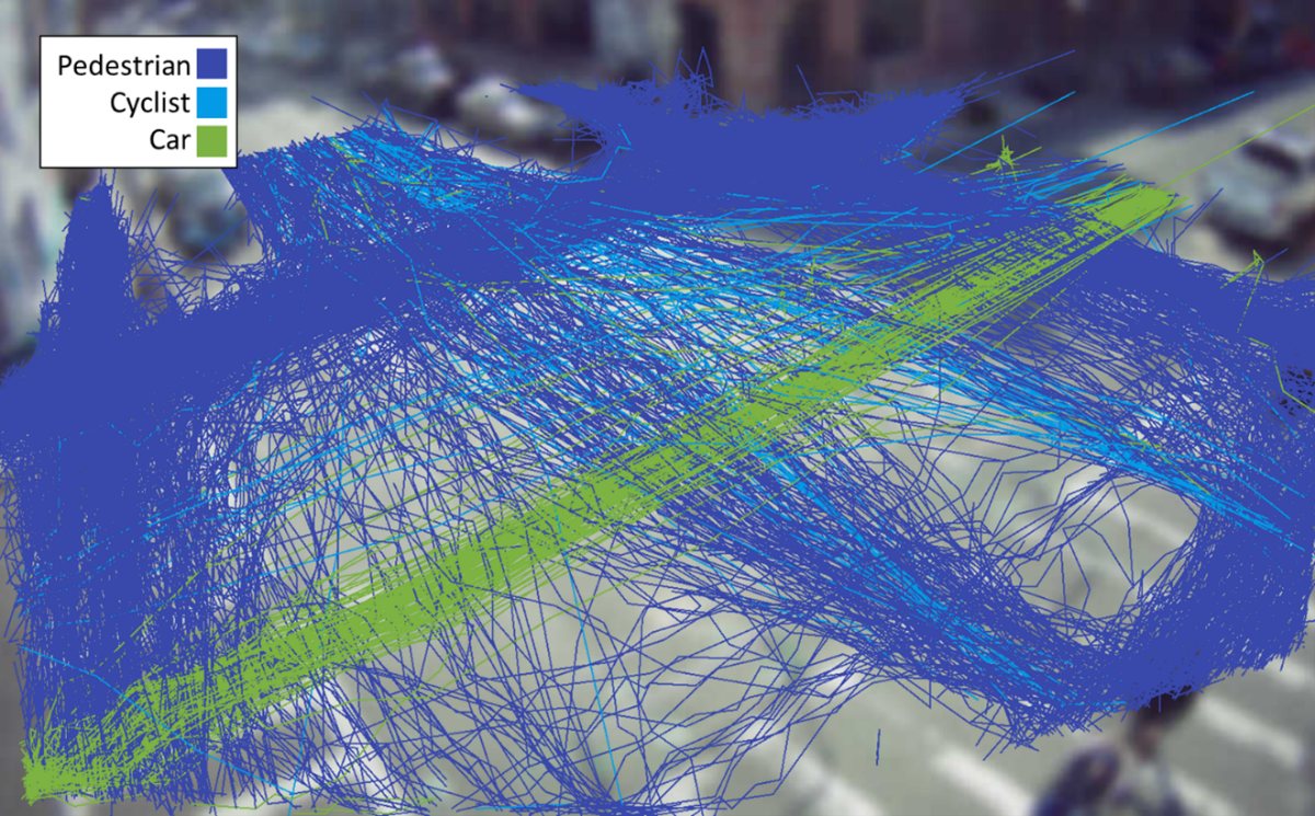
And on Berry and N. Sixth streets, a sensor spits out a colorful analysis of the roadway’s traffic patterns — highlighting just how many more pedestrians than cars traverse the roadway, and where and how cyclists move about.
The sensors could also help resolve misallocations of public space, where cars often get the bulk of room despite being outnumbered by pedestrians or cyclists.
On Lexington Avenue, for example, the city plans to take a lane away from cars to expand the sidewalk after a manual DOT analysis revealed that cars, which get three vehicular travel lanes, comprise just 17 percent of its usage, and that pedestrians, who get just one-third of the public space available, make up 76 percent of the roadway’s users. At some points throughout the day, pedestrians even outnumber drivers more than four to one, according to DOT.
And on the popular First Avenue bike lane, a vehicle count conducted in 2021 revealed that cars and trucks barely outnumbered bikes, despite drivers getting almost 12 times as much space on the uptown roadway. One of the sensors will be placed at First Avenue and E. 59th Street.
Those numbers followed a similar pattern on Second Avenue, where a count revealed that there were 323 cars and trucks and 171 bikes, or 1.9 cars and trucks for every bike, despite bikes having just eight feet of space on the wide road, compared to 100 feet for the movement and storage of cars.
But advocates are skeptical that it’ll make a difference. The city lacks enforcement and political gutsiness, not data. Case in point, bike lanes blocked by cars with placards on them.
“Additional information is always good, but it won’t clear the court officers out of the Lafayette Street bike lane. Our yawning gap is in leadership and management, not technology and data,” said Bike New York’s Jon Orcutt.

Read More:
Streetsblog has migrated to a new comment system. New commenters can register directly in the comments section of any article. Returning commenters: your previous comments and display name have been preserved, but you'll need to reclaim your account by clicking "Forgot your password?" on the sign-in form, entering your email, and following the verification link to set a new password — this is required because passwords could not be carried over during the migration. For questions, contact tips@streetsblog.org.