Since last year, the city Department of Transportation has been unveiling a variety of “bike boulevard” configurations across the city, including ones on Jackson Avenue in the Bronx, 39th Avenue in Queens, 20th Street in Brooklyn and a forthcoming one on Underhill Avenue in Brooklyn. But the specific elements of the DOTs bike boulevards differ based on locations. Last month, the agency unveiled a plan to convert the existing Berry Street “open street” into a true “bike boulevard,'' but what does that mean? Let Streetsblog guide you…
First, an overview
The DOT came before Community Board 1's Transportation Committee on June 30 to present what it had dubbed an update on the Berry Street open street — part of the Covid-era initiative to provide crammed urban residents more outdoor recreation space free of speeding cars. The stretch of Berry Street between South Fifth and North 12th streets has proven to be one of the agency's most successful and enduring open streets.
In a survey conducted last year, area residents told DOT that they love their open street for casual strolling, and 77 percent of residents said they visit the open street daily or several times a week. (The agency said 93 percent of survey respondents live in the neighborhood — an important statistic because opponents of open streets at the community board meeting claimed DOT only listens to outsiders.)
In the survey, 76 percent of respondents want the future configuration of the open street to accommodate “strolling” and 56 percent want it improved for biking, while only 19 percent of residents want the roadway to benefit “driving.”
Open streets have proven to be far safer for pedestrians and cyclists than regular car-filled roadways. In the five full years before open streets were created, there were 409 crashes reported on Berry Street just between South Fifth and North 12 streets, injuring 30 cyclists, 21 pedestrians and 69 motorists, or roughly 24 injuries per year.
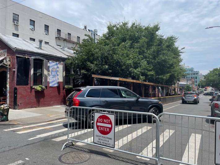
But in 2021, there were only 17 reported crashes during open street hours, injuring just five people, a decrease in average annual crashes of 80 percent and a decrease in injuries also of 80 percent. Cars are, of course, still allowed on Berry Street for parking and motoring, as the photo below shows:
Despite all that, the community board committee — having spent close to four hours debating other issues that night — tabled a full discussion of the bike boulevard until its July meeting (date to be determined). Dozens of people were on hand to support the project, and hundreds have already signed a petition in support.
Here's the plan in full:
The specifics

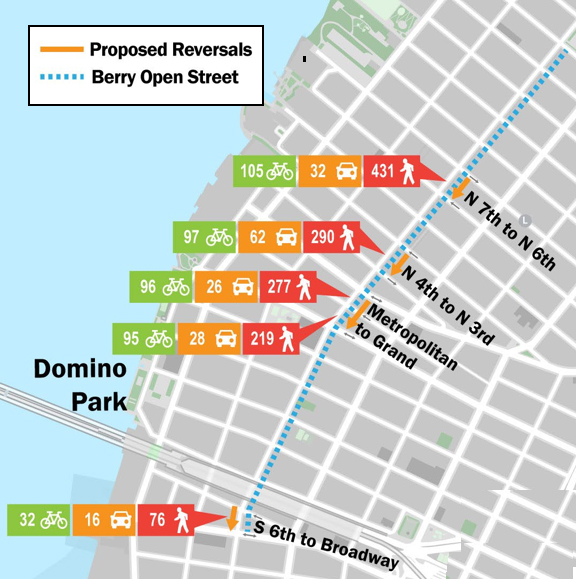
The new bike boulevard would extend between Grand and North 12th Street, with a southern spur on Grand between Berry and Domino Park and a northern spur on North 12th between Berry and Bedford to create what DOT is calling a "Park to Park Connection" (see map, right).
Four blocks on the proposed bike boulevard would be converted from one-way northbound to one-way southbound through the placement of a painted (and eventually raised) pedestrian island. A fifth block of Berry at the gateway to the corridor — between South Sixth Street and Broadway — would also be changed to one-way southbound, but that’s outside the bike boulevard (for now).
Unlike the Vanderbilt Avenue on weekends, the Berry open street isn’t fully car free, though pedestrians and cyclists far outnumber drivers. According to the DOT, on a typical weekday in the afternoon, 431 pedestrians, 105 cyclists and 32 drivers use the block of Berry Street between North Sixth and North Seventh streets (see graphic below).
Also, residents complain that cyclists and delivery workers speed through the area because of a lack of designated routes. But compared to existing conditions along the corridor, the DOT plan promises significant safety improvements. Here's a primer:
Directional changes
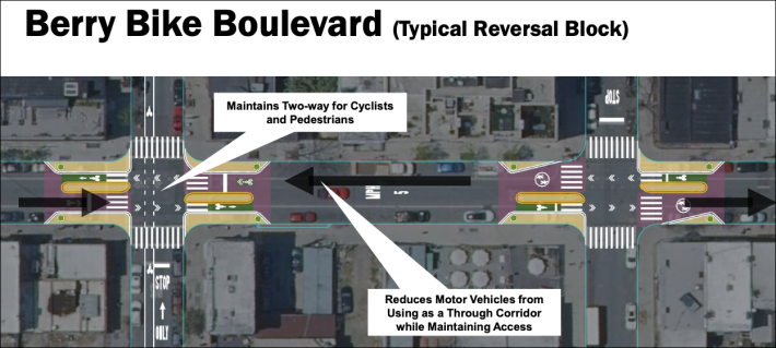
The signature element of a DOT bike boulevard is the manner in which it redirects car drivers to eliminate thru traffic. On one-way northbound Berry Street, this would be accomplished with “reversal blocks”: North Sixth to North Seventh, North Third to North Fourth and Grand Street to Metropolitan Avenue will be rerouted to southbound-only for traffic (cyclists can still go both ways).
The directional switch prevents drivers from using Berry as a thru street, which, according to DOT, has also reduced speeds and car volume along a corridor — a strategy that showed significant success on 39th Avenue in Sunnyside, which used to be a major shortcut for drivers and has returned to being a low-density residential street.
“Right now, it is very hard to enjoy the open street because I feel like I have to be way more on guard than if I'm on a sidewalk,” said Christian Philippone, complaining of car traffic on the open street. “While I am walking down Berry Street, I'm like, ‘Oh, that could be a bike, it could be a car or it could be a scooter.’ I would rather be on the sidewalk.”
Other locals who understand the concept like it.
“That's a fun one, because there are people, just for the hell of it, currently driving through and weaving around those barriers all the time,” said resident Doug Krehbiel. “Now they won't have anywhere to go.
Pedestrian and bike improvements
Along the proposed Berry Street bike boulevard, pedestrian zones (initially paint, but perhaps someday more) will be placed at each intersection, creating a shorter crossing distance for pedestrians and narrowing the overall street, calming traffic speeds. The curb extensions slow down drivers by widening the turning angle and, at least in theory, forcing the driver to execute the turn more carefully. Also a wider angle allows drivers to better see pedestrians.
The Berry Street bike boulevard will not feature a completely separated bike lane, as seen in the Sunnyside boulevard, but cyclists will have a designated corridor at intersections between the new pedestrian islands and the sidewalk. The goal is to organize the flow of bikes and other forms of micro-mobility along the shared street. See graphic below:
Cyclists support such paint treatments.
“There are a lot of restaurants down here and they have a lot of delivery guys on bikes. I am one of them, so we bike up and down this street all the time,” said Nate Williams. “Having a better design for bikes would be great.”
Loading zones
Residents also complain that Berry Street currently suffers from excessive double-parking by commercial vehicles, the result of too many car owners using the roadway for all-day storage of their vehicles.
To alleviate the double-parking, the DOT will set aside some of the curbside space on Berry Street as commercial loading zones.
The DOT did not specify how many zones it will create, but Krehbiel wants a lot of them.
“I cannot stand it that people can store their polluting nasty cars for free in the neighborhood,” he said.
Park-to-park corridor improvements
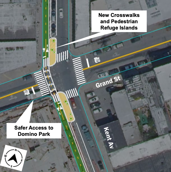
Separate from the bike boulevard, the DOT will add safety improvements to better connect the new Domino Park and the long-existing McCarren Park for pedestrians and cyclists. And some of those intersections along that corridor beyond Berry Street really need it:
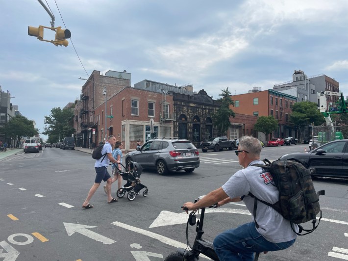
The southern end of the “park-to-park” connector — the entrance to Domino Park at Grand Street and Kent Avenue — is currently a mess, as pedestrians who seek to cross Kent must wait for cars that are only controlled by a blinking red light and a two-way bike lane without any stop sign. As a result, pedestrians are given the least priority — and feel like it, too.
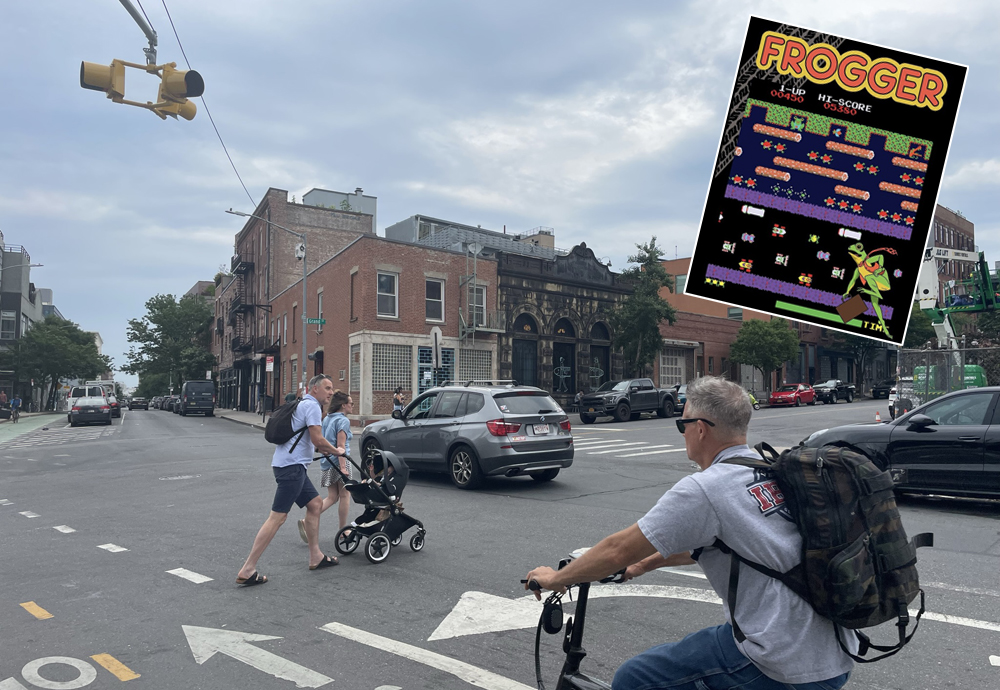
“It’s like Frogger,” said Jarryd Boyd, who, perhaps ironically, works for a tech company as he likened crossing Kent to the 1981 arcade game. “You get past the cars, but then you almost get hit by a bike.”
As Streetsblog watched the intersection on a recent day, many car drivers sped through the intersection, either out of recklessness or simply not realizing that a blinking red light means to stop.
So at the intersection in question, the DOT proposes two large pedestrian zones, with planters, to reduce the crossing distance and give pedestrians a place to safely wait (also like Frogger). But nothing in the DOT proposal suggests that car drivers will be better controlled, though there will be a crosswalk added to Kent.
“I actually commented at the community board meeting that I was in favor of them doing the improvements,” said Brent Bovenzi, a resident. “But the DOT probably needs to do more.“
Is it enough?
A full reaction won’t be clear until the community board returns in July for a discussion of the proposal, but for now, residents interviewed by Streetsblog support the scheme.
“It's a good idea,” said Megan Lytle, who works in greener energy. “In this part of the city, pedestrians should be more prioritized. I think that the vast majority of people don't drive to the waterfront park, and [Kent Avenue] should not be a car speedway.”
Jesse Spellman, another area resident who was walking near the notorious Kent Avenue/Grand Street intersection, also approved.
“It makes perfect sense,” Spellman said. “We should absolutely make it a more pedestrian and bike friendly city. Any changes to help with that, I would be in favor of.
Some residents want more.
“My issue with the improvements along Berry Street is that they stop at Grand Street,” said Bovenzi. “We made Berry Street this long open street, so we should make these new improvements down that entire length.” (The DOT said it hoped to expand the bike boulevard from Grand to South Fifth Street next year.)
Jason Linklow, another area resident, said safety treatments must be made to all of the Kent Avenue intersections near Domino Park.
“Nobody knows what to do,” he said, referring to the dangerous dance of cyclists, pedestrians and drivers. “I don't think anyone thinks that [the blinking redlight] even means anything. And the problems go all the way down [Kent Avenue] and all the entrances to Domino Park.”
One issue for the DOT will be combating significant opposition to street safety measures fro the Hasidic community at the southern end of the neighborhood.
— with Gersh Kuntzman
