City’s Proposed Eastern Queens Bike Network Needs Work, Activists Say
The city’s proposal for a protected bike-lane network in a dangerous section of Eastern Queens is better, but still lacks important connections that compromise its safety, activists say.
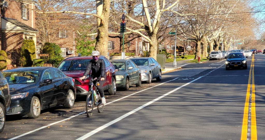
Last week, the Department of Transportation presented to Community Board 11 an updated plan for a bike network in a five-square-mile wedge of Bayside and Oakland Gardens in the northeast section of the borough between the Cross Island and Utopia parkways. The agency touted the plan as crucial cycling infrastructure that provides protected access to the area’s parks as well as the Central Queens and Queens Waterfront (aka Joe Michaels Mile) greenways, which cyclists use heavily for commuting and recreation.
But the latest DOT proposal came only after CB11 made the agency go back to the drawing board after the initial proposal did not contain any protected bike lanes. The community board wanted 17 miles of protected lanes, and resulting plan has about nine (if you count them, as the DOT does, in both directions):
- 26th Avenue, from Utopia Parkway to Bell Boulevard (almost 1 mile).
- Corporal Kennedy Street, from 26th to 33rd avenues (0.5 miles).
- 53rd Avenue, from Underhill Avenue to Oceania Street (1.1 miles)
- Oceania Street, from 46th Avenue to the Horace Harding Expressway (0.8 miles)
- 46th Avenue from Oceana Street to Cloverdale Boulevard (1 mile)
“This proposed bike lane network would bring important connections the [proposed] Eastern Queens Greenway, parks, and other local destinations. In response to community board feedback, DOT added several protected bike lanes and new safety treatments to improve safety for all road users — and we look forward to continuing to collaborate with the board on this project,” said department spokesman Vin Barone.
As seen in the rendering above, the protected lanes cluster in two areas. The plan links the two areas with a “shared lane” (sharrow) configuration on Corporal Kennedy Street from the 33rd Avenue protected section in the north to the 46th Avenue one in the south.
It also envisions a miles-long “calm” corridor with a lower speed limit and pedestrian-safety improvements on 33rd Avenue, parallel to and connecting with the 26th Avenue/Corporal Kennedy protected lanes, and the possibility of another protected lane to be built later to the west on Utopia Parkway. The board had requested the Utopia lane because of the many students who cycle to school on the dangerous street.
The new proposal calls for the removal of parking to create the protected lanes — a highly controversial measure in auto-centric Queens. Car owners, of course, complained about various aspects of the proposal — even though the single-family homes in the area usually have driveways or other off-street parking. Several said that there would be “pushback” if parking was removed.
But the gaps — the lack of robust connections between the two areas of protected lanes — prompted at least one activist to ask: Is it safe? One even evoked the recent death of a 3-year-old in Chicago, who was killed by a truck driver earlier this month as she rode in a carrier on her mom’s bike on a “shared” street.
“I greatly respect the engineering the DOT did in this process; the street geometry and politics they need to work around aren’t easy,” CB11 member John Kelly told Streetsblog, stressing that he was speaking in his personal capacity and not for the board. “Other activists have told me to just say I’m happy getting any street-safety improvement in Eastern Queens. But I have a 3-year-old and I put her on my bike twice a day, bringing her to her grandparents’ house three miles away. I see lots of other parents doing the same. Without the car culture shift that a protected bike-lane network brings, I’m afraid my daughter will end up like Lily Grace. We should never have a tragedy like that again.”
The bike network in Eastern Queens is important for an area that is potentially very bike friendly and verdant, but for the fact that it is bounded by some of the most dangerous, noxious highways in the city: the Long Island and Clearview expressways, and Grand Central and Utopia parkways; and Northern and Francis Lewis boulevards are where the majority of the neighborhood’s seven crashes per day happen.
But Auburndale, Bayside, Douglaston, Douglas Manor, Little Neck, Hollis Hills and Oakland Gardens also hold lovely parks, including Alley Pond Park, Cunningham Park, and the car-free Vanderbilt Motor Parkway between them. The Queens waterfront is an impressive nature preserve. Thus, local safe-streets activists seek to calm traffic in the area not only in order to save lives but also to create safe bike connections among the greenswards for the benefit of all New Yorkers.
Noting that a cyclist was killed in Eastern Queens last month, Kelly said that DOT’s rationale for why it could not put protected lanes on certain streets — its 11-foot travel-lane standard — seemed excessively rigid when the National Association of City Transportation Officials recommends a standard of 10 feet.
“Even just a few feet difference might open up some street geometry options that would make protected bike-lane implementation much easier,” he said. “Many streets in the area already have less than 10 feet for travel lanes. We need to create some smart flexibility because we all know the status quo isn’t working.”
The chairman of the CB11 Transportation Committee, Victor Dadras, said that the DOT’s plan represents “a step in the right direction” for an auto-centered area that right now has no protected bike infrastructure and a population that “has not always been receptive to bike lanes or even Vision Zero.”
He said that he looks forward to working in his committee to better the DOT plan. “This is a phase; we can improve it,” he said, adding, “This is about building a spine. We’re not going to get it 100 percent right on the first cut….I don’t want to hold out for something that may not come.”
The Transportation Committee will met to discuss the proposal on July 13. The full board will consider it in September. The city may begin marking parts of the network in September or October, DOT staffers said.

Read More:
Streetsblog has migrated to a new comment system. New commenters can register directly in the comments section of any article. Returning commenters: your previous comments and display name have been preserved, but you'll need to reclaim your account by clicking "Forgot your password?" on the sign-in form, entering your email, and following the verification link to set a new password — this is required because passwords could not be carried over during the migration. For questions, contact tips@streetsblog.org.