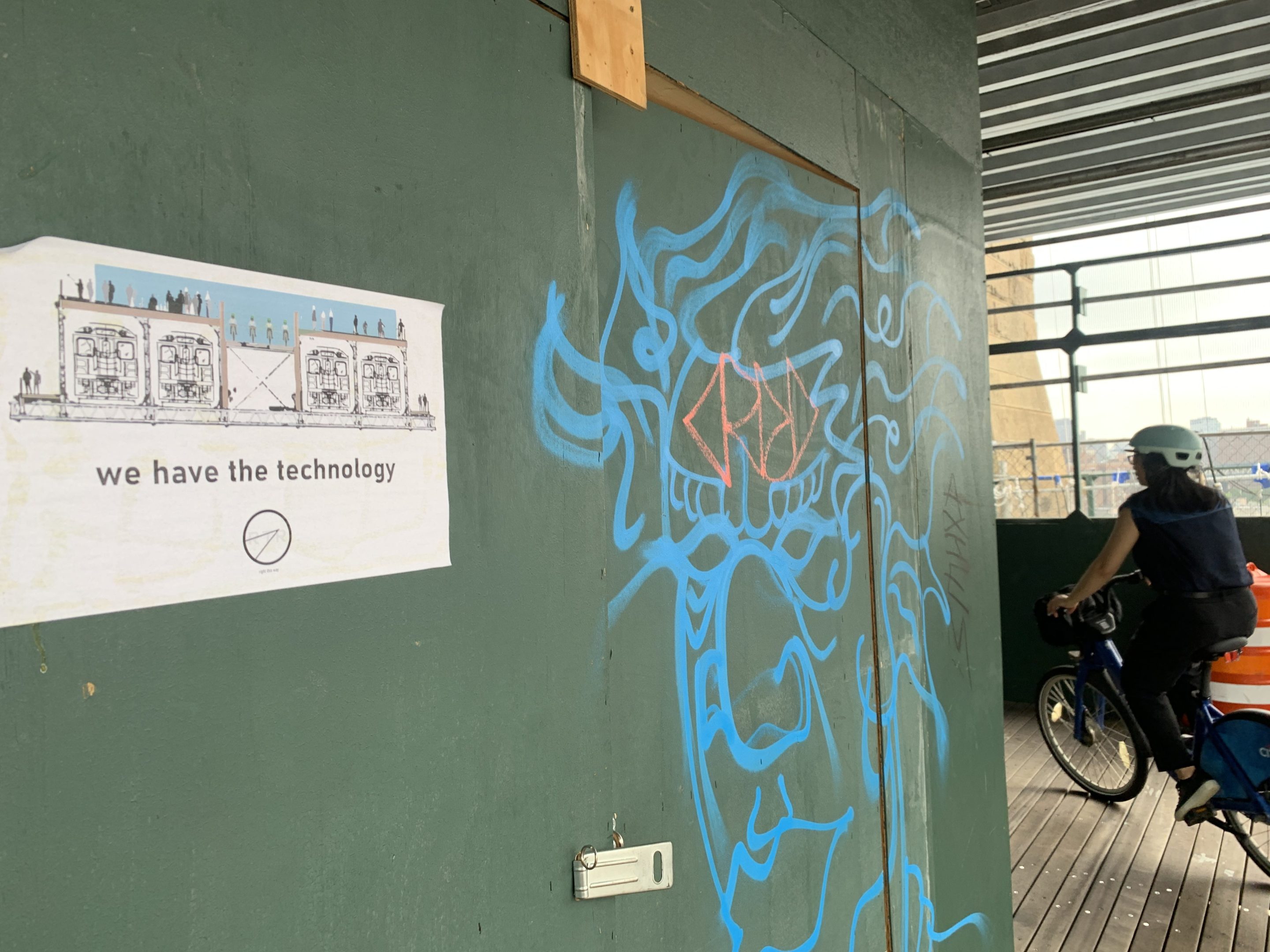
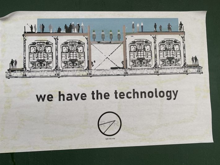
Some mysterious new signs are demanding that the Department of Transportation go "back to the future" on the Brooklyn Bridge.
The paper signs, affixed by a group that calls itself Right This Way, show a rendering of the bridge with four lower lanes devoted to subway trains and the top deck given over to pedestrians and cyclists. A legend on the sign says, "We have the technology" — meaning that the Brooklyn Bridge (in fact, all the East River bridges) could be (and were originally) carrying WAY more people a day than they do now in the automobile age.
Indeed, we do have the technology. It's called public transit.
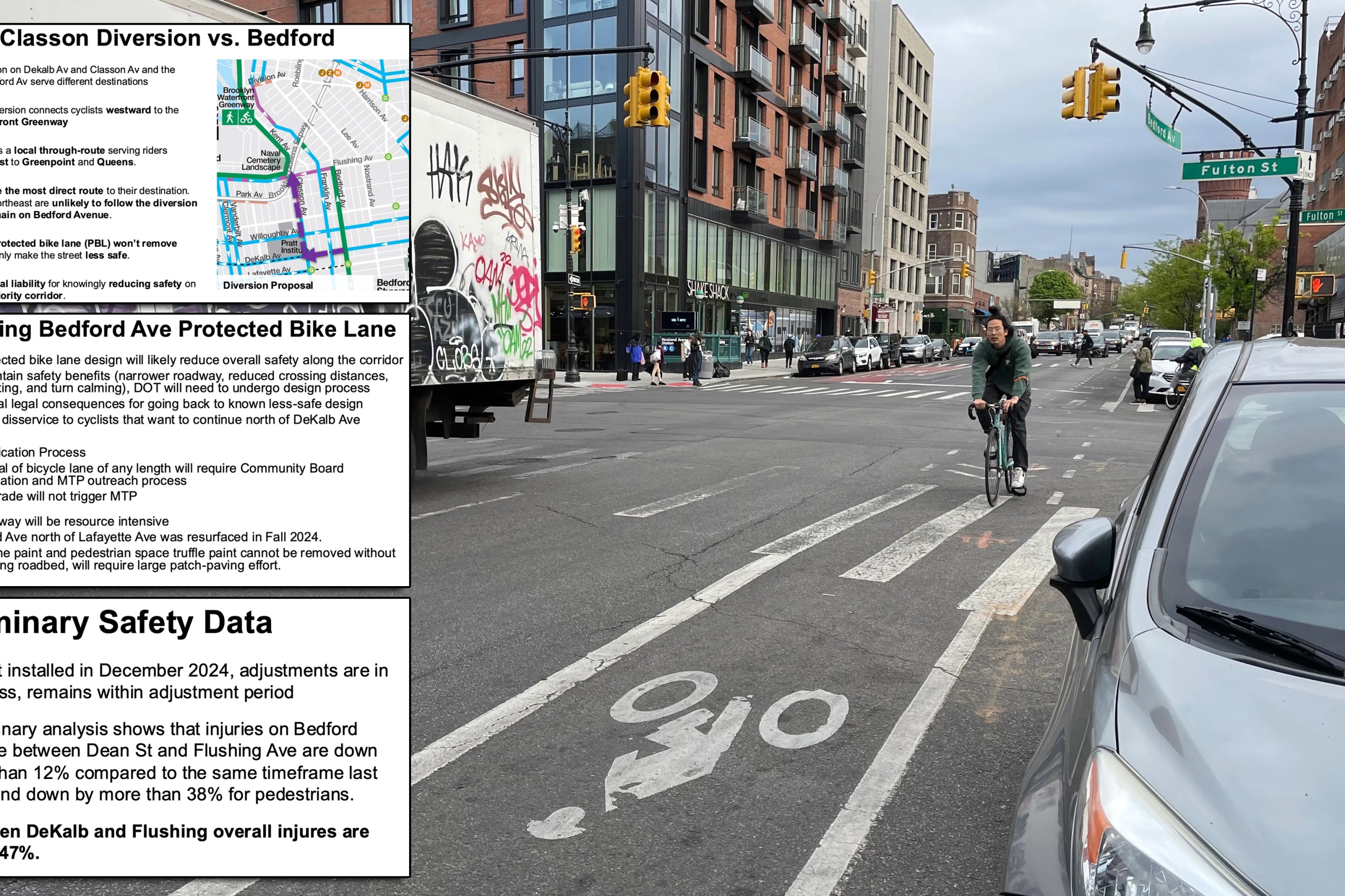
Two of the East River bridges, the Brooklyn and the Queensboro, are the focus of the intense Bridges for People campaign by Transportation Alternatives, which successfully petitioned the de Blasio administration to claw back space from car lanes to relieve suffering pedestrians and cyclists. The Brooklyn Bridge — the city's most celebrated and iconic span — long has figured in activists' plans because the bike boom and international tourism created clogged and dangerous conditions on the bridge's narrow bike and pedestrian path. The DOT is now constructing a dedicated, protected bike lane on the span.
The Queensboro's bike and foot traffic likewise began waxing years ago, and the span took on even more importance as a cyclist route for essential workers during the pandemic. Its crashes, conflicts, and hairpin turns are legendary. The city will turn the bridge’s South Outer Roadway into a pedestrian-only path and turn the current shared path on the North Outer Roadway into an exclusive bike path.
The Brooklyn Bridge, built in 1883, carried 341,000 people daily at its opening and 426,000 in its peak year of 1907, with lanes for streetcars and trains and one for horse-drawn wagons, as well as a walkway for pedestrians. In more recent times, it has carried fewer than 180,000 people a day, with six lanes devoted to cars and a cramped, shared bike/pedestrian path. It is a similar story on the other crossings, according to a 1989 diagram cited by Streetsblog (below) that showed the bridges and their various transportation modes over time.
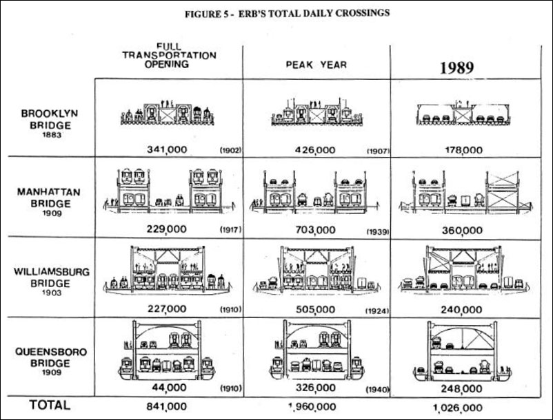
The Manhattan Bridge (1909) carried 703,000 during its peak year (1939) but about half that (360,000) during the 1980s. The Williamsburg Bridge (1903) peaked at 505,000 in 1924 and dropped to 240,000 in the later period, while the Queensboro Bridge fell from 326,000 in 1940 to 248,000 in 1989.
If anything, those numbers have fallen even further since.
"You could literally close NYC's most iconic bridge to all traffic and most people probably would not notice, since even at peak it's carrying a handful of subway trains worth of people," transportation planner Nilo Cobau recently posted on Twitter, with an eye-popping chart (below). Basically, drivers have abandoned the Brooklyn Bridge (and the Queensboro Bridge, too). Each is bringing in fewer than 5,000 cars a day during the morning peak hours.
That's something to contemplate when apologists for motorists claim, for example, that the construction of the protected bike lane on the Brooklyn Bridge is inconveniencing motorists or lacks planning and foresight. In fact, it was the surrender of the East River bridges to the least efficient transportation mode that embodied the latter.