OPINION: The Next Steps on the Queensboro Bridge
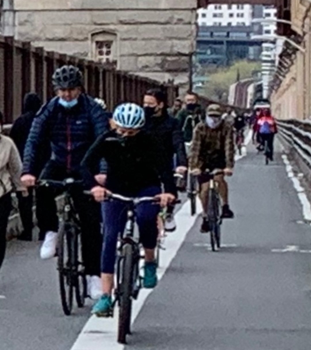
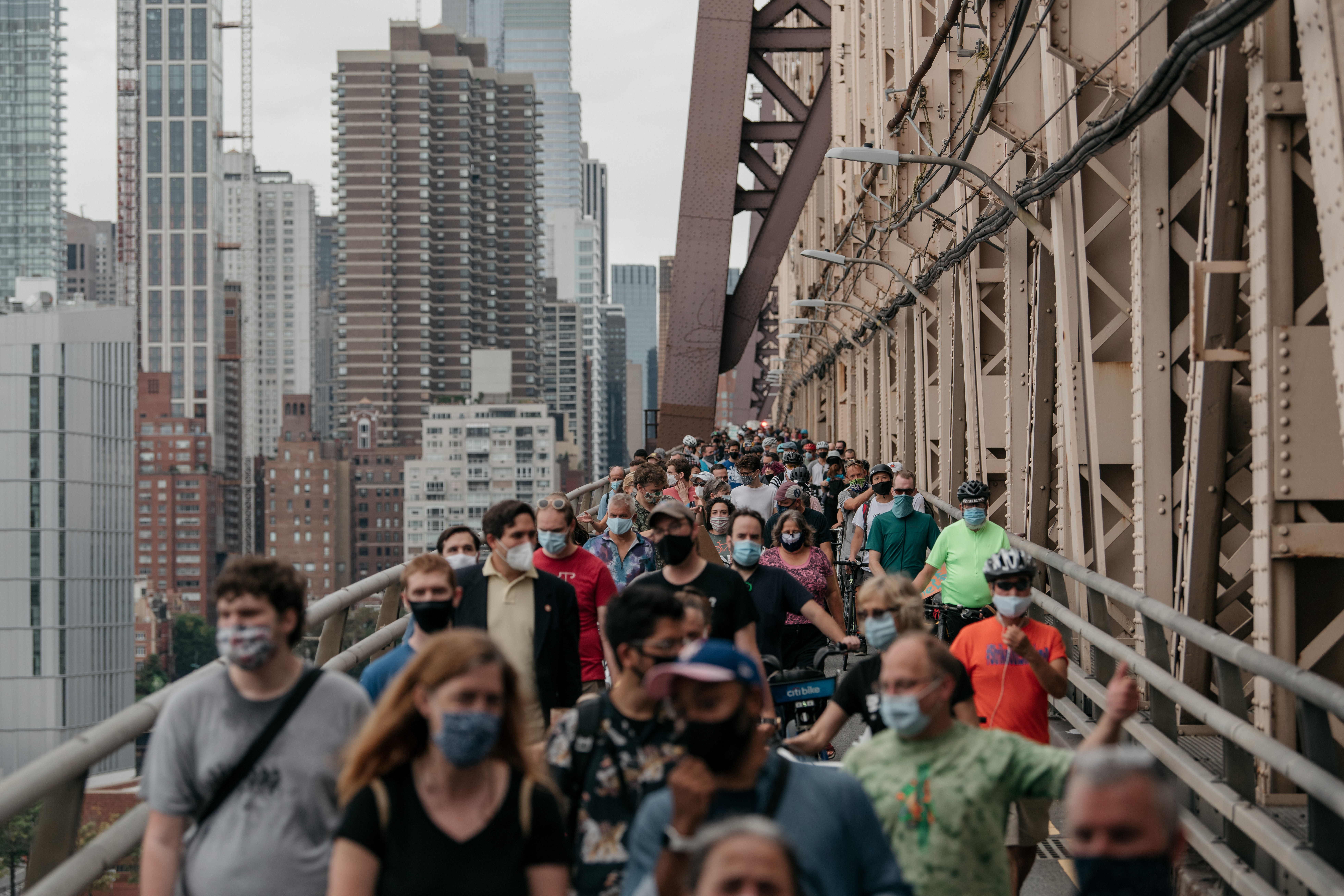
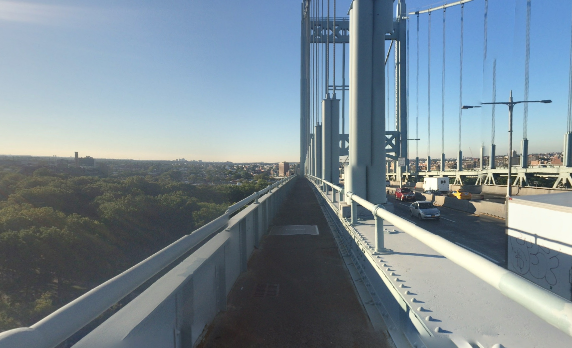
The Queensboro Bridge, packed with essential workers just trying to get to and from work. File photo: Melodie Bryant
The city’s recent announcement that it would heed our “Bridges for People” campaign by giving pedestrians and cyclists their own lane on the Queensboro Bridge was a welcome acknowledgement of the needs of the many thousands of cyclists and pedestrians who daily traverse the span between Queens and Manhattan.
The changes — which will turn the bridge’s South Outer Roadway into a pedestrian-only path and its North Outer Roadway into a two-way bike path — were a long time coming and the result of a years-long campaign organized and executed by dozens of the city’s most talented bike and pedestrian advocates. Through petitions, rallies, and social media, thousands of pedestrians, cyclists, and runners voiced their discontent with the dangerously overcrowded safety conditions on the current shared path — and prevailed.
As activists, we’ve thought long and hard about the changes that the city should enact in order to make the newly bike- and pedestrian-friendly span optimal for residents and tourists. Here are some ideas that the city should explore as it contemplates the “grand opening” of the pedestrian path next year:
Enhance the pedestrian experience
The South Outer Walkway will become the entrance to Long Island City, the place where residents return home at the end of the day, tourists disembark after watching the sunset, and runners touch down before sprinting back to Manhattan or charging further into Queens.
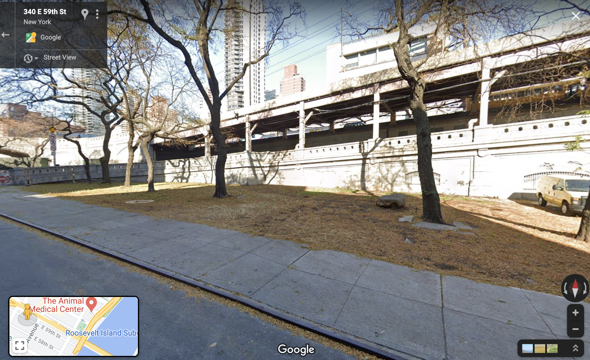
Pedestrians now descend from the bridge at Queens Plaza South — more of an at-grade highway than a city plaza. In fact, the South Outer Roadway is littered with guardrails and impact barrels because of the many crashes there — so many that the local police precinct ordered the lane’s overnight closure.
As more pedestrians use the South Outer Roadway, the Department of Transportation should improve signal timing improvements on Queens Plaza South in order to ensure pedestrian safety. Seniors and the disabled, in particular, will need more time to cross the sprawling boulevard.
Also, the Manhattan entrance to the path could be improved, too:
A welcome pedestrian plaza would include sidewalks and greenery, benches to relax after the long trek over the bridge, and signage to guide walkers to nearby amenities.
A seamless, stress-free promenade from Queens Plaza to Court Square would connect the bridge with residences, hotels, restaurants, breweries, museums, and more. The DOT should build on its plans to expand pedestrian space around Court Square, by closing excess vehicular slip lanes and adding restaurant seating, especially on Crescent Street next to the future entrance of the pedestrian path.
Improve connections to bike lanes
Long Island City, on the Queens side of the bridge, has changed dramatically in recent years, but much of its streetscape reflects its heavily industrial usage. Wide vehicle lanes incentivize speeding by car and truck drivers and double parking is rampant — all of which can be hazardous and intimidating for cyclists.
LIC must become bikeable for people of all ages and abilities, by ensuring that one is never more than a few blocks away from a protected bike lane or safe bike parking; thus, the surrounding neighborhoods will need comprehensive networks that connect with it and help riders reach their destinations.
The DOT should embrace and build the LIC Bike Neighborhood plan championed by local Council Member Jimmy Van Bramer, which knits together homes, parks, schools, workplaces, transit stops, the waterfront, and commercial corridors.
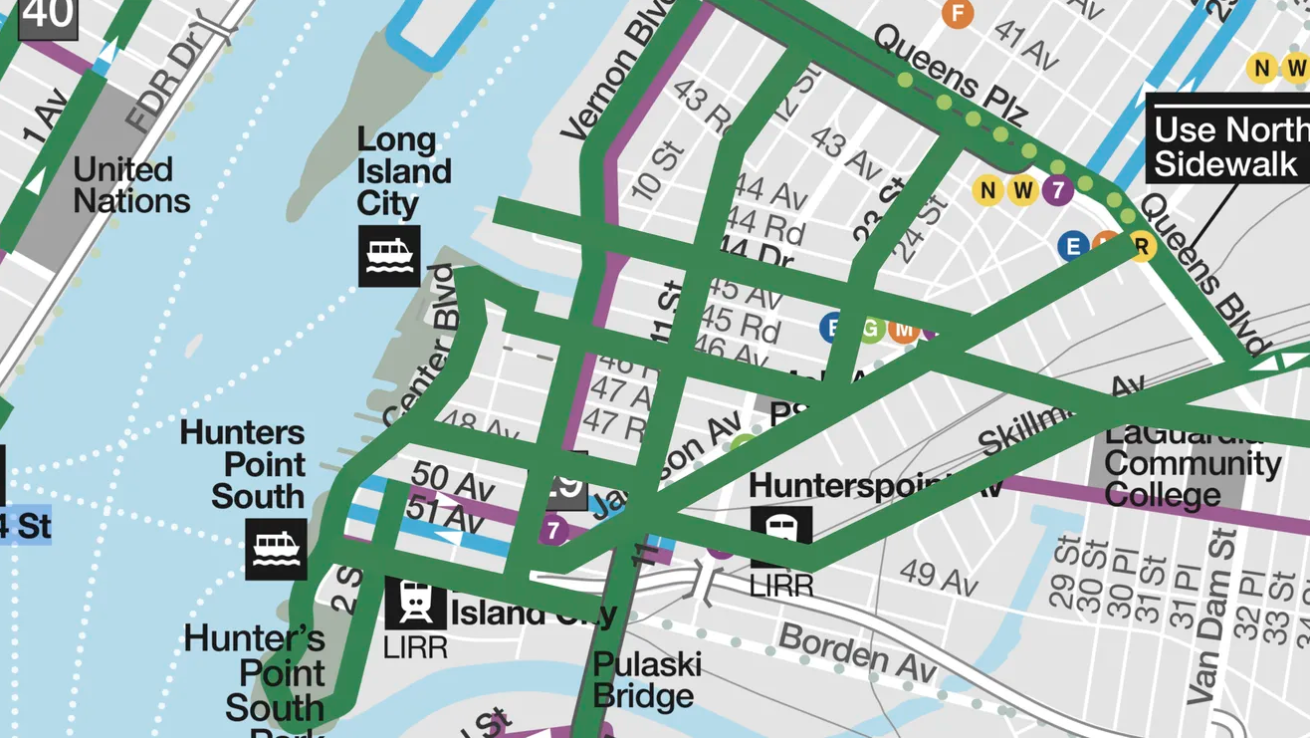
The backbone of the plan is a protected route between the Queensboro Bridge in Long Island City and the Pulaski Bridge further south in Hunters Point neighborhood, which would serve the growing numbers of commuters and working cyclists who daily traverse the spans. Long Island City is becoming an ever-more important junction, especially as e-bikes and e-scooters make longer commutes faster and more pleasant for people in Manhattan, Queens, and Brooklyn.
Prevent vehicle encroachment
Quality matters as much as quantity when it comes to protected bike lanes — and the bike lanes to the bridge, unfortunately, are chronically blocked by cars and trucks, a dangerous situation which discourages cycling. This is true of the newly built Crescent Street and Northern Boulevard bike paths as well as the older Vernon Boulevard waterfront protected bike lane, which for years has suffered double parked trucks with little action from city government.
These bike paths and many others leading to the bridge can be built to be world class connections by prioritizing safe design and not cars’ access to the curb — through solid barriers or bollards, raising the lane to sidewalk level, or landscaping elements.
Create a Western Queens Greenway
The greenways ringing parts of the city’s waterfront are the crown jewels of our bike network. Queens deserves a contiguous waterfront greenway — not the disjointed arrangement we have now. An intuitive and scenic route, fully separated from car traffic all the way from the Pulaski Bridge in the south to Flushing Bay in the east, would open up vast swaths of shoreline to residents and visitors alike — with endless potential benefits for getting around, family-friendly recreation, skyline views, and waterfront connections.
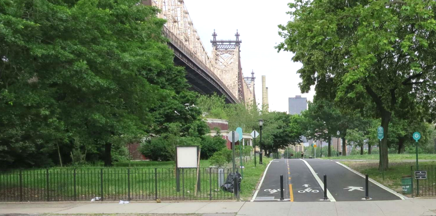
Yet the current pieces of the Western Queens Waterfront Greenway (Hunters Point Park, Center Boulevard, Vernon Boulevard, Shore Boulevard, and the Flushing Bay Promenade) don’t seamlessly connect to one another. For example:
- The Dutch Kills Greenway includes awkward intersections at 21st Street and Vernon Boulevard.
- Center Boulevard’s greenway abruptly dead ends near 50th Avenue, depositing riders onto cobblestones. There is no designated, protected east-west route to the Vernon Boulevard two way protected bike lane’s southern terminus at 46th Avenue.
- The Vernon Boulevard protected bike lane detours into Queensbridge and Rainey Parks, frustrating commuters who rely on it for a quick, efficient north-south route.
- The route beyond the northern end of Vernon Boulevard protected bike lane features a confusing detour through the Astoria Houses, where the pathway’s concrete is in precarious condition, or an unprotected route involving steep hills.
- The Shore Towers condominium complex’s unpredictably locked gate between Astoria’s 9th Street and Astoria Park’s Shore Boulevard Open Street forces walkers and bikers onto the adjacent streets, which contain steep hills and confusing signage.
Finally, the route from Astoria Park to the Flushing Bay Promenade lacks a safe consistent greenway. A two-way protected bike lane on 20th Avenue dead-ends at 37th Street. There is no bike infrastructure on 19th Ave or 81st Street. A protected bike lane on Ditmars Boulevard (along the edge of LaGuardia Airport) was promised as part of the “Big Jump” initiative, but has not been constructed yet. This would provide access to the Flushing Bay Promenade via the bridges at 27th Avenue and 31st Drive.
Upgrading the connections between the various segments of the greenway and delineating space for walking and biking will be crucial.
Fix Queens’s MTA Bridges
We wouldn’t be able to talk about this bridge without mentioning the exciting new bills being sponsored by Sen. Alessandra Biaggi and Assembly Member Jessica Gonzalez-Rojas. These bills would establish an advisory committee tasked with creating a strategic plan, in consultation with the MTA, to promote cycling and pedestrian access on MTA bridges and stations. Queens’s MTA bridges are notoriously inaccessible by bike and foot. Expect ticketing blitzes every Spring along the RFK bridge and Rockaway bridges shared paths as MTA rules deem you must walk not ride your path along these long stretches. The Whitestone and Throgs Neck bridges have no paths to walk or bike on, but are the only points of connectivity between the Bronx and Eastern Queens.
These transit connections are crucial to provide more transportation options in the transit deserts further out in Queens.
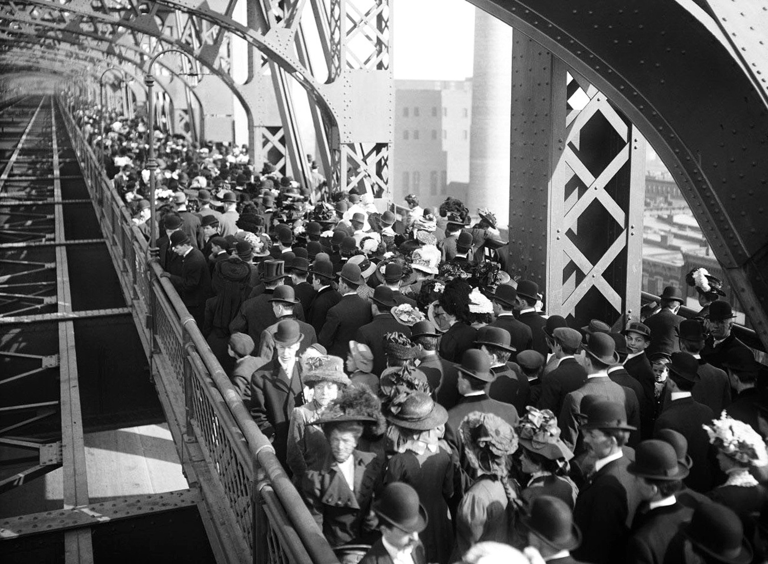
F. Scott Fitzgerald once said, “The city seen from the Queensboro Bridge is always the city seen for the first time, in its first wild promise of all the mystery and the beauty in the world.”
A new generation of New Yorkers will see their city from this vantage point, accessible via their own two feet for the first time, at the grand opening of the rebranded South Outer Walkway. Let’s seize this moment of radical transformation to build accessible paths, connected bike networks and more as we seek an equitable standard of mobility.
Juan Restrepo (@juaninQNS) is the Queens organizer of Transportation Alternatives. Laura Shepard (@LAShepard221) is a Queens-based bike and safe streets advocate.
Read More:
Stay in touch
Sign up for our free newsletter
More from Streetsblog New York City
Stockholm Leader’s Message to NYC: ‘Congestion Pricing Just Works’
"In Stockholm, people really thought that congestion pricing would be the end of the world, the city will come to a standstill, no one would be able to get to work anymore and all the theaters and shops would just go bankrupt. None of that happened."

Friday’s Headlines: Trump Trial Trumps Safety Edition
Is anyone going to bother to fix the dangerous mess on the streets and plazas around the Trump trial? Plus more news.
Adams Offers Bare Minimum to Seize Congestion Pricing’s ‘Space Dividend’ Opportunity
The mayor's list of projects supposedly meant to harness congestion pricing's expected reduction in traffic is mostly old news, according to critics.
OPINION: Congestion Pricing Will Help My Family Get Around As We Navigate Cancer Treatment
My partner was recently diagnosed with cancer. Congestion pricing will make getting her to treatment faster and easier.