Periodically, Streetsblog likes to take a look back at how destructive car culture has been to New York City, which was once a more livable place where people had ample space to stroll (at least, outside of the central business districts and congested lower Manhattan) without the worry of being run over by heedless automobile drivers.
Yes, we know that the horse-drawn carriages and streetcars of an earlier era presented their own dangers. But the plain fact of the matter is that, in the last century, city pedestrians have lost miles and miles of turf, in the form of narrowed sidewalks and broadened streets, to the conveyance formerly known as the "devil wagon" (for its propensity to belch brimstone and scare horses and children).
As we like to repeat (because so few New Yorkers remember), all the free parking that car drivers guard as their God-given entitlement is a fairly recent perk: The city did not allow overnight parking on its streets until 1950; the ugly clutter of steel boxes you see outside your window is a modern intrusion of private property into the public right of way — and needn't be a permanent one.
Open restaurants and open streets have shown how New Yorkers could return to a better balance, if the mayor follows the lead of cities such as Paris and others that have used the coronavirus crisis as an opportunity to expand active transportation. Here are a few examples of what we lost — and how we might regain at least part of it.
Bedford at Division in Brooklyn
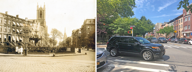
In the late 19th century, a lovely, marble fountain formed the centerpiece of a parklet jutting out from the corner of Bedford Avenue and Division Avenue in Williamsburg, Brooklyn. A triangle of park, now named in memory of Judge Harold W. Cohn, remains at the spot, without the fountain, which deteriorated and was removed in 1953. Widening of the surrounding streets has much circumscribed the parklet and has left the neighboring houses with postage-stamp-sized sidewalks. This corner, in a heavily residential area, might make for a good open street.
Park at 50th in Manhattan
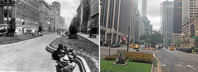
A view north from Park Avenue at 50th Street illustrates perhaps the most egregious example in the city of the automobile's usurpation of pedestrians' former dominion in Manhattan. Park Avenue derives its name from the park that formerly occupied its median, which was built over the tracks of the New York Central Railroad in the late 19th century.
That median now exists as a sad rump of its former self, having lost most of it width to a road widening in 1927. The famously beautiful avenue of yore, once compared to the finest Parisian boulevards and where strollers and fresh-air seekers once dawdled, is now a car sewer that's dangerous to cross. Perhaps a future mayor will restore its former glory by reclaiming a lane on each side for the median.
34th Avenue in Jackson Heights
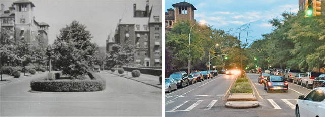
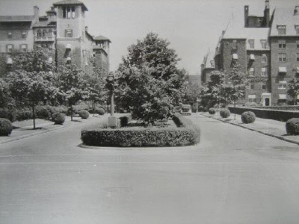
Jackson Heights in Queens was one of the city's original suburbs, with "garden apartments" and "garden homes" built around treelined boulevards with ample medians.
The vintage view of 34th Avenue, when compared to the puny median of today, shows just how much space (and foliage) were lost to car lanes. Happily, 34th Avenue was one of the earliest streets opened to pedestrians during the COVID crisis, and it is perhaps the best such open street in the city — so much so that local leaders are agitating to keep it so permanently.
Tillary at Jay in Brooklyn

These two views look west on Tillary Street in Downtown Brooklyn (as you can see from 16 Court Street in the haze of the left side of the left photo).
The barren wasteland that today confronts visitors to the area around Brooklyn's municipal and federal buildings arose because of the animus of 20th century master planner Robert Moses (and others such as critic Louis Mumford) to the lively, untidy, human-scaled neighborhood that used to exist there.
City planners tore it down in order to impose a car-centered order that looks like a bit of Houston had dropped into gracious Victorian Brooklyn. There's no way to bring back the old neighborhood, but this gargantuan road definitely could take more narrowing.
Houston at Sullivan in Manhattan
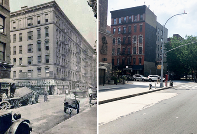
This shot of the borderland of SoHo and the Village is Houston looking west at Sullivan. Note the fact that Houston was widened from a simple roadway to a double-width highway (not pictured in the current shot) in the 1930s during the construction of the Sixth Avenue IND Subway.
It's now a truck route and infamous car sewer.
The city completed a rebuild of Houston in recent years, but the six-lane road could use further pedestrian improvements.
