THANKSGIVING WEEKEND READ: Staten Island’s Sidewalks in the Woods

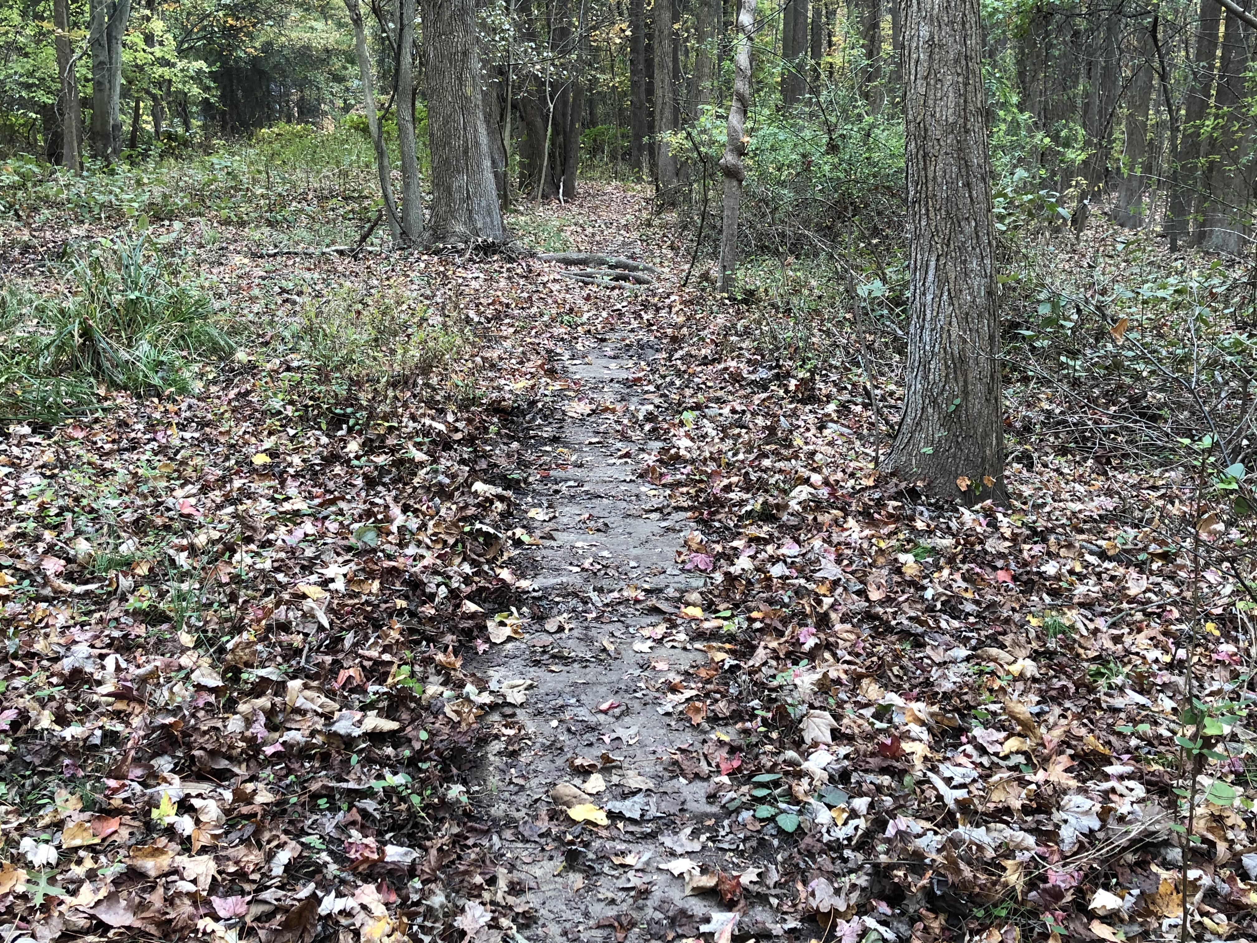
Hiking in the deep in the woods of Staten Island, our Rock correspondent came upon a number of sidewalks far from the nearest roads or houses. Photo: Vince DiMiceli
Many longtime Staten Islanders will tell you the opening of the Verrazzano-Narrows Bridge in 1964 paved the way for the overdevelopment of the city’s then-bucolic borough.
The original $1 round-trip toll on the span that linked the Island directly to Brooklyn couldn’t curtail the bulldozers and steamrollers that soon landed there and went to work fleecing forests, paving over ponds, and shaping a special type of black-topped suburban sprawl that could only occur on a small piece of land surrounded by water.
By the 1990s, there wasn’t much buildable space left, and the traffic nightmare that so logically ensued is, to this day, the bane of most Islanders’ existence.
But for those that lived there before the rush — or, like me, grew up there in the midst of the building boom — Staten Island’s less populated South Shore offered a unique upbringing. Back then, there were still plenty of woods to explore, ponds to fish in, and open fields to play ball away from those ever-encroaching automobiles. And, when we were old enough, that train in town took us to the ferry and the city beyond, where we could experience all those things Manhattan had to offer. (Yes, I’m talking about getting fake IDs at Times Square).
It was during those days of exploration that my childhood friends and I discovered signs of an earlier building boom. Hidden in plain sight beneath the canopy of trees behind the delis and pharmacy and gift shop and greasy spoon and gas station that made up Annadale town (which sprung up around the Staten Island Rapid Transit station of the same name by the turn of the 20th century) were sidewalks. For some reason, there, in the middle of the woods, sidewalks with curbs sat silently, as if waiting for new homes to suddenly spring up around them.
Being kids, we of course asked our parents how the zombie sidewalks got there, but our Brooklyn-born progenitors had no answers.
Soon enough, those woods in Annadale were chopped down, the phantom sidewalks ripped up, and a new sleeve of ugly townhouses installed in their place — bringing new kids while paving over a mystery.
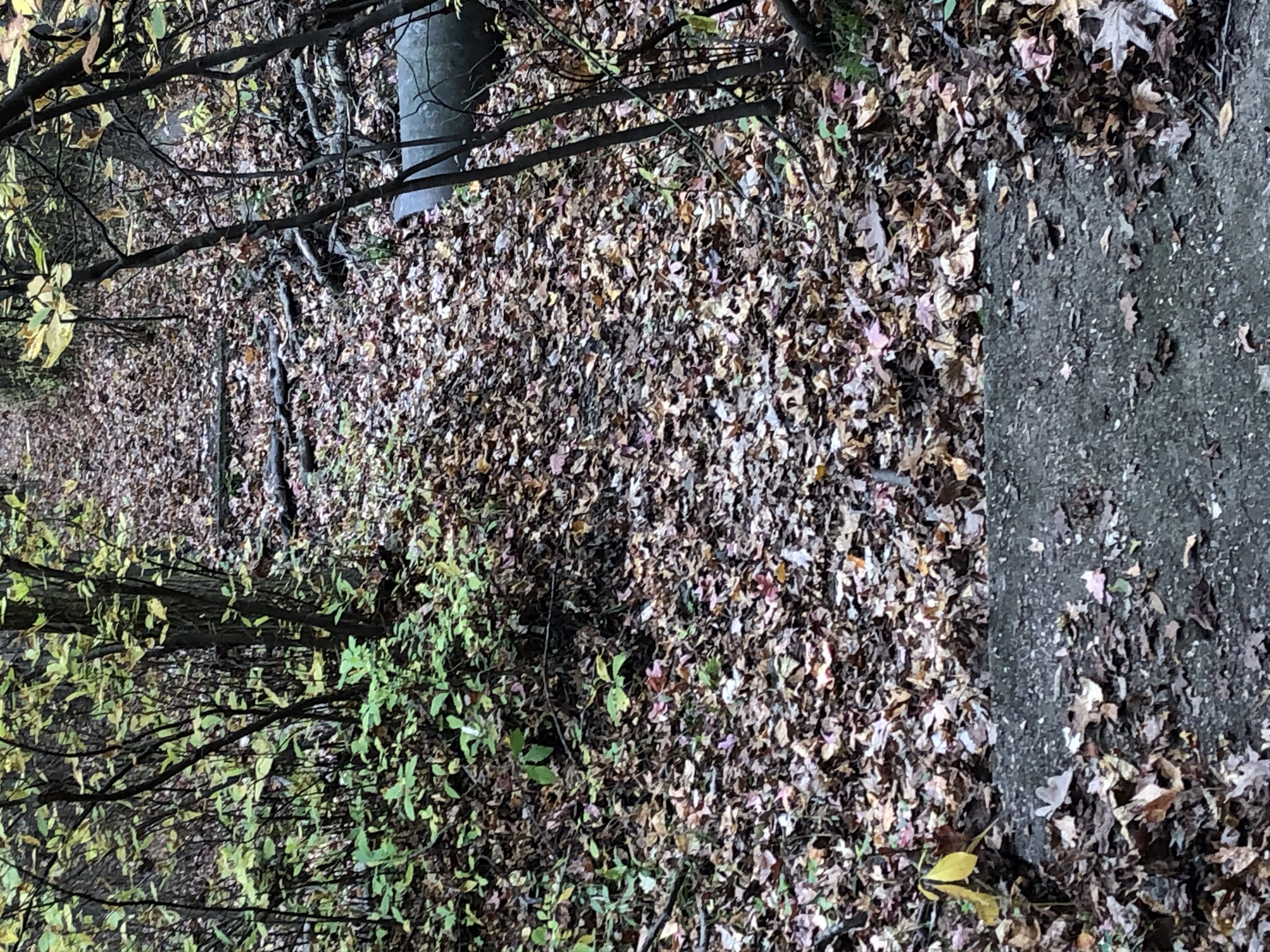
I hadn’t thought much about the secret sidewalks until a recent walk with my 12-year-old son and our dog through Blue Heron Park, a bit further south in Annadale between Amboy Road and Hylan Boulevard sliced in half by Poillon Avenue. Deep in the woods, while trying to find an old fishing hole in which I casted as a kid, I came upon another sidewalk that had no business being where it was. The curbs seem to be gone, and tree roots and soil covers part of it up, but it was otherwise pristine. Perfectly straight and pretty long, we followed it as far as we could until thicket overcame it.
Looking to our left, we saw what appeared to be a rise in the woods’ floor that did not seem natural. We cut across to the top of the bluff, dug down a bit, and found another sidewalk — about the distance it would be from its sister sidewalk if there were a street in between.
Further exploration revealed a few more of these archeological finds when my son asked me the same question I pondered more than 30 years earlier: “Why are there sidewalks in the middle of the woods?”
Internet searches revealed little, so I called in the big guns. Staten Island Borough Historian Thomas Matteo said he didn’t know about them off the top of his head. But I hit paydirt when I questioned native Staten Islander, naturalist, and longtime Staten Island Academy science teacher Clay Wollney, who didn’t let me finish my question when I cornered him at a school event.
“Works Progress Administration,” he said of the Depression-era agency that used government funds to put people to work. “They built those sidewalks and gravel roads on the island between 1935 and 1939, thinking the land would someday be developed.”
According to Wollney, who grew up in Tottenville — the southern tip of New York State and the last stop on the Railroad — in the 1960s, the demarcations were much clearer, especially down by the historic Conference House, where the gravel paths could still be driven on and overgrown sidewalks were still relatively walkable. He wrote about them in the Staten Island Advance back in 2014.
In the 1930s, the expectation was a connection of some kind — either a subway tunnel or bridge — would soon connect the Island to the city, and, just as it had in Queens, Brooklyn, and the Bronx, the newly valuable land would be developed. And what better way to be prepared for the deluge than to lay down a grid and get a head start on putting the infrastructure in place?
Local engineer George William Allison was put in charge of the project in 1934, and oversaw the “development” in the coming years.
Some of the roads and sidewalks eventually did become part of Staten Island’s grid, including many off Foster Road less than a mile away in Huguenot, according to Wollney. And others, like those I explored in Annadale and some off Hylan Boulevard near Conference House Park in Tottenville, were ripped up and replace in the ’80s and ’90s. But the sidewalks in Blue Heron and Arbutus Woods Park ended up getting grown over and mostly forgotten on land that was bought and designated as parks by the city in the 1970s and ’80s. While not manicured like Central or Prospect parks, their marked trails provide a respite from the traffic-laden thoroughfares of the island where you can come upon a pond or even spot a deer.
There, these relics of progress remain, giving hikers — and the next generation of kids — a curious discovery when they come upon them.
Read More:
Stay in touch
Sign up for our free newsletter
More from Streetsblog New York City
Thursday’s Headlines: Speed-Limiting Tech Edition
State Sen. Andrew Gounardes continues his push to force reckless drivers to install speed limiters in their cars. Plus more news.
DOT Official: All Our Free Parking Justifies Keeping Curb Space for EVs
If only someone could do something about the parking!
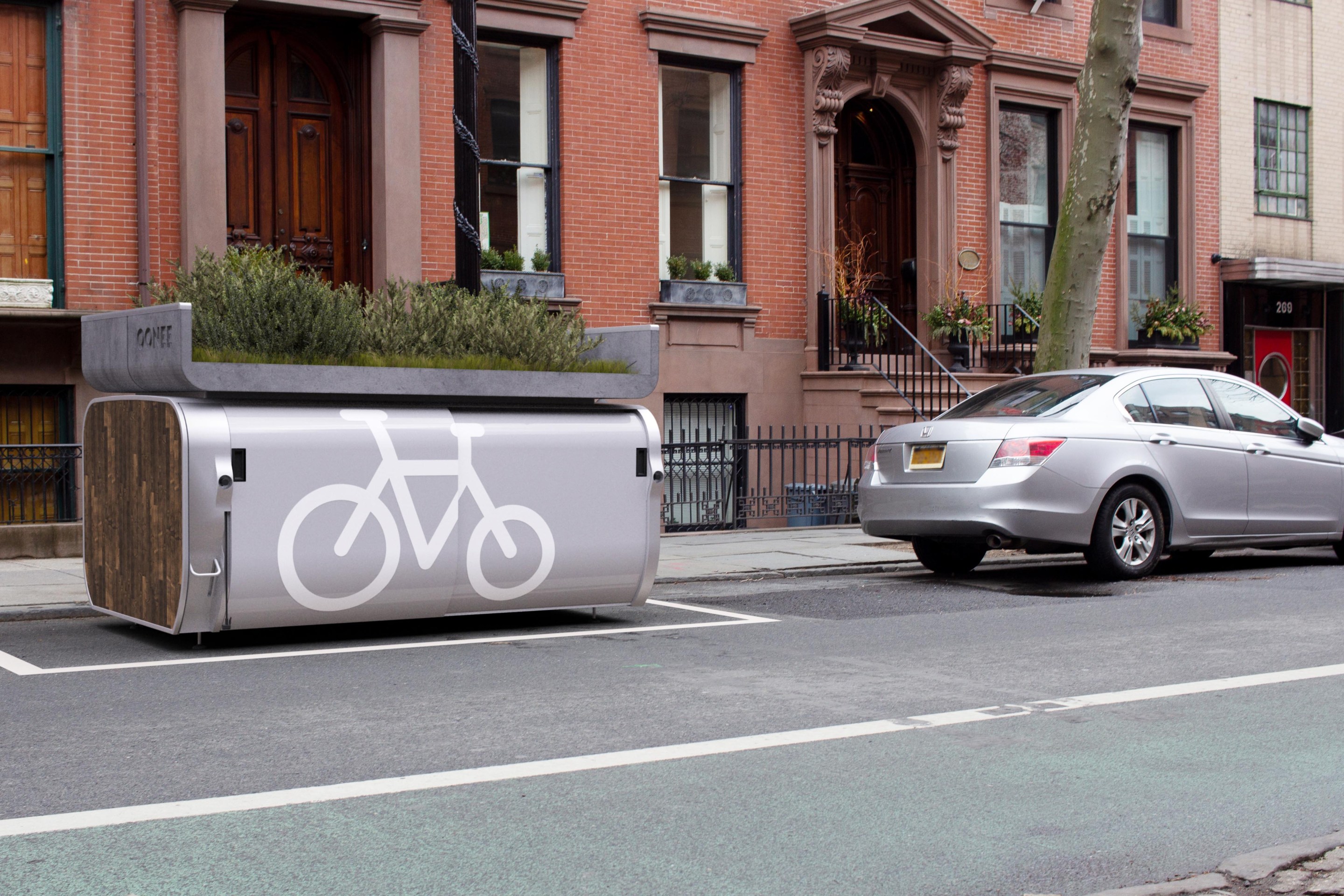
New York City to Install 500 Secure Bike Parking Hubs In The Next Five Years: Sources
Your bike may finally get a roof over its head.
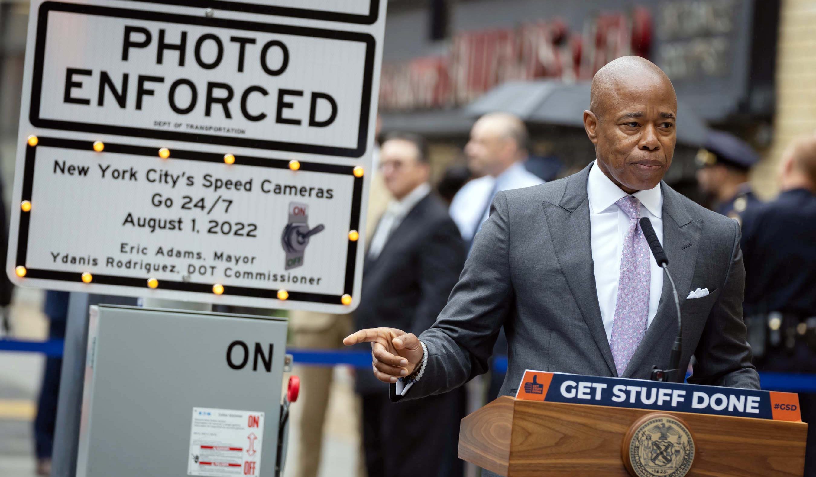
Adams Backs Lower Speed Limits, Calls Crashes ‘Accidents’
The mayor wants New York City drivers to "slow down," but it's not clear yet how many streets will get lower speed limits.
Wednesday’s Headlines: Trump Posts About Congestion Pricing Edition
Donald Trump comments on congestion pricing — no surprise, he's against it. Plus more news.