Today DOT released its long-awaited blueprint for safer walking and biking conditions across the Harlem River bridges.
These 13 crossings should function as convenient connections between neighborhood street networks, where people feel comfortable getting around by walking or biking. Instead they're overbuilt for cars, like small highway segments disrupting the local street grid.
Making the bridges function well for walking and biking could have the same transformative effect for neighborhoods in northern Manhattan and the South Bronx as East River bridge access improvements have had for northern Brooklyn and lower Manhattan, anchoring a new wave of safer street designs linking up with the bridges.
Local organizing for safer Harlem River bridge access began with a Transportation Alternatives campaign in 2014, and DOT started talking to local residents about improving safety on and around the bridges the next year. DOT released a preliminary plan for better bridge access in 2016 and has implemented a few projects on surface streets that connect to the bridges. (This redesign of 138th Street just wrapped up yesterday.)
Streetsblog's David Meyer will have a post on DOT's announcement later today. In the meantime, you can look over the DOT report [PDF], which lays out a series of bike and pedestrian fixes for several Harlem River bridges and the streets that feed into them. Below is a brief look at some of the report's best visuals for enhanced bridge access.
While this plan is very encouraging, there's a lot of advocacy and oversight still to come. Timetables are missing for most of the projects, the city will need to be pressed to make the best possible design choices, and the momentum from the bridge improvements will have to carry over to more surface streets to create a truly safe network for biking and walking.
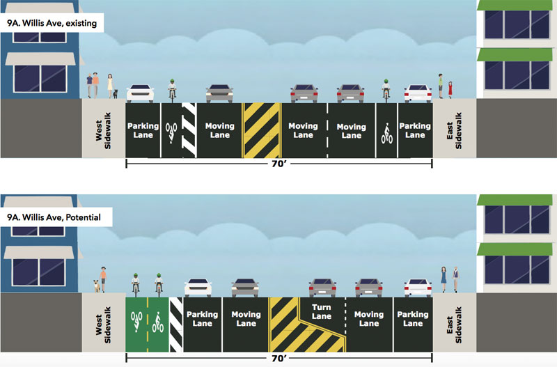
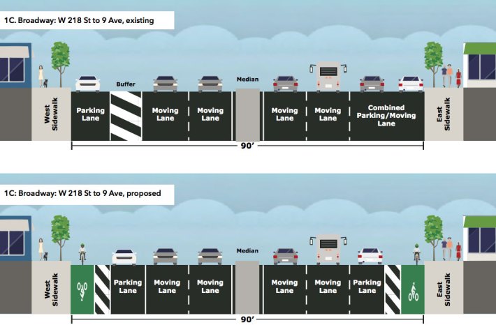
Approaching the Broadway Bridge from Manhattan, DOT is proposing a short segment of parking-protected bike lanes, feeding into buffered bike lanes on the bridge itself, which will be included in an upcoming bridge replacement. DOT expects the Broadway Bridge replacement to wrap up in 2020.
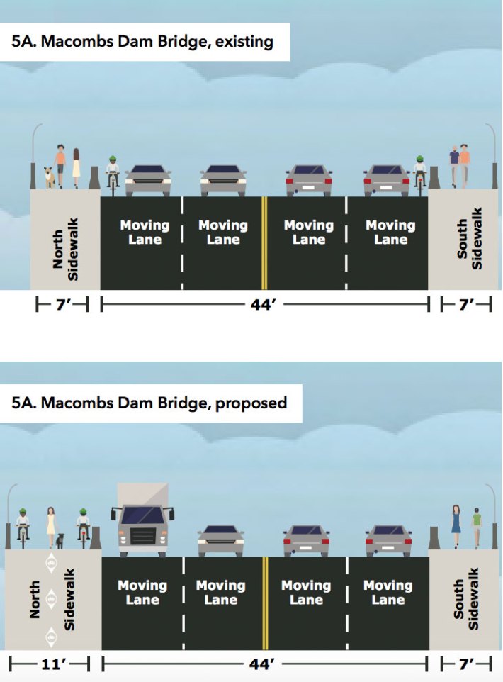
A capital project on the Macombs Dam Bridge will widen the north sidewalk so it can function as a shared path. At 11 feet wide, it would still be pretty narrow to handle large numbers of people biking and walking.
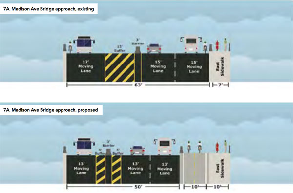
On the dangerous approach to the Madison Avenue Bridge from Manhattan, where cyclists currently have to mix it up with motor vehicles moving on 15-foot-wide lanes, DOT is proposing a capital project to add a two-way bike lane.
