The city is close to recommending that the Sheridan Expressway, a short, sparsely-used interstate that community activists have targeted for removal for years, be transformed into a street-level roadway that opens land for new development and improves neighborhood access to parks along the Bronx River.
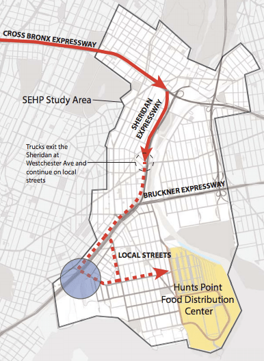
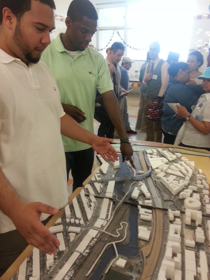
The news came Tuesday night at a public meeting attended by about 60 people, where staff from the Department of City Planning, the Department of Transportation, and the Economic Development Corporation fielded questions after unveiling the draft recommendations, which would narrow the road width from 210 feet to an estimated 115 feet, create three signalized intersections along a section of the Sheridan, and open up new sites for development.
The next morning, the Southern Bronx River Watershed Alliance held a press conference on an overpass above the Sheridan. "That is a good start," Youth Ministries for Peace and Justice Executive Director David Shuffler said of the surface road proposal. "But we still feel that they have a lot more ways to go."
The plan's two major components come with cost estimates: DOT says that new ramps connecting Oak Point Avenue with the Bruckner Expressway would cost $72 million, while transforming a section of the Sheridan into a surface road would require $45 million. These cost estimates don't include other recommendations, such as pedestrian access improvements and decking over a portion of the highway.
"Closing things is always cheaper than opening them," DOT federal programs advisor Linda Bailey said, adding that the project team was trying to keep costs down in order to improve the likelihood of the project's most important components becoming reality.
The Oak Point ramps, in combination with the closure of a ramp from the southbound Sheridan to Westchester Avenue, would re-route trucks accessing the Hunts Point Produce Market off local streets and directly to the industrial area. Advocates want ramps to and from the west, as well, but DOT only studied east-side ramps, which would serve traffic using the Sheridan and reduce the overall project cost by tens of millions of dollars. Another DOT cost-saving measure was to redesign the off-ramp from the westbound Bruckner; instead of flying over the expressway, it would connect directly to street level at Leggett Avenue.
In addition to calling for a study of all four Oak Point ramps, SBRWA is asking the city to study the impact of closing the northbound ramp from the Sheridan to Westchester Avenue. The closure would allow for decking over the expressway across the southern side of Westchester Avenue and improving access to Concrete Plant Park. The plan already calls for decking over the expressway on the north side of Westchester Avenue for new retail development.
Even without decking, the project would create big new development sites. Julie Stein, assistant vice president for development at EDC, provided job creation projections showing that by 2035, the area could gain anywhere from 9,600 to 18,200 construction and 3,000 to 4,700 permanent jobs if the Sheridan were redesigned to create new development lots. Some meeting attendees were skeptical that those jobs would be held by people who live in the neighborhood, and asked that local employment and procurement requirements be included in the final recommendations, a suggestion the city team was open to at the meeting.
DOT also presented the results of an air quality analysis requested by advocates at a community working group meeting in March. Federal fuel economy and engine specification regulations are expected to drive most of the reductions in greenhouse gas emissions and particulate matter, but the study found that converting the Sheridan to a surface street would have a negligible impact on pollution levels.
The draft plan also included some recommendations beyond the confines of the Sheridan Expressway, including potential zoning changes along Southern Boulevard and an improved pedestrian environment along Bronx River Avenue and West Farms Road.
The study team, funded by a $1.5 million federal grant, will release its final recommendations next month. Some recommendations can be implemented relatively quickly.
DOT has already put forward a proposal to improve bicyclist and pedestrian safety on the surrounding streets, including a two-way protected bike lane, painted curb extensions, and plaza space along Westchester Avenue, Bruckner Boulevard, and Edgewater Road. The plan, which aims to improve access to parks along the Bronx River, was slightly modified earlier this month to add parking and shared lane markings along Edgewater Road instead of bike lanes [PDF]. Community Board 9 public services committee chair William Rivera told Streetsblog via e-mail that he is "very optimistic" that the modified plan will pass at the committee's next meeting on June 3.
Meanwhile, the Bronx River Alliance continues its efforts to get the city, state, and Amtrak to come to an agreement that would allow for construction of the Bronx River Greenway connection between Starlight Park and Concrete Plant Park.
The Sheridan's transformation, however, will have to involve the city's next mayor and the New York State DOT.
"This advocacy needs to go beyond the next five months into the next administration," said Tri-State Transportation Campaign executive director Veronica Vanterpool.
