City Floats Busway, Parking Maximums to Ease Traffic from Red Hook Redevelopment
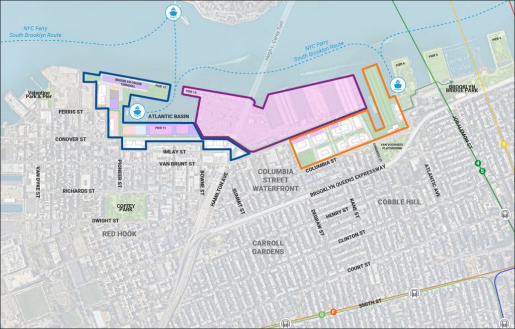
City planners want to institute parking maximums and build a new busway through Red Hook and the Columbia Street Waterfront as part of plans to build 6,000 new units of housing on the 122-acre Brooklyn Marine Terminal site.
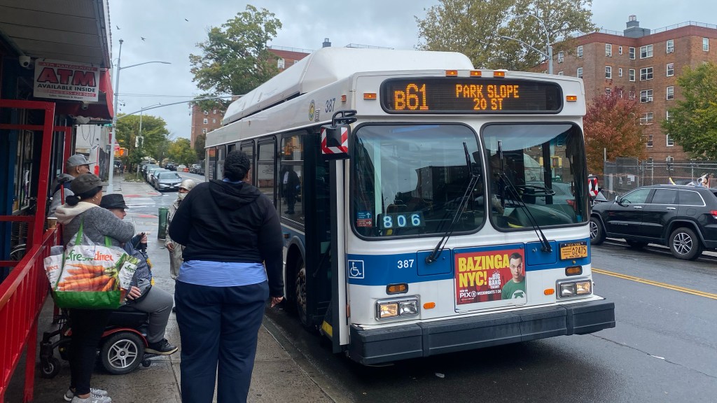
Officials recently revealed plans for a “bus rapid transit” corridor on Van Brunt and Columbia streets to help filter out spillover traffic from the nearby Brooklyn-Queens Expressway that too often chokes the area’s streets today.
“The main point is to reduce the background volumes to a point where that’s not a source of delay for the buses,” Department of Transportation Director of Transit Planning and Policy, Chris Hrones, said a July 31 meeting of the “task force” advising the redevelopment effort. “This is a creative application of sort of the busway concept.”
The changes are still years off, however, as the city won’t advance them until the Marine Terminal redevelopment begins construction, according to the quasi-public Economic Development Corporation, which leads the project.
EDC expects the plans to move toward an environmental impact statement in early 2027, according to spokesperson Seth Schuster, and aims to secure the right to redevelop the site through a state-approved process known as a General Project Plan.
The city-run development agency had not previously answered how it planned to handle transportation to and from the site, which sits more than a mile from the nearest subway stop. Critics including local State Assembly Member Jo Anne Simon have cited the lack of clarity in transportation planning among the reasons for their opposition.
A busway should put those concerns to bed, said one transit advocate.
“Everyone knows that the biggest objection to new housing is traffic, and so by building a busway and restricting parking, the city is making an effort to confront those issues, and to bring new neighbors into the community in a way that doesn’t clog the arteries of the streets,” said Riders Alliance Policy and Communications Director Danny Pearlstein.
Like other busways, DOT’s vision for Van Brunt Street-Columbia Street would limit through-traffic on the streets to just buses and trucks, and force all other drivers to turn right off at several intersections, including Commerce, Bowne, and Congress Streets.
The revamp would also close off the block of Columbia north of Hamilton Avenue entirely, which currently channels cars coming off the BQE, creating a car-free plaza. Car drivers would still be able to travel north-south via two new streets the city will open as part of the port redevelopment, extensions of Conover Street and Van Brunt Street.
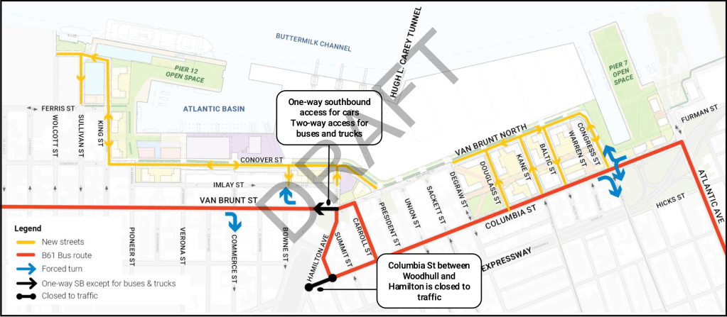
All that put together should keep BQE traffic out of the way of bus riders, according to a consultant working on the project for EDC.
“Traffic is not going to ride up Columbia without knowing there’s going to be a forced turn, especially with the way people follow Google Maps and you know apps. It’ll know about the forced right and it’ll not put them on Columbia in the first place,” Jeff Smithline of TYLin said at the July 31 task force meeting.
Motorists have for years clogged up streets adjacent to the BQE path through Carroll Gardens and Cobble Hill, using nearby Hicks Street, Columbia Street and Clinton Street as shortcuts before getting back on the highway at the chaotic Atlantic Avenue interchange.
The spillover traffic inundates the neighborhoods nearby and slows the B61 bus, the closest mass transit option, and makes the area less safe for pedestrians.
“If you ask anyone trying to cross Hamilton Avenue, we know that their safety is being sacrificed for people commuting in from suburban parts of Brooklyn and actual suburbs further away,” said Pearlstein. “People don’t want to live in flyover country.”
A member of the task force — former DOT Commissioner Hank Gutman — urged officials to also ban trucks from the busway, and warned that opening new roads nearby on Van Brunt and Conover Streets would encourage more driving.
“Why are we exempting trucks on Columbia Street? Most of the trucks using it today are there illegally,” Gutman said at the July meeting. “We’re again inducing demand by creating another several lanes for some undefined element of the traffic to use, and then all of this dumps into Atlantic Avenue, which is a disaster.”
DOT has been considering closing the Atlantic Avenue on-ramp — an idea experts have floated for years — as part of its larger work to address the deteriorating highway’s triple-cantilever around Brooklyn Heights, but the Mamdani administration has yet to reveal plans for the future of the Robert Moses-era expressway.
Officials at the state-controlled MTA have also been looking into better bus connections for the area, including a direct line to Lower Manhattan via the Hugh Carey Tunnel.
Putting a limit on parking
EDC’s marine terminal planners also want to mandate parking maximums in the new buildings, in order to discourage car ownership among the thousands of residents they expect to move in.
The caps aren’t yet final, but could range from a low of between zero and 0.6 parking spaces per unit, or three for every five dwellings. The parking maximums would be the first in Brooklyn, but not in New York City.
The plans would also centralize parking infrastructure in a few locations on the marine terminal site, rather than requiring it in every development.
“We’re doing this because both academic research and common lived experience show that when it is harder to park, it is harder to drive,” Sam Frommer, with the consulting firm Buro Happold, told the task force last month.
The redevelopment aims to only have 16 percent of people traveling by car or taxi, while 65 percent would take public transit and 19 percent would walk or bike, according to the July presentation.
“In creating a development that prioritizes transit, walking, biking and active ground floors, open space and climate resilience, the BMT project will make owning and driving a car much less attractive,” Frommer said. “We’re not saying there’ll be no cars or that people won’t be able to drive, however, we have designed the site to promote the most use in sustainable transportation modes.”

Streetsblog has migrated to a new comment system. New commenters can register directly in the comments section of any article. Returning commenters: your previous comments and display name have been preserved, but you'll need to reclaim your account by clicking "Forgot your password?" on the sign-in form, entering your email, and following the verification link to set a new password — this is required because passwords could not be carried over during the migration. For questions, contact tips@streetsblog.org.