The much-debated and partially watered-down redesign of McGuinness Boulevard is nearing completion after years of advocates battling an allegedly corrupted City Hall to make the deadly north Brooklyn artery safe.
The redesign became the first and one of the most heated flashpoints in the fight for better streets under the Adams administration, after years of advocacy for better safety following the vehicular slaying of beloved local teacher Matthew Jensen on the road in 2021.
The roughly mile-long corridor between the Brooklyn-Queens Expressway and the Pulaski Bridge now has two redesigns: A watered-down version north of Calyer Street installed last year that keeps two car lanes in each direction, and a road diet removing one lane each way between Calyer and Meeker Avenue.
The new single-lane configuration has transformed McGuinness Boulevard into a calmer and safer road for vulnerable road users, while the compromised portion to the north remains an unsafe danger zone.
"It would help to extend it the whole way," said Greenpoint resident Brett M. as he biked on the new paths earlier this week. "We kinda needed [the redesign]. People were speeding."
DOT had originally planned to remove a lane each way for the whole thoroughfare in 2023, before opponents, backed by the powerful soundstages company Broadway Stages, got then-chief mayoral adviser Ingrid Lewis-Martin to intervene, which led Mayor Adams to hack away at the plan several times last year, despite all local elected officials backing the road diet.
In October came another switcheroo, back to the original plan for the southern section, just days after investigators reportedly seized the phones of both Lewis-Martin and Broadway Stages exec Gina Argento.
DOT workers are still adding some finishing touches through the end of the year, but since the bike lanes are now rideable, I tested out the entire corridor for our latest "Eyes on the Street" feature.
Highway connections
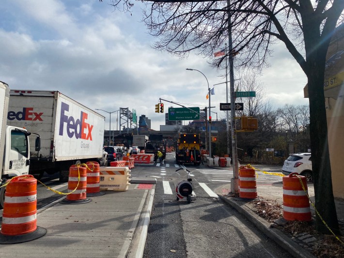
Starting at the southern end and along the east curb of McGuinness Boulevard, at Meeker Avenue and the BQE, there is little protection from the busy traffic coming off the highway or drivers heading to an adjacent gas station:
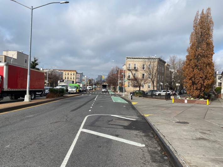
On the western side, DOT was still installing concrete islands at the intersection of Bayard Street, where Jensen was killed.
The corner also has an on-ramp to the highway, so the hard infrastructure is designed to calm traffic heading to the BQE, according to an agency update from September.
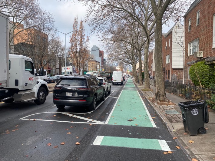
Continuing north, the new protected bike lane becomes wide and pleasant to ride thanks to the parking protection.
Drivers largely adhered to the designated spots, including delivery vehicles, keeping the paths free from obstructions.
Pedestrian space galore
The most noticeable change besides the bike lanes is the addition of pedestrian infrastructure, like parking bans for better visibility near corners — a design known as daylighting — and painted islands, which dramatically shorten the space people on foot need to traverse.
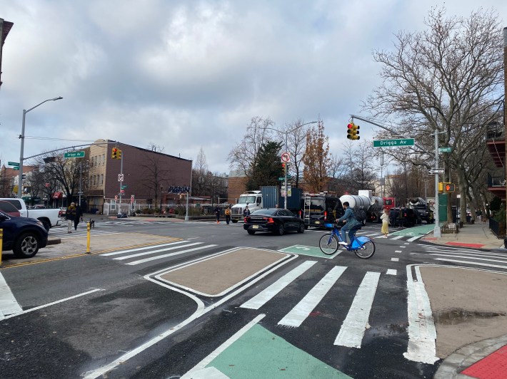
Protected bike lanes reduce serious pedestrian injuries by 24 percent, and by 39 percent among seniors on foot, according to DOT data.
But because the additions are so far largely just paint, it was easy for some drivers to ignore them and make dangerously tight turns, as seen here.
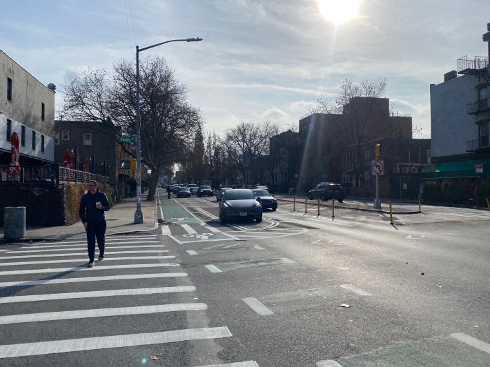
One dad pushing a stroller said the city must focus on keeping the corridor safe for pedestrians.
"Any way to increase pedestrian safety helps," said Jordan, who didn't give his last name.
Calyer compromise
Once I arrived at Calyer Street, the design changed to the watered-down version that has been in place since last year.
The city decided to keep two car lanes in both directions during the daytime from Calyer to the Pulaski Bridge — it's supposed to turn into a parking lane on nights and weekends — while ditching the shortened crossings, and setting up some jersey barriers and plastic bollards to keep the roaring car traffic at bay.
That area is notably also closer to Broadway Stages outposts, which DOT explicitly marked on a map in a presentation last year.
Local politicians have complained to DOT that the reduced version on the northern third of McGuinness did "nothing," for pedestrians, and it's an even starker discrepancy now that the original redesign is in effect just blocks away.
The policy also causes a lack of legal parking and loading zones during the day time, so motorists just pull into the bike lane, forcing cyclists into fast-moving traffic.
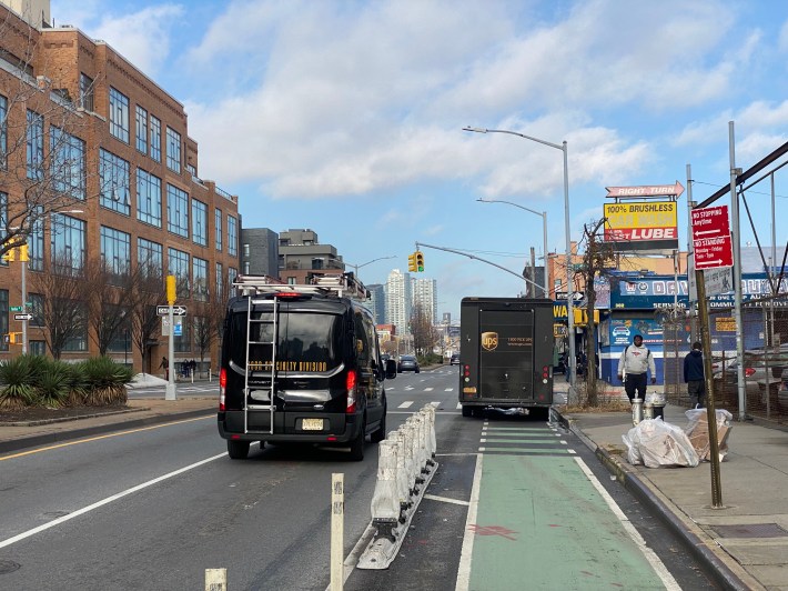
That treacherous arrangement continues in front of several lots with potential for conflicts with cars, including parking lots, gas stations, auto body shops and car washes.
At Green Street, the bike lane moves over to the west curb and becomes two-way until the Pulaski Bridge for the remaining two blocks.
DOT built out better protections along this section, in the form of a painted pedestrian space expansion that replaced a slip lane onto Freeman Street, and some concrete islands.
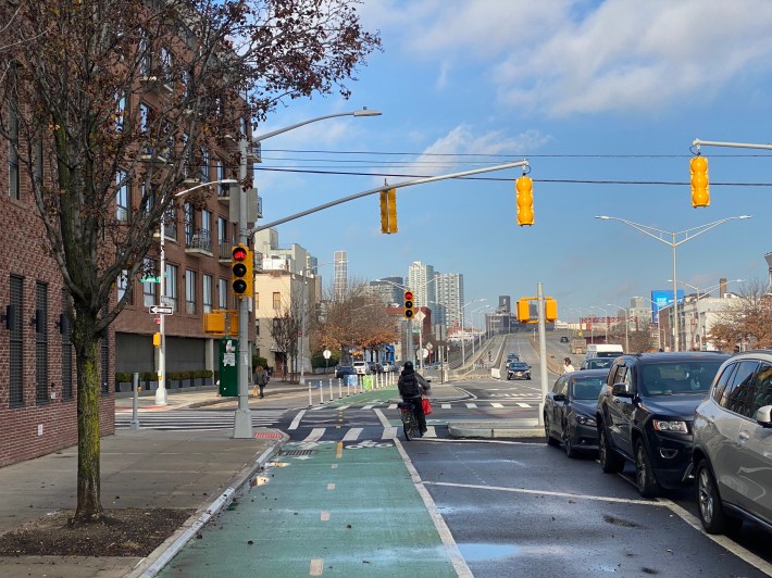
That design helps keep traffic coming off the Pulaski Bridge from cutting across the bike lane, although there's still some potential for conflict with drivers coming from McGuinness Boulevard's service road-like section just west of the span.
However, drivers were pretty much following the stop line set back from the bike lane.
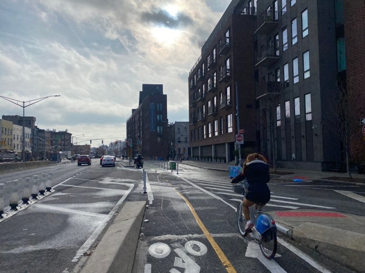
DOT's press office did not respond for comment by press time.
For a good before-and-after, also check out the newly published Streetfilms video:


