DOT to Tweak Brooklyn Bridge Bike Path Exit on Manhattan Side
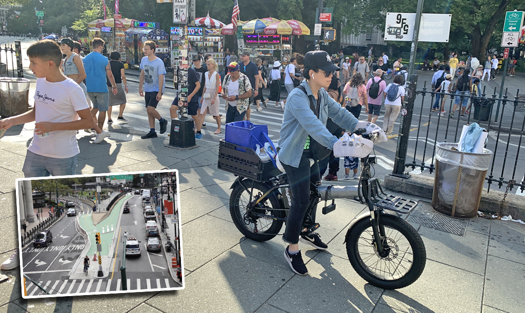
Pedestrians and cyclists will no longer fight for space on an often-packed sidewalk exit ramp from the Brooklyn Bridge bike and walking path, thanks to a redesign put forward tonight by the Department of Transportation.
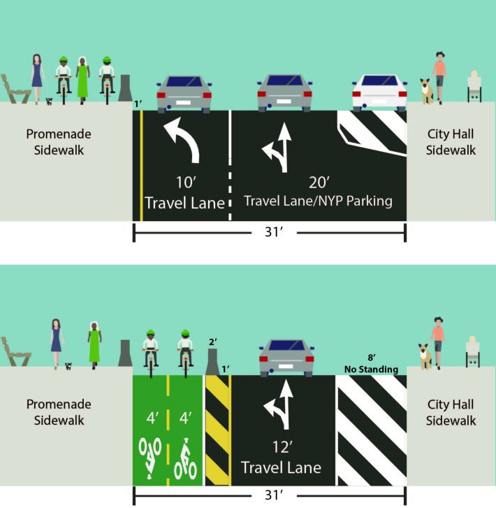
The new scheme would take the existing left-turn-only lane for car drivers to access the Brooklyn Bridge from Centre Street and refashion it into a protected two-way bike lane, giving cyclists a way to get off the bridge and head downtown without having to mix with pedestrians or cars.
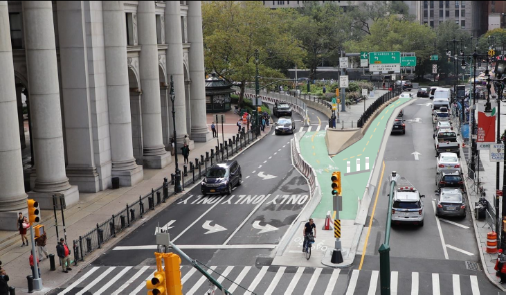
Drivers will still be able to access the eastbound Brooklyn Bridge from the one downtown lane, as seen in this DOT rendering:
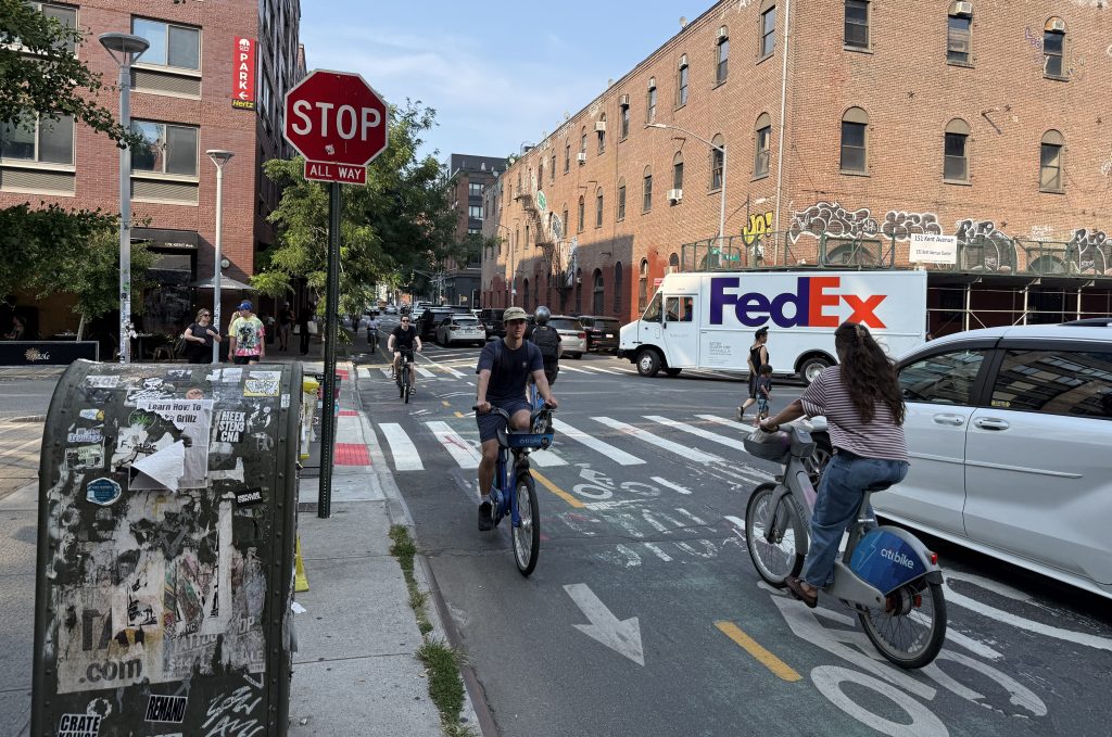
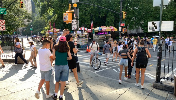
The change will eliminate the current very tight, blind turn that downtown-bound cyclists must make at the foot of the bridge in Manhattan (where the pavement turns to green in the rendering above). It will also give pedestrians full access to the plaza at the foot of the bridge, so that conflicts like the one below don’t keep happening:
There will be separate bike, car and pedestrian timing at the signalized intersection that will remain in the picture above.
The changes are much-needed, as even the DOT’s graphic shows:
The fix is also needed because the Brooklyn Bridge bike lane has become hugely popular since its opening in September 2021, quickly doubling the number of cycling trips over the bridge. In August, the DOT recorded a record number of trips over the bridge — 160,659, or 5,182 per day — even as bike trips over the other East River bridges grew slightly.
The DOT takes that as evidence that the Brooklyn Bridge bike lane has inspired more overall bike trips over the river.
“Our Brooklyn Bridge bike lane represented a historic improvement for cyclists and pedestrians, directly leading to a surge in bike ridership over the span,” agency spokesman Vin Barone said in a statement. “We look forward to building on this success by upgrading the approach on the Manhattan side to reduce conflicts between cyclists and pedestrians, and improve safety, as they access the bridge.”
Streetsblog got an early look at the DOT plan because it is considered part of the community that will be affected by the redesign — in this case, journalists because the plan also calls for the relocation of a press parking zone from the west side of Centre Street to the south side of Chambers Street. (Full disclosure: No member of the Streetsblog staff has NYP license plates nor does any member of the Streetsblog staff drive a car for work.)
On a phone call with several other media outlets, no journalists objected to the relocation of the press parking zone, suggesting that there will be little controversy over the change.
Left out of the plan, however, is a direct connection for cyclists heading south from the bridge or north towards it from Lower Manhattan. Under this plan, cyclists leaving the Brooklyn Bridge will still have to cross Centre Street to continue downtown to the protected lane on Broadway. And northbound cyclists will have to cross Centre Street twice to access the bridge, just as they do now.
Longtime cycling advocate Jon Orcutt was optimistic about the short-term fix, but pointed out that a real solution would take a lot more effort.
“This plan is welcome and a lot better than what we have now,” said Orcutt, a former DOT official under Mayor Mike Bloomberg. “As for the street connection issues, the real problem is that Park Row along City Hall Park is a highway ramp posing as a Lower Manhattan street. A city with any pride in its streets, landmarks and public realm would dramatically overhaul it and connect the Brooklyn Bridge Promenade directly into the park.”
Manhattan Community Board 1’s Transportation Committee will take up the issue tonight at 6 p.m. in a virtual meeting. Click here to watch.

Read More:
Streetsblog has migrated to a new comment system. New commenters can register directly in the comments section of any article. Returning commenters: your previous comments and display name have been preserved, but you'll need to reclaim your account by clicking "Forgot your password?" on the sign-in form, entering your email, and following the verification link to set a new password — this is required because passwords could not be carried over during the migration. For questions, contact tips@streetsblog.org.