"If everybody drives a car," the mayor of Milan said last week, "there is no space for people, there is no space to move, there is no space for commercial activities outside the shops."
Why do we normally have too many cars driving around New York City? Because we spend billions of dollars on roads and highways that encourage people to drive. Milan, Brussels, and Paris are all using Open Street experiments during the pandemic to permanently change the driving culture in their cities. Here are some ideas to do that here.
The ideas are both radical and common sense — "radical" because everyone reading this has grown up in the age of King Car, when what was good for General Motors was good for America. We built an American way of life dependent on driving, and we're used to it.
But the changes are common sense because we're all living through an event the likes of which hasn't been seen for 100 years. Many hope that returning to "normal" after the pandemic won't mean going back to the pre-virus status quo. There are ways to change the car culture and make city life healthier and more pleasant. To quote Winston Churchill, "Never waste a good crisis.”
Manhattan streets
Manhattan is the easiest place to begin transitioning from streets for machines to a better balance of streets for traffic and people. Manhattan has the lowest car ownership rates, the highest number of cars coming in from elsewhere, the most crowded streets, and the highest concentration of mass transit. Three-quarters of Manhattan households don't own a motor vehicle, yet three-quarters of streets are given over to the movement and storage of machines.
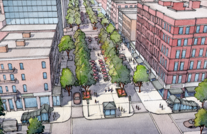
To rebalance how we use our streets, the plan suggests:
- Reducing the number of Manhattan avenues dominated by cars. New two-way designs could make the avenues safer and slower than today. Sidewalks would be wider.
- Creating pairs of one-way, car-free avenues redesigned for bicycles in the center of the street. Sidewalks will be wider on those streets, too.
- Creating "shared-space" avenues and promenades for pedestrians and slow cyclists.
- Making many cross streets shared-space streets for slow drivers, pedestrians, and cyclists.
Shared-space streets — where pedestrians, cyclists, and drivers can go — are common in cities like Amsterdam and Rome, where experimentation with shared-space started in the 1960s. Today, every European country has examples of shared-space streets, and we know how to make them four to five times safer than Manhattan's auto-centric streets.
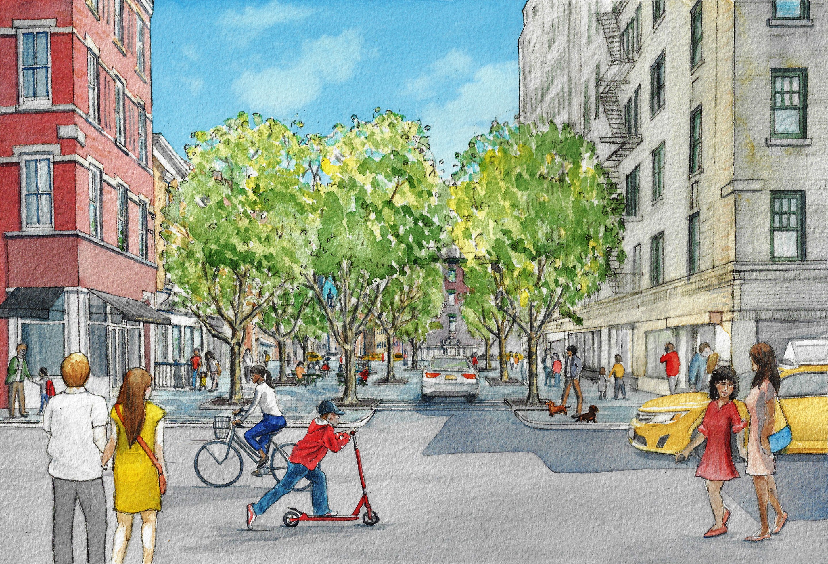
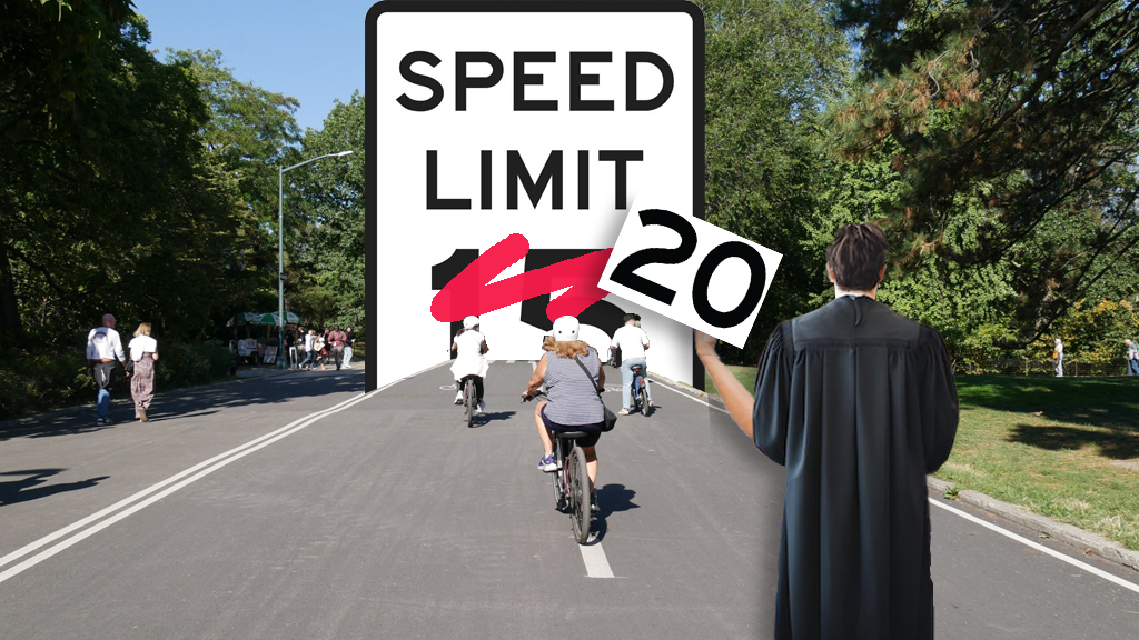
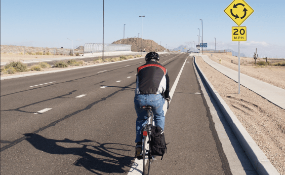
Most of the cross-streets in Manhattan could become shared-space Slow Streets, where cars move at a speed safe for people on foot or on bikes. That means less than 20 miles per hour. The design techniques that support that also support good urban design and placemaking, making streets where people want to get out of their cars and stroll.
Wide cross streets like 23rd Street and 96th Street would remain two-way streets dominated by cars. With pedestrians and cyclists strictly separated from traffic, cars could go 25 miles per hour, though narrowing the lanes would make driving faster than that uncomfortable.
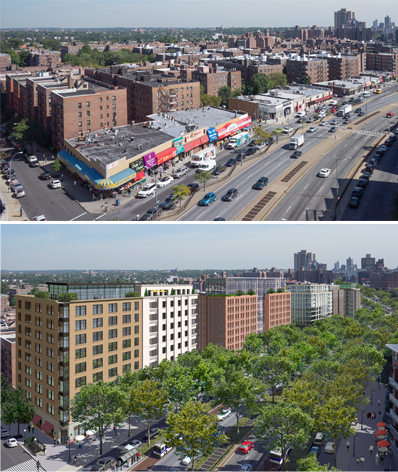
The avenues would have three new basic designs. One would be for avenues still devoted to moving cars around the city, but these avenues would become two way. Like the wide cross streets, they could have a design speed of 25 miles per hour. European examples show that slow, two-way streets are the safest transportation corridors.
Exercising next to noisy, polluting cars and trucks is unhealthy and unpleasant. So pairs of avenues would form one-way, car-free transportation “couplets" for bicycles. Synchronized traffic lights would encourage a travel speed of 10 to 15 miles per hour, making what is known as a “green wave,” so that cyclists could roll along without frequently stopping for red lights. The lack of motor vehicles would also make the wide sidewalks next to the bicycle routes healthier and more pleasant for walking.
The third type of avenue would be a slow, shared-space street, with pedestrians, cyclists, and motor vehicles allowed anywhere on the streets at any time. These would be the centers of Slow Zones, with no traffic lights or crosswalks where they cross other shared-space streets. Drivers and cyclists alike would have to go slowly enough that they wouldn't endanger pedestrians.
The city of Brussels recently announced that all streets in the center of the city will be part of a Slow Zone with a speed limit of 12.5 miles per hour. We can do that, too. Slow Zones are part of New York City’s Vision Zero plan to eliminate all traffic deaths and serious injuries on New York City streets by 2024.
Before and after
Before the pandemic and the shelter-at-home orders, several Manhattan avenues had as much traffic as interstate highways. In California, it is illegal to build a school within a thousand feet of a highway, but we spend our lives walking and biking next to streets that move thousands of cars per hour.
Traffic coming into the city is now down 40 to 60 percent. That's not a lot, but the effect has been enormous. The street design manuals used by traffic engineers employ formulas that are repeated with little variation: that's why all the rebuilt avenues in Manhattan are essentially the same.
But urban design and street design are contextual. Even under this plan, designs could vary in different neighborhoods and sometimes from block to block. Some unique streets like Park Avenue and Broadway north of Columbus Circle are already tree-lined, two-way boulevards that would be fine-tuned more than changed.
A Boomer born in New York, I've spent most of my life in or around the city. Riding a bike on Central Park's East Drive last week, I had to stop and admire the scene because I had never seen light and air like I saw that day. The light shone down on spring-green leaves, flowering cherry trees, and brick and limestone buildings on Fifth Avenue that sparkled in the sun. I was in awe.
This is a once-in-a-lifetime opportunity; we see a glimpse of a better future. Instead of going back to the old New York, choked with pollution and cars that don't move, we can decide what kind of city we want. Change the streets and change the city.
John Massengale is an architect and urban designer. Follow him on Twitter @jmassengale.
