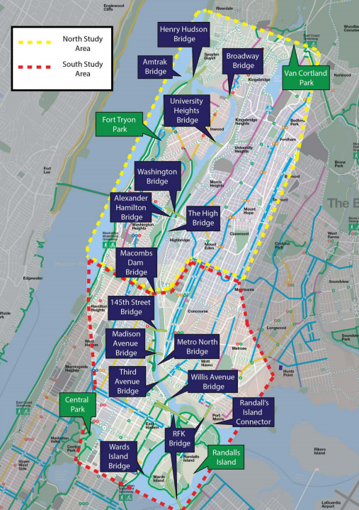
There are 16 bridges linking Manhattan and the Bronx, but if you walk or bike between the boroughs, safe, convenient routes are still scarce. That could change if DOT follows through on ideas the agency released this spring to improve walking and biking access over the Harlem River bridges [PDF].
Currently, 13 of the 16 bridges along the river have pedestrian access and just five (including the Randall's Island Connector) have bike paths. The streets and ramps feeding into the bridges are mainly designed for motor vehicle movement and poorly equipped to keep pedestrians and cyclists safe.
Most nearby residents don't own cars, and the conditions make it especially difficult for them to make short trips between the boroughs. “I know it could be more efficient for people to get to and from the Bronx, as opposed to waiting for the bus,” said Transportation Alternatives' Sandra Hawkins. “Some of [the bridges] are not easily navigable for walking or cycling.”
After Bronx and Uptown residents called for safer access between the boroughs, DOT launched a series of workshops last summer to gather ideas for its "Harlem River Bridges Access Plan," which will guide walking and biking improvements on the bridges and the neighborhood streets they connect.
DOT's final plan is set to be released in the fall, but in March, the agency shared some of the improvements it is considering based on what people have said so far. The projects cover both short-term fixes that can be implemented quickly at low cost, and more time- and resource-intensive capital projects.
There's a ton of potential in the 40 projects DOT has floated -- including bike infrastructure and/or wider sidewalks on each bridge, as well as safer biking and walking connections on the streets that feed into them.
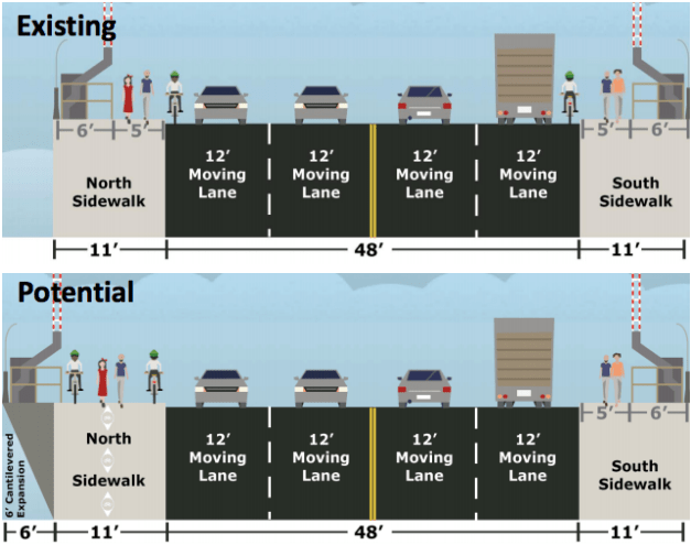
On the 145th Street Bridge, for example, DOT is considering a six-foot cantilever to make enough room on the north side for pedestrians and cyclists to share a grade-separated path; safer pedestrian crossings and new bike lanes on East 149th Street in the Bronx; and an improved bike connection to the Harlem River Greenway in Manhattan. Further from the bridge, the agency may install bike connections to the Hub in the Bronx and Adam Clayton Powell Boulevard and St. Nicholas Avenue in Manhattan.
“That’s a very heavy traffic bridge in terms of pedestrians crossing,” said Hawkins, who attended one of the recent workshops. “Just trying to get to there is not as safe as it could be because of the turns on and off bridges.”
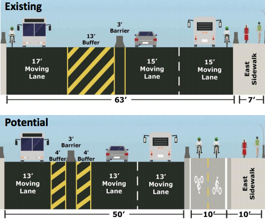
DOT is also considering two-way barrier-protected bikeways, similar to the new Pulaski Bridge bikeway, for the University Heights, Washington, and Madison Avenue bridges. A protected bike path on the Third Avenue Bridge is "not feasible with current traffic conditions," but toll reform could change that, according to the DOT presentation.
It would take some time for the city to build out all of these proposals, given the generally lethargic pace of capital construction. But some ideas from the workshops are already coming to fruition.
In February, DOT presented a proposal to Manhattan Community Board 11 for protected bike lanes linking the Willis Avenue Bridge and First and Second Avenue. On the Bronx side, DOT plans to present a two-way protected bike lane on Bruckner Boulevard between Willis Avenue and Willow Avenue to Bronx CB 1 this summer.
