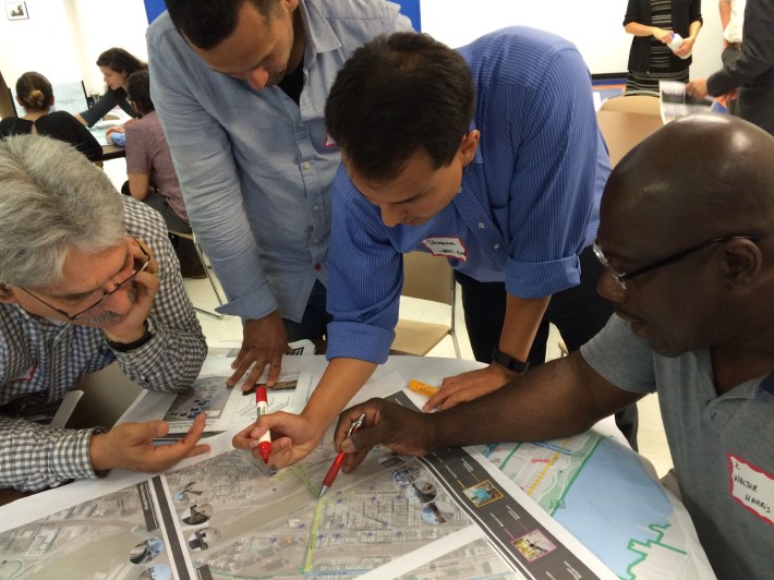
Residents from the Bronx and Manhattan told DOT last night how they want to improve walking and biking across the Harlem River bridges. It was the second of four Harlem River bridges workshops this month.
DOT is looking to improve access at all 16 bridges along the Harlem River, including the soon-to-open Randall's Island Connector. Streets up to a mile inland on both sides of the river fall within the scope of the project.
"We're not coming here with a plan," project manager Alice Friedman told the approximately 15 people at last night's workshop. "We're really here to hear from you."
Attendees last night split into three groups to highlight problem areas and offer suggestions. Most wanted wider paths on the bridges, safer intersections where the bridges touch down, and protected bike paths connecting nearby neighborhoods to the crossings. There were also smaller requests, such as better signage, more lighting, mirrors on blind corners, and improved snow clearance.
Mychal Johnson of South Bronx Unite said he often uses Exterior Street on rides to Mill Pond Park. "This is our safest route," he said. "And there's nothing protecting bikes. And there should be."
In addition to a healthy contingent of Transportation Alternatives Bronx members, last night's event attracted local community board members, including Manhattan CB 10 transportation committee chair Maria Garcia and Bronx Community Board 4 member Walter Harris. "It's an awesome thing to get the views of the community," Harris said, "especially for the Bronx."
DOT will be holding a dozen workshops in the coming months to inform its plans, including the four this month to assess existing conditions. (Unlike some other DOT projects, however, the Harlem River bridges plan does not have an online portal to gather ideas.)
The agency will present conceptual designs this fall, followed by a draft plan by the end of the year and a final report in spring 2016. Friedman said DOT hopes to go before community boards with a first round of short-term projects next year, while developing long-term capital projects to improve bicycle and pedestrian access to the bridges.
The latest round of planning builds on work by the Department of City Planning, which issued the Manhattan Waterfront Greenway Master Plan in 2004 and the Bronx Harlem River Waterfront Bicycle and Pedestrian Study in 2006.
