4 Reasons a $2.5 Billion Brooklyn-Queens Streetcar Doesn’t Add Up

Later today, Mayor de Blasio is going to deliver his State of the City speech, and one centerpiece is expected to be a new streetcar running from Sunset Park to Astoria along the Brooklyn-Queens waterfront. It's an idea that's surfaced repeatedly in one form or another as developers have transformed sections of the waterfront into new residential neighborhoods. As alluring as it may be to picture modern rail on the streets of Brooklyn and Queens, there are good reasons it's gone nowhere.
The argument for the streetcar goes something like this... The waterfront is booming with residential development in western Queens and northern Brooklyn, and job centers are growing at the Navy Yard and Sunset Park. A lot of this growth isn't very close to trains, and Red Hook has always been isolated from the subway network. So connect everything with a streetcar line and voila, transit access problem solved.
The vision of a sleek streetcar connecting people and jobs, with the East River glinting in the background, has a seductive appeal. The renderings will look fantastic in the marketing materials for new luxury condos. (Major backers of the plan include developers Two Trees and the Durst Organization.) Plus the city says the project will basically pay for itself through increased property tax revenue.
Too good to be true? I think so. Based on what we know so far, there's no way this proposal will deliver on the hype. What we're going to end up with is a highly-subsidized transit route with modest ridership at best. Here are four aspects of the project that don't add up.
Subway connections. A lot of the new development coming to northern Brooklyn and western Queens is a schlep from the subway. There are transit solutions to the subway access problem (here's one), but the streetcar route isn't a good one.
The streetcar is, instead, an expensive way to connect waterfront neighborhoods and destinations to each other. As for subway access, it won't stop anywhere near the J/M/Z, and anyone transferring to the L would have to walk two or three long blocks:
Paying for it. The pitch for the streetcar claims that increased property tax revenue can be captured and funneled toward the $2.5 billion project cost. In a quote that has since been edited away, NYU's Mitchell Moss told the Times, "This is going to do more to encourage more housing than any other transit improvement currently underway."
But the properties the streetcar will serve are already getting developed. (Have you been to the waterfront lately?) The real estate doesn't need an extra push from a streetcar with poor connections to the subway. If the project is funded by skimming property tax revenue that would have been collected anyway, that's a plain old subsidy that comes at the cost of other public priorities in the city budget.
Operations and fare integration. Let's assume the city does its part with street design and repurposes motor vehicle lanes and parking spaces so the streetcar won't have to slog through car traffic. There are still some tough questions about how the streetcar will be run.
This is going to be a city project, not an MTA project, so how will it be integrated with the MTA's fare system? Will people pay a separate fare for the streetcar, like they do for ferries or Citi Bike? If so, the streetcar loses even more utility as a subway connector. But if there's no fare, then all the operating costs will be perpetually subsidized.
Other transit priorities. The MTA and NYC DOT have produced some excellent analysis of the city's transit needs as planners formulate routes for enhanced bus service. The agencies look at where there are high concentrations of people without subway access, where travel demand is high but transit service is poor, and where the city is growing. Tellingly, this analysis has never concluded that the streetcar route is a high priority.
The map at the top of the post shows the largest concentrations of people who live outside convenient walking distance of the subway. The Brooklyn-Queens waterfront isn't one of them.
Because parts of the waterfront are growing rapidly, the agencies do put some sections of the proposed streetcar route on their priority map. But other corridors would serve more people, and the waterfront priorities are much more targeted than a snaking route from Sunset Park to Astoria. Here's a look at the transit service needs the MTA and DOT identified in 2009.
Previously, the de Blasio administration has set its sights on some great transit improvements, like extending the subway along Utica Avenue and improving service on the city's most heavily-used but sluggish bus routes. It would be a big loss if the streetcar project saps energy from those other initiatives.
Stay in touch
Sign up for our free newsletter
More from Streetsblog New York City
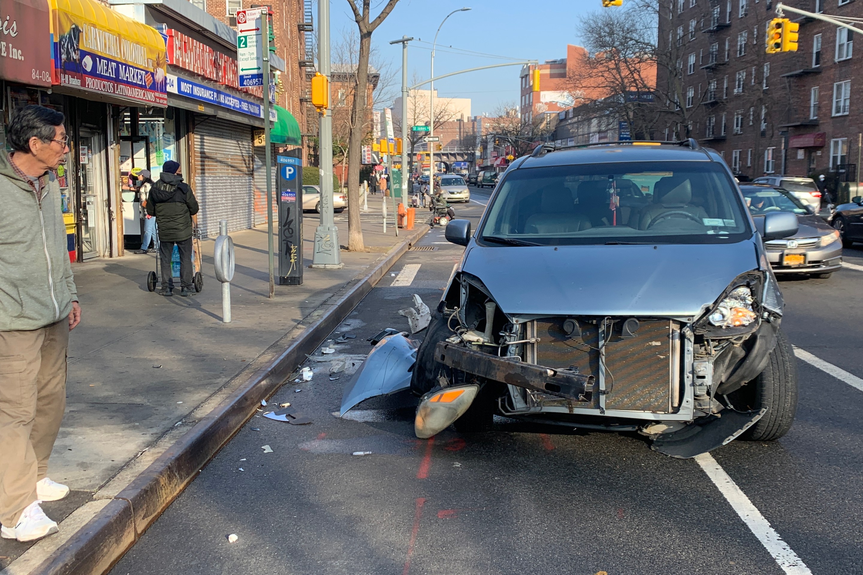
Report: Road Violence Hits Record in First Quarter of 2024
Sixty people died in the first three months of the year, 50 percent more than the first quarter of 2018, which was the safest opening three months of any Vision Zero year.
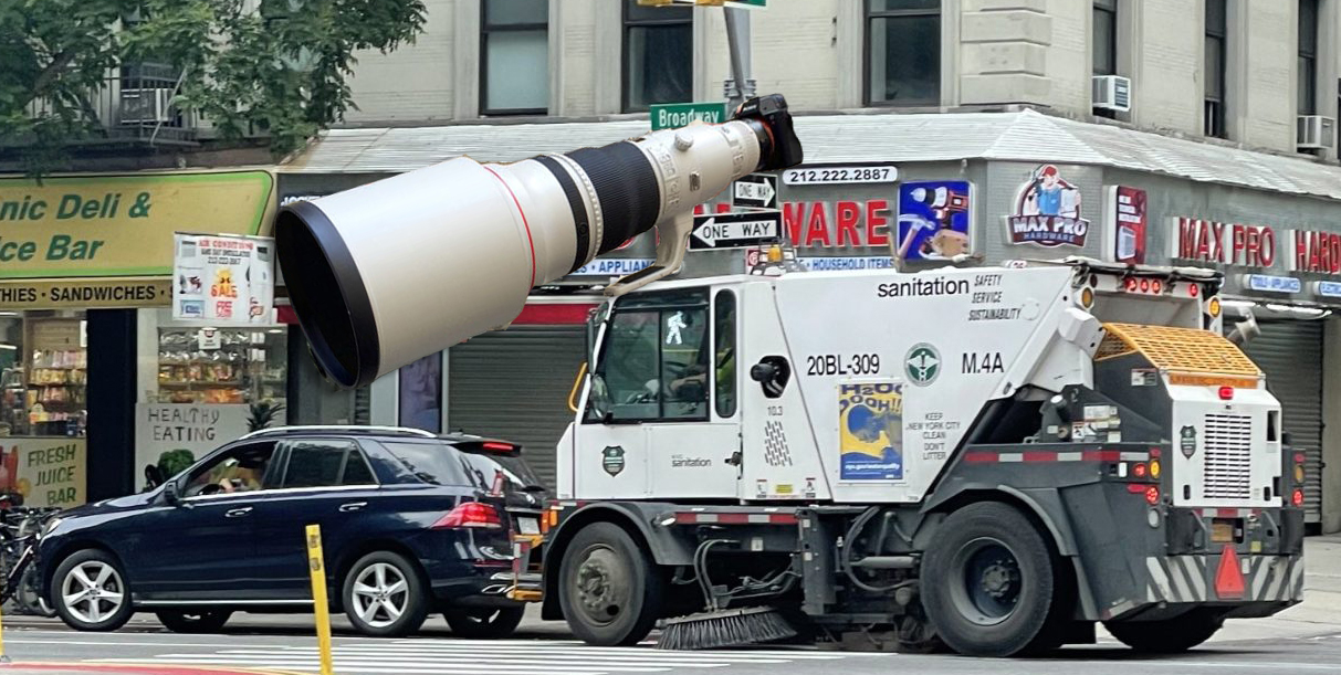
Street Sweepers Could Nab Illegal Parking Under State Bill
Smile for the street-sweeper!
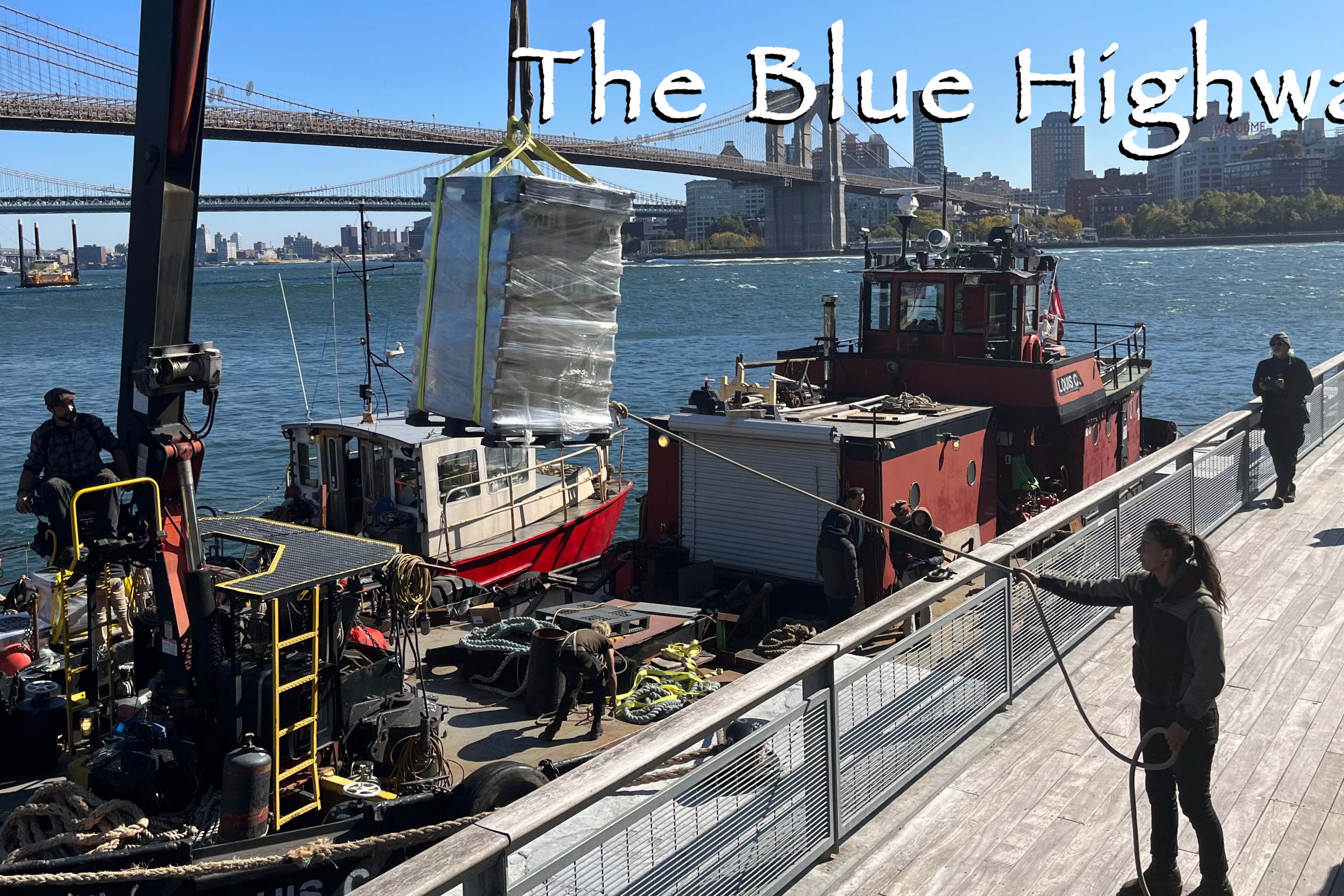
Thursday’s Headlines: The Way of Water Edition
The "Blue Highways" campaign wants the mayor to convert a downtown heliport into a freight delivery hub. Plus more news.
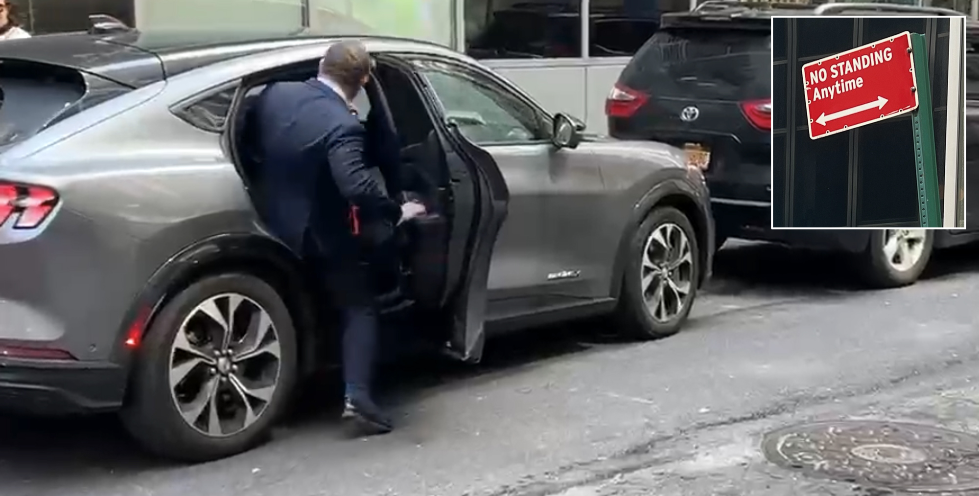
Gotcha-Heimer! Anti-Congestion Pricing Jersey Rep. With a City Speeding Ticket Drove to Manhattan on Wednesday
New Jersey's most vociferous opponent of congestion pricing parked illegally and once got a speeding ticket.