Can New York City Fix Its Deadly ‘Conduit’ to JFK Airport?
The high-speed three-mile stretch known as The Conduit, a residential highway that connects Atlantic Avenue to the Belt Parkway and JFK Airport, will get a major safety overhaul after years of traffic carnage, city officials said on Monday.
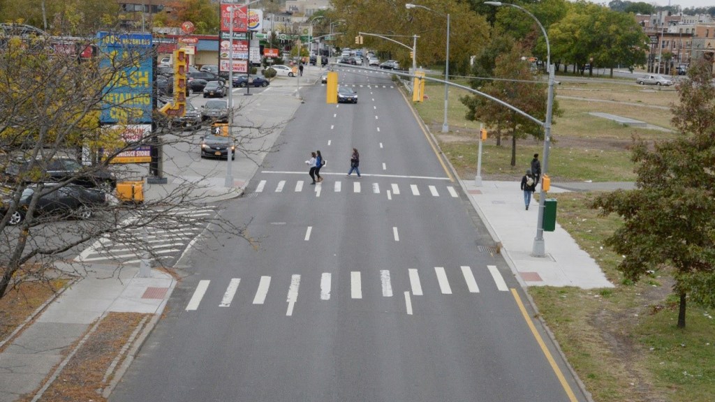
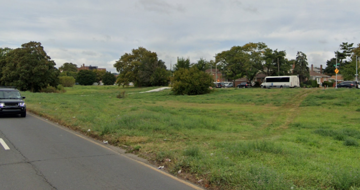
Some 61 acres of green space lie in the median between the northbound and southbound sides of Conduit Avenue/Conduit Boulevard — enough for 46 football fields, according to the Department of Transportation.
Most people who live in the area do not own cars, and the grassy median is filled with “desire” dirt paths indicating heavy foot traffic. That’s a deadly combo alongside several wide lanes in either direction of high-speed traffic: The corridor’s cameras clock more speeders than any else in the city. Five people died in crashes on the Conduit between Atlantic Avenue and Lefferts Boulevard in the last five years, according to DOT. Another 40 suffered severe injuries.
“The current state of the Conduit falls significantly short of meeting the needs of drivers, cyclists and pedestrians alike. It’s confusing, it’s poorly designed … and we know the lack of sufficient pedestrian and bike infrastructure makes it even more dangerous for the neighbors of Queens and Brooklyn,” Queens Borough President Donovan Richards said at a press conference with DOT Commissioner Ydanis Rodriguez on Monday.
Richards and his Brooklyn counterpart Antonio Reynoso asked DOT back in 2023 to make “urgent” changes on the corridor, which crosses the border between their two boroughs. DOT on Monday announced plans to collect community input in advance of a potential safety project on the corridor.
DOT has done some work on the Conduit in recent years, but without making changes to the high-speed car travel lanes. A 2016 project added new signals and crosswalks and replaced a few of the dirt paths with concrete on a short stretch between Atlantic Avenue and Sutter Avenue. Subsequent project added crosswalks at two intersections further south. None of those efforts amounted to the hypothetical redesign DOT floated on Monday, with Richards’s support.
Conduit’s excessively wide medians are the result of an abandoned effort to build a highway down the strip, officials said. The city widened the strip in the 1930s to make way for an elevate highway that never got built, DOT’s press release said. The strip retained a 40-mile-per-hour speed limit for years after then-Mayor Bill de Blasio lowered the citywide speed limit to 25 miles per hour. Today the speed limit is 25 mph on all of Conduit, but the corridor still only have 15 signalized crosswalks on the three miles between Atlantic and Lefferts.
“This is not a highway. This is a street,” Rodriguez said on Monday. “Even though this expressway was never built as a highway, we still know this corridor is a barrier for New Yorkers on either side.”

Queens cycling advocates have viewed Conduit as a potential link in a greater Southern Queens Greenway, which DOT could build in the medians or the existing roadway. The median provides ample space for a safer, more engaging public space.
“Brooklyn and Queens deserve a Conduit Boulevard that improves daily life, not a roadway that puts pedestrians and drivers at risk and physically divides entire neighborhoods,” Rodriguez said, adding that the process — which will leave the future of the roadway in the hands of the next mayor — would lead to a “safer, healthier roadway that serves all New Yorkers on all modes of transportation.”
DOT will collect input on how to fix the corridor at in-person workshops beginning in June. Members of the public can also enter input into an online interactive feedback map.
The public engagement process will likely run up into 2026, when Eric Adams is not likely to be mayor anymore. Adams’s successor could easily kill the redesign effort entirely.
DOT applied for, but did not receive, federal funding for the corridor during the Biden administration, but the study will be entirely city-funded, an agency rep said.

Streetsblog has migrated to a new comment system. New commenters can register directly in the comments section of any article. Returning commenters: your previous comments and display name have been preserved, but you'll need to reclaim your account by clicking "Forgot your password?" on the sign-in form, entering your email, and following the verification link to set a new password — this is required because passwords could not be carried over during the migration. For questions, contact tips@streetsblog.org.