Off the Waterfront: Bronx Part of ‘Harlem River Greenway’ Will Be Bike Lanes on Street
Mayor Adams announces things in poetry, but the Department of Transportation carries them out in prose.
The latest case in point? The agency’s plan for implementing Hizzoner’s supposed vision of a greenway along the Harlem River in the Bronx will, instead, be standard protected bike lanes that are not along the waterfront, but on nearby streets between Van Cortlandt Park and Randalls Island.
Adams had promised two years ago to reconnect Bronxites with a waterway cut off by highways, but then his agency had to deal with the reality of the situation: state and private landowners control much of the shoreline, and they have shown little interest in yielding the space for bike and pedestrian infrastructure.
As such advocates lauded DOT for doing the best it could, while also lamenting the missed opportunity for a true waterfront greenway like the one along the Hudson River in Manhattan, the nation’s busiest bike path.
“The Hudson River Greenway is such a special place because it’s like an oasis away from the street,” said Chauncy Young, a Bronx advocate with the Harlem River Working Group, told Streetsblog. “The more that you’re on the street and you’re interacting with [cars] the less family-friendly the space is.”
The plan
The draft seven-mile roadside route that DOT unveiled on Monday night [PDF] will run along the closest streets to the water, including Bailey Avenue, Sedgwick Avenue, Depot Place, Exterior Street, E. 135th Street, Lincoln Avenue, and Bruckner Boulevard.
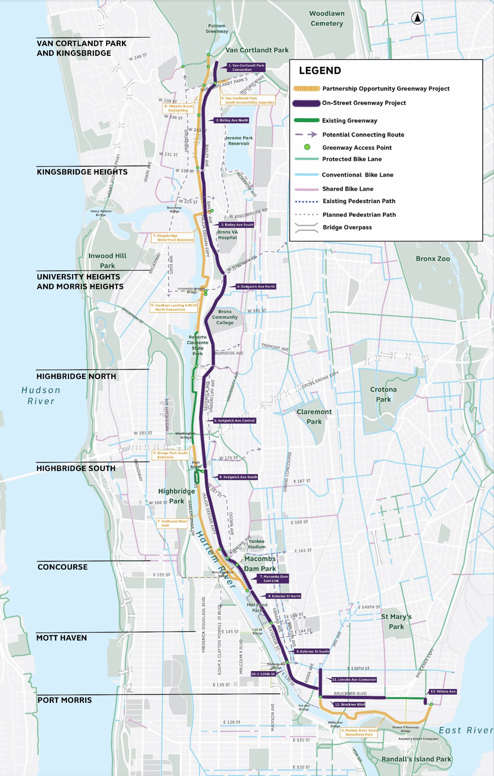
An alternate path could go along the waterfront — but only if the agencies and landowners in charge of those portions commit; DOT labeled those stretches “partnership opportunities” at its workshop at the Bronx Alehouse in Kingsbridge.
“We’re trying to build momentum here in the near term, which will only help us unlock some of those more strategic partnership opportunities in the future,” said Margaux Groux, assistant director for Greenways at DOT’s Bicycle Unit. “The idea is to create a continuous path, a transportation spine for cyclists and pedestrians hugging the Harlem River as a sort of anchoring frame.”
The work comprises eight projects, three of which (two parts of Bailey Avenue and Depot Place) will be implemented this year, the agency said. It is unclear when the entirety will be done.
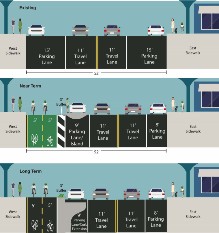
Each project creates the familiar curbside two-way bike lane with long stretches that can be free of conflicts with car drivers, much like existing stretches of the Brooklyn Greenway. And areas with conflicts with cars could be later built out with harder infrastructure, such as a raised bike path, if city officials decide to allocate more funding down the road.
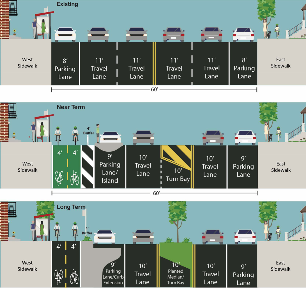
The redesign includes road diets along the northern end of Bailey Avenue, from Van Cortlandt Park to 230th Street, removing two of the strip’s four car lanes.
A nearby separate city project to uncover the Tibbetts Brook and build a pedestrian and bike path next the stream will run alongside this section once it opens in 2030.
Heading south, the protected bike lane continues along Bailey, before the street turns into Sedgwick Avenue adjacent to the Major Deegan Expressway, before continuing on south on Exterior Street underneath the highway.
Exterior Street turns into E. 135th Street at the Madison Avenue Bridge, where the bike lane continues on toward Lincoln Avenue and Bruckner Boulevard.
Lincoln Avenue will also get a road diet from four lanes to two, between Third Avenue and Bruckner, and Bruckner will narrow from four lanes and a whopping 70 feet to three lanes with a two-way bike lane.
Bruckner splits off into E. 133rd Street, which has an existing protected bike lane and leads to the Randalls Island Connector beneath the Hell Gate Bridge.
Attendees at the Monday night workshop were excited to see a safer north-south connection in the borough.
“Generally speaking, hell yes,” said Laura Solis, who grew up in the South Bronx, but was visiting from Portland, Oregon. “I’m excited to see something like this. It encourages people to ride bikes more.”
Who owns the waterfront?
In order to build a true waterfront greenway, the city would have to secure the buy-in from the Metropolitan Transportation Authority, the State Department of Transportation, the State Office of Parks, Recreation and Historic Preservation, and private landowners.
The state-controlled MTA’s Metro-North railroads run along the water, and the transit agency has two facilities, one where it manages its trash, and another active rail yard.
Roberto Clemente State Park occupies another parcel along the Harlem River, but Albany parks officials lock its gates at 8:30 p.m., and DOT officials said a greenway should be usable around the clock.
The state also owns a large swath of waterfront property at the southern end in Port Morris, but the state DOT leases it out to the Harlem River Yards, a freight rail facility.
Developer Dynamic Star plans to build a mega-project of apartments and offices along a strip of land in University Heights, dubbed Fordham Landing, with a promenade “to connect greenways,” according to news reports. But privately owned esplanades aren’t the best transportation artery, as Groux of DOT noted (and anyone who bikes in Astoria also understands).
Defining Boogie down
The end result — a protected bike lane rather than a greenway — comes despite some lofty rhetoric from Mayor Adams two years ago.
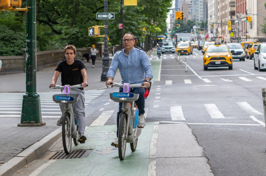
“Our administration is leading the way in undoing the devastation caused by highways like the Cross-Bronx Expressway, the BQE, and now the Deegan — reversing the devastation left by others in communities of color,” he said after riding a Citi Bike to a press conference on the High Bridge in March 2023. “Greenways help us move forward while righting the wrongs of the past, give people a place where they can exercise and breathe freely, and create a sense of community by bringing people together.”
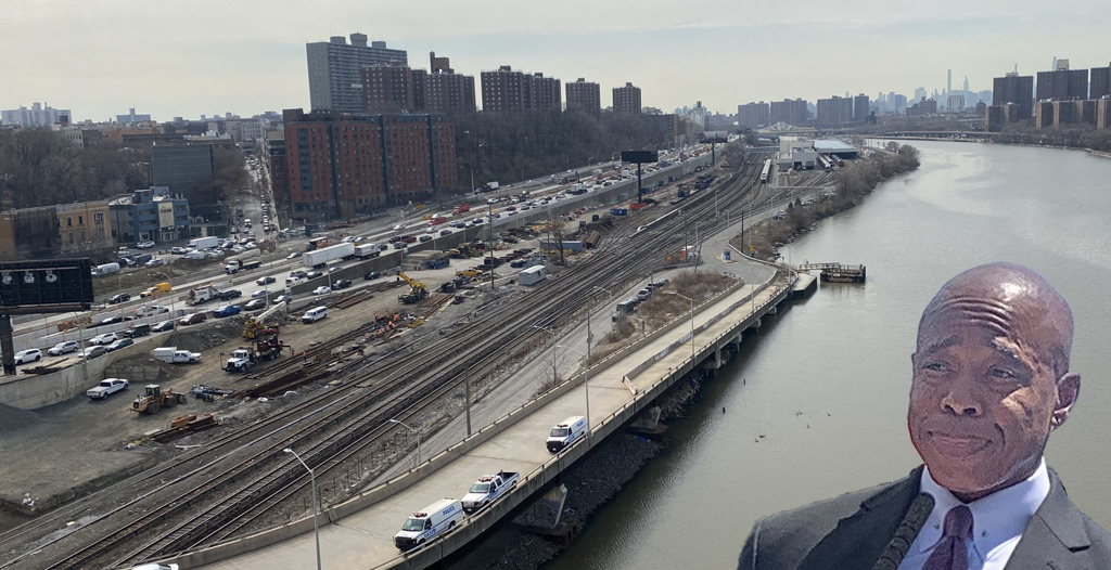
Certainly, from the get-go, DOT tamped down expectations, with Commissioner Ydanis Rodriguez saying the greenway will be next to the water “whenever possible,” but it wasn’t the first time Mayor Adams had promised more than he ended up delivering.
For example, as a candidate, Eric Adams pledged to exceed the Streets Master Plan for new bike and bus lanes (which he did not do) and also vowed to lace the city with bicycle superhighways (which he did not do).
Meanwhile, across the river from some of the poorest sections of the United Staters, the city is advancing a grand plan for a riverfront esplanade on the Manhattan side, where the Economic Development Corporation wants to pour $309 million to build a linear shoreline park as part of an effort to close the greenway gap between East Harlem and Inwood.
Another stretch further south in wealthy Midtown behind the United Nations got a glorious bike path in late 2023.
DOT will hold two more public workshops on the Bronx Harlem River Greenway plan.
- Tuesday, April 1: 6-8pm, the Bronx Brewery, 856 E. 136th Street.
- Monday, April 7: 6-8pm, on Zoom. Register here.
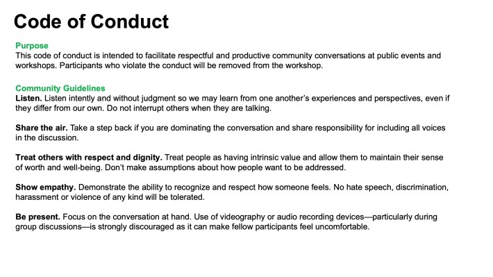
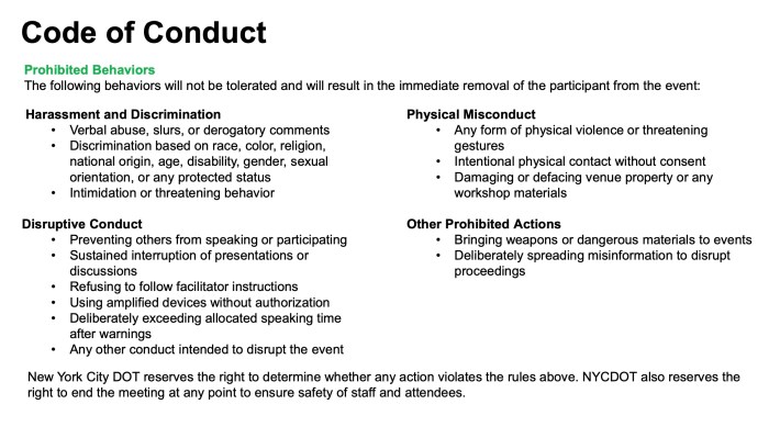
Update (Tuesday, April 22, 2025, at 5:06 p.m.): After initial publication of this article, DOT’s press office reached out requesting Streetsblog replace its link to the agency’s greenway presentation with another version that included alternative text, making it accessible for people with visual impairments. The new document also omitted two slides detailing DOT’s code of conduct at the meeting, so Streetsblog replaced the link in the story, but is keeping the two deleted slides below in the interest of our readers.
The copy of the presentation DOT originally provided at the meeting is also still available here [PDF].

Read More:
Streetsblog has migrated to a new comment system. New commenters can register directly in the comments section of any article. Returning commenters: your previous comments and display name have been preserved, but you'll need to reclaim your account by clicking "Forgot your password?" on the sign-in form, entering your email, and following the verification link to set a new password — this is required because passwords could not be carried over during the migration. For questions, contact tips@streetsblog.org.