We've seen the future of open streets — and it's 1980s Queens.
As the de Blasio administration ponders how to turn its "gold standard" car-free street project on 34th Avenue in Jackson Heights into a permanent resource for the park-starved neighborhood, Department of Transportation officials need only walk around Springfield Gardens to see what an earlier generation of planners did when they wanted to reduce the danger of reckless drivers and truckers using residential streets as a shortcut to make time.
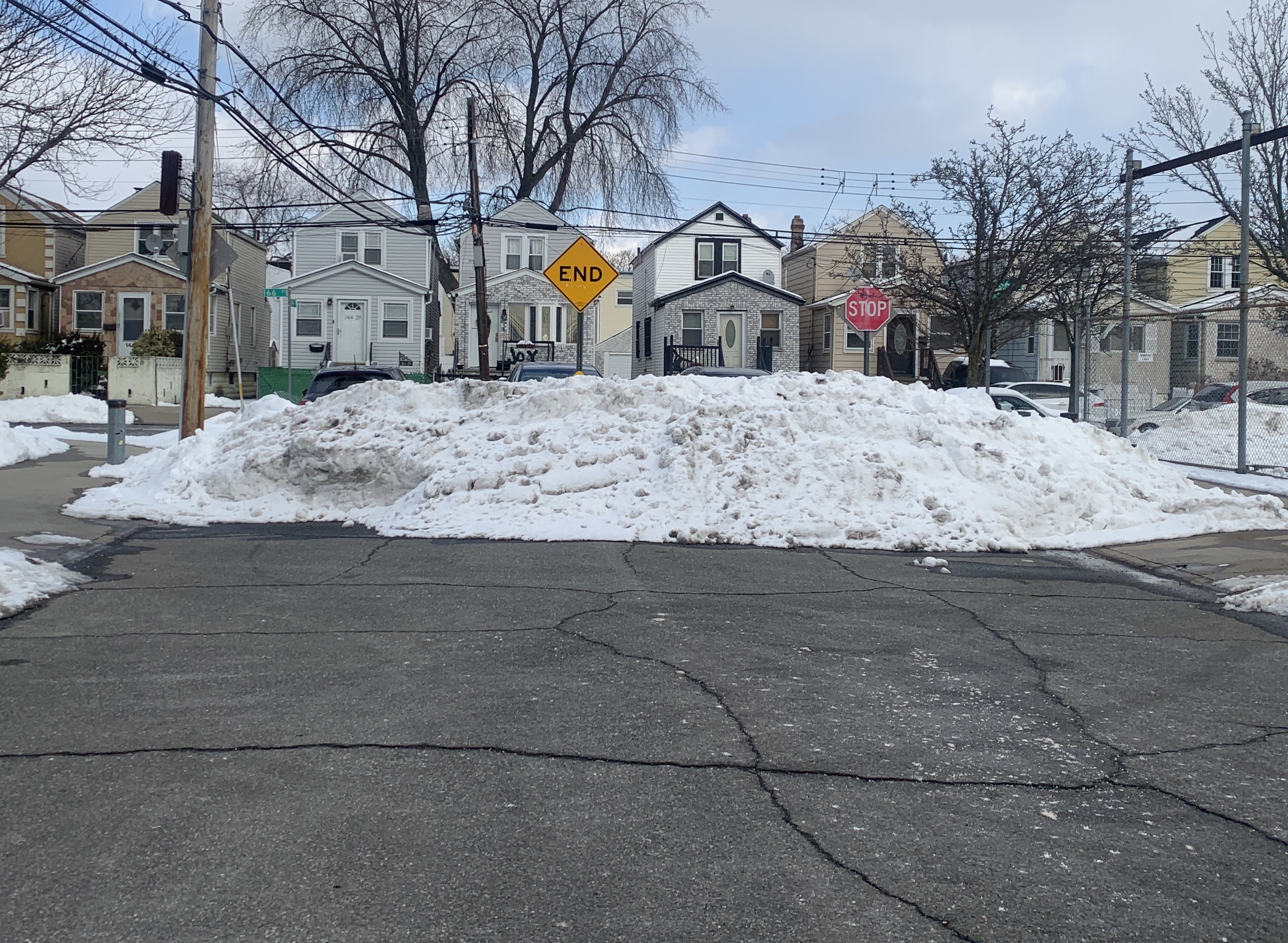
There, in a quiet residential neighborhood hard by JFK Airport, the Koch Administration radically altered the street grid with mid-block barricades that effectively turned high-speed thru-streets into dead ends. The move was made, several residents said, after a child was run over and killed by a driver (the details of that death could not be found in a search of newspaper archives of the era, but it is believed to have occurred in 1987).
"It's great because no cars can come through here," said resident Ray Hodge, who lives on 144th Drive, one of the dead-ends that effectively eliminated a shortcut for drivers from Rockaway Boulevard to South Conduit Boulevard and Guy Brewer Boulevard — the three speedways that frame this tiny enclave.
"Cars are always speeding," Hodge added, "but on these dead-ends, we can hang out. The kids can play basketball. I can even let my niece play in the street."
There are about eight places in the neighborhood where the city cut off thru-traffic with bollards and cement. Interviews with neighbors and a review of historic city maps suggest that the changes are made between 1983 and 1988 after someone was run down and killed. Then-Borough President Donald Manes also had a longstanding war with nearby Nassau County over truck traffic to JFK, and Manes's name is all over planning maps from the era.
A Board of Estimate map of the scheme for dead-ends and cul-de-sacs was dated 1988, though it is unclear when the changes were made. In any event, neighbors like it.
"It was even better back in the days when kids would actually play outdoors," said one man, who declined to give his name. "I like it, though, because it basically eliminated all the trucks that were coming through here."
As if on cue, the driver of a Department of Sanitation truck — not a regular garbage truck, but clearly a vehicle driven by an employee who did not know the neighborhood — pulled up and realized he could not cut use the area as a shortcut. The neighbor directed him out.
Is the area safer as a result of the cul-de-sacs? Yes.
In the roughly 25-square-block residential area bordered by Rockaway, Guy Brewer and Farmers boulevards — where the dead-ends are a prominent feature — there have been 10 injury-causing crashes since 2017, injuring one cyclist, one pedestrian and 16 drivers. In a similarly sized area framed by Guy Brewer, Farmers and Springfield boulevards just to the east but without the dead-ends, there have been 52 crashes in the same period, injuring nine pedestrians and 70 motorists. That's more than five times the crashes and more than four times the injuries.
There are other examples of city efforts to rein in drivers and provide more safety. There's one on Balcom Avenue in the Throggs Neck section of The Bronx [map]. And there's a famous pair in Brooklyn created by Robert F. Kennedy and the Bedford-Stuyvesant Restoration Corporation, which cut a block in half and used the space in the middle for a playground. And St. Louis is considered the nation's leader in this kind of street design.
Now, the past is prologue. This week, the DOT will host three more "visioning sessions" about the future of 34th Avenue, which agency officials (who are obviously obsessed with metals) have called "the gold standard" and a "sterling example" of the open streets program. Many residents of the area have ask DOT to bar thru traffic on 34th Avenue between Junction Boulevard and 69th Street.
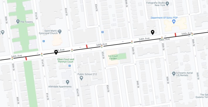
Opponents say that emergency vehicles would have trouble accessing the roadway if it is entirely blocked off. Also, there are about 13 private garages on the stretch (see black icons in the map above) to which drivers would require access.
But the Springfield Gardens experience shows that local car owners could still be accommodated even as thru traffic is reduced greatly. Barricades could easily be alternated to allow drivers to access or leave their garages, but only allow cars to access one block of 34th Avenue at a time.
Here's how that could be accomplished. The red marks show the mid-block barricades, the black line is the center median on the roadway, and the black icons show the locations of garages. If properly placed, drivers could still access the garages and still leave 34th Avenue easily.
The Department of Transportation declined to comment on this review of what happened in Springfield Gardens, but the agency is clearly open to the idea that its 1980s design work could influence open streets going forward.
"We have no pre-set design for 34th Avenue, and as we told workshop participants and also CB3, we are interested in feedback about potential adjustments to the current treatment, along with ideas for the corridor in the longer term," said agency spokesman Brian Zumhagen. "We welcome all ideas."
Well, you heard the man.
The DOT's three visioning sessions this week are:
- Wednesday, Feb. 24, 6-8 p.m. Watch on Zoom here.
- Thursday, Feb. 25, 1-3 p.m. Watch on Zoom here.
- Thursday, March 4, 6-8 p.m. Watch on Zoom here.
