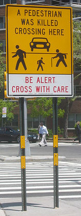
The 2013 citywide data on traffic fatalities is out, and a pair of number-crunching reports from street safety advocates confirm what New Yorkers know in their gut: Wide, car-centric streets are the most dangerous places to walk in New York City. Now, the question is whether Mayor Bill de Blasio will use the release of his Vision Zero strategy later this month to put the full power of his administration behind fixing the city's most dangerous streets.

"Arterial streets make up only 10 percent of our city's road network, but these multi-lane speedways are the site of more than half of pedestrian and cyclist fatalities," Transportation Alternatives Executive Director Paul Steely White said in a statement yesterday. TA crunched the recently-released 2013 numbers from NYPD, which showed that traffic violence claimed the lives of 286 New Yorkers and injured nearly 55,000. Pedestrians and cyclists accounted for 178 deaths and more than 16,000 injuries.
Last September, a TA poll [PDF] asked New Yorkers to identify the most dangerous street in their borough. The results aren't surprising: Queens Boulevard, Atlantic Avenue in Brooklyn, the Grand Concourse in the Bronx, Fifth and Sixth Avenues in Manhattan were the top suggestions. Last year, on these five roads alone, drivers killed 18 people and injured 2,671, including 305 cyclists and 762 pedestrians.
These numbers are up compared to 2012, when this selection of streets saw 51 fewer injuries and three fewer deaths. Other areas with high numbers of fatalities and injuries according to TA's analysis include 125th Street and 14th Street in Manhattan, Eastern Parkway in Brooklyn, and Broadway in Williamsburg.
Also today, the Tri-State Transportation Campaign released its annual report on the region’s most dangerous roads for walking, compiling federal data on pedestrian fatalities from 2010 to 2012. On top of the dangerous streets identified by TA’s analysis, Tri-State’s report highlights even more streets in the city that need life-saving safety measures.
On the six most dangerous roads in Brooklyn, a total of 27 pedestrians died over three years. In Queens, drivers on the four most dangerous roads killed 23 pedestrians. In the Bronx, 16 pedestrians died on the four most dangerous roads. These streets often appear on Streetsblog as sites of motor vehicle mayhem: Woodhaven Boulevard, Northern Boulevard, Flatbush Avenue, Ocean Parkway, Grand Concourse. The list goes on.
City Hall is probably well aware of the danger these streets pose. In its pedestrian safety action plan from 2010, DOT analyzed injury and fatality data and also found that the highest rates of traffic violence are concentrated on these major roads.
The de Blasio administration will have to overhaul these streets to achieve a major reduction in traffic injuries and deaths. The question is: Will the mayor devote enough resources and political capital to his transportation and police departments to move forward with the necessary street redesigns and enforcement?
In recent years, DOT has installed traffic calming measures on some of the city's deadliest multi-lane streets, including Fourth Avenue and Pennsylvania Avenue in Brooklyn and Adam Clayton Powell Jr. Boulevard in Manhattan. But last year’s rise in pedestrian deaths, especially in areas outside the city's core, shows that more needs to be done.
Big questions remain for DOT: Will it receive enough funding for the staff needed to plan with communities on major street redesign projects across the city? Will City Hall empower the DOT to implement projects, or will the agency continue to shrink from obstinate community board appointees? Will other city agencies like the Department of Design and Construction add bureaucratic hurdles or help streamline the process of building safer streets?
The enforcement component is also huge: Will Police Commissioner Bill Bratton push precincts to get over unproductive jaywalking blitzes and instead enforce violations, like speeding and failure to yield, that are actually killing and injuring New Yorkers? Will NYPD shift more resources to crash investigations and work with the city's district attorneys to ensure that reckless drivers face consequences for their actions?
It's worth noting that the number of deaths on these corridors could actually be higher than what advocates could glean from NYPD's information. "Numbers are likely underreported because of how the NYPD releases data," TA policy coordinator Alana Miller said in an e-mail. NYPD posts PDFs of data to its website without complete geographic data, so using software to collect and organize the information is unlikely to accurately translate all the location information. Street safety and open data advocates have long called on NYPD to release its data to the public in a standard format.


