Will Cuomo Botch the Sheridan Expressway Removal?
The state DOT’s initial concept for the Sheridan Expressway replacement would remain a wide, dangerous street designed mainly to move large trucks. Image: NY Governor’s Office
The Cuomo administration intends to decommission the Sheridan Expressway, which cuts off South Bronx neighborhoods from the Bronx River. But will it turn the Sheridan into a walkable street or a wide, rumbling arterial for trucks?
In March, Governor Cuomo announced his intention to move forward with the removal of the Sheridan, a lightly-trafficked, Moses-era highway that connects the Bruckner and the Cross-Bronx expressways. It was a breakthrough for South Bronx neighborhood groups that had fought for years to replace the Sheridan with housing and parks. A close look at the state DOT's initial concept for the Sheridan replacement, as well as the agency's track record on highway removals elsewhere in New York, shows that the fight's not over.
In Buffalo, for example, the Scajaquada Expressway is in the process of being converted into what the state DOT calls a lower-speed boulevard. But local residents who want safer walking and biking conditions in Delaware Park and the neighborhoods where the expressway runs say the state DOT's design doesn't go far enough. Without repurposing more space for active transportation, they say, car speeds will remain too high, pedestrian crossings too long, and bike connections too scarce.
Is the Cuomo administration's Sheridan removal heading down a similar path? The state DOT says the final plan is still a work in progress. However, there are already some red flags.
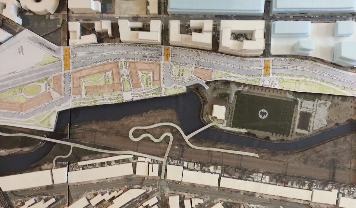
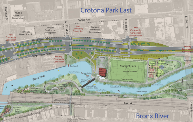
Removing the Sheridan is supposed to decrease the footprint of the roadway, opening up land for housing and providing neighborhood residents with safe access to the Bronx River waterfront. In its 2013 Sheridan Expressway Study, the NYC Department of City Planning put forward three scenarios, and its top choice called for integrating the Sheridan into the local street network, narrowing the right-of-way to 115 feet, adding crosswalks at East 173rd, East 172nd, and Jennings streets, and making targeted safety improvements at dangerous intersections.
The state DOT's conceptual design unveiled in March is much wider. It maintains the same number of travel lanes as the Sheridan, retaining West Farms Road and Edgewater Road as parallel side streets.
Why did New York State show a street design for its highway removal project that so closely resembles a highway, when elected officials and community organizations have called for a neighborhood-scale street? The answer appears to be related to the Hunts Point Market, one of the largest food distribution centers in the world.
For many years, Bronxites have complained about diesel trucks traveling through local neighborhoods, which have some of the highest asthma rates in the state, to reach the market. The city's 2013 study recommended constructing ramps at Oak Point/Leggett Avenue over a lightly-used rail yard, to connect the Bruckner Expressway directly to Hunts Point Market. The idea was to improve access between the Bruckner and the market, bypassing local streets and the Sheridan.
The Cuomo administration’s plan instead proposes ramps over Edgewater Road, which will connect to both the Bruckner and the Sheridan replacement.
This is important because it shows that the administration still sees "Sheridan Boulevard" as a truck access route for the market. While it would be a marginal improvement for Bronx residents who've campaigned for decades to get better access to parkland and the river, the new Sheridan's primary purpose would be the same as the old: to shuttle large, polluting trucks to and from the Hunts Point Market and connect them to the Cross-Bronx Expressway.
The state DOT says it will "develop a final plan that meets the needs of the community now and for the future." Neighborhood advocates are intently focused on the state's "lower level" environmental study for the Sheridan project, which is already underway. To deliver the safe neighborhood street network and reduction in truck traffic that local residents have been clamoring for, the Cuomo administration will have to make major changes to its plan.
Read More:
Stay in touch
Sign up for our free newsletter
More from Streetsblog New York City
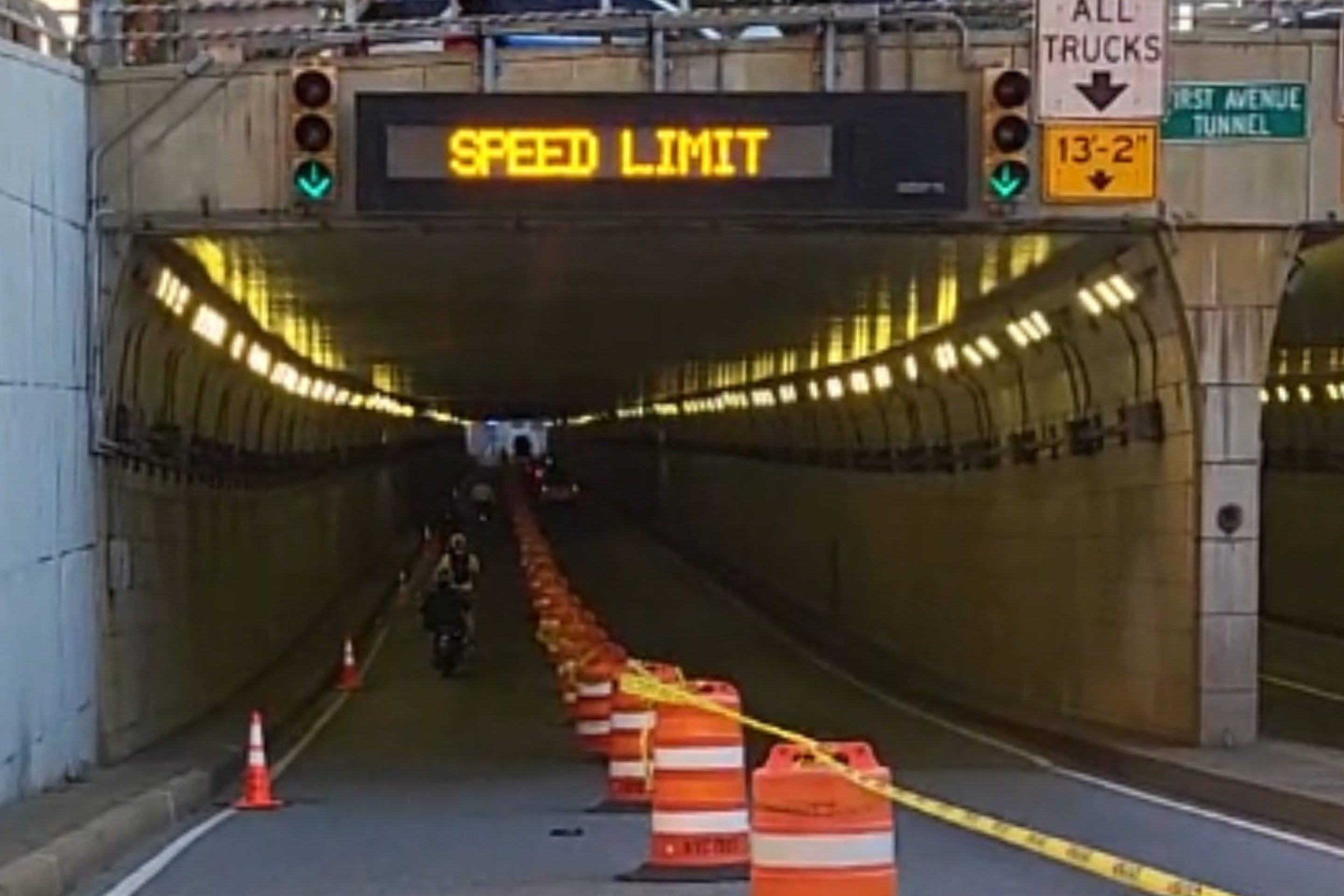
DOT Aims to Build First Ave. Tunnel Bike Lane Before September’s UN General Assembly
DOT hopes to have the concrete-protect tunnel bike lane installed this summer, but its exact plans are still in development.
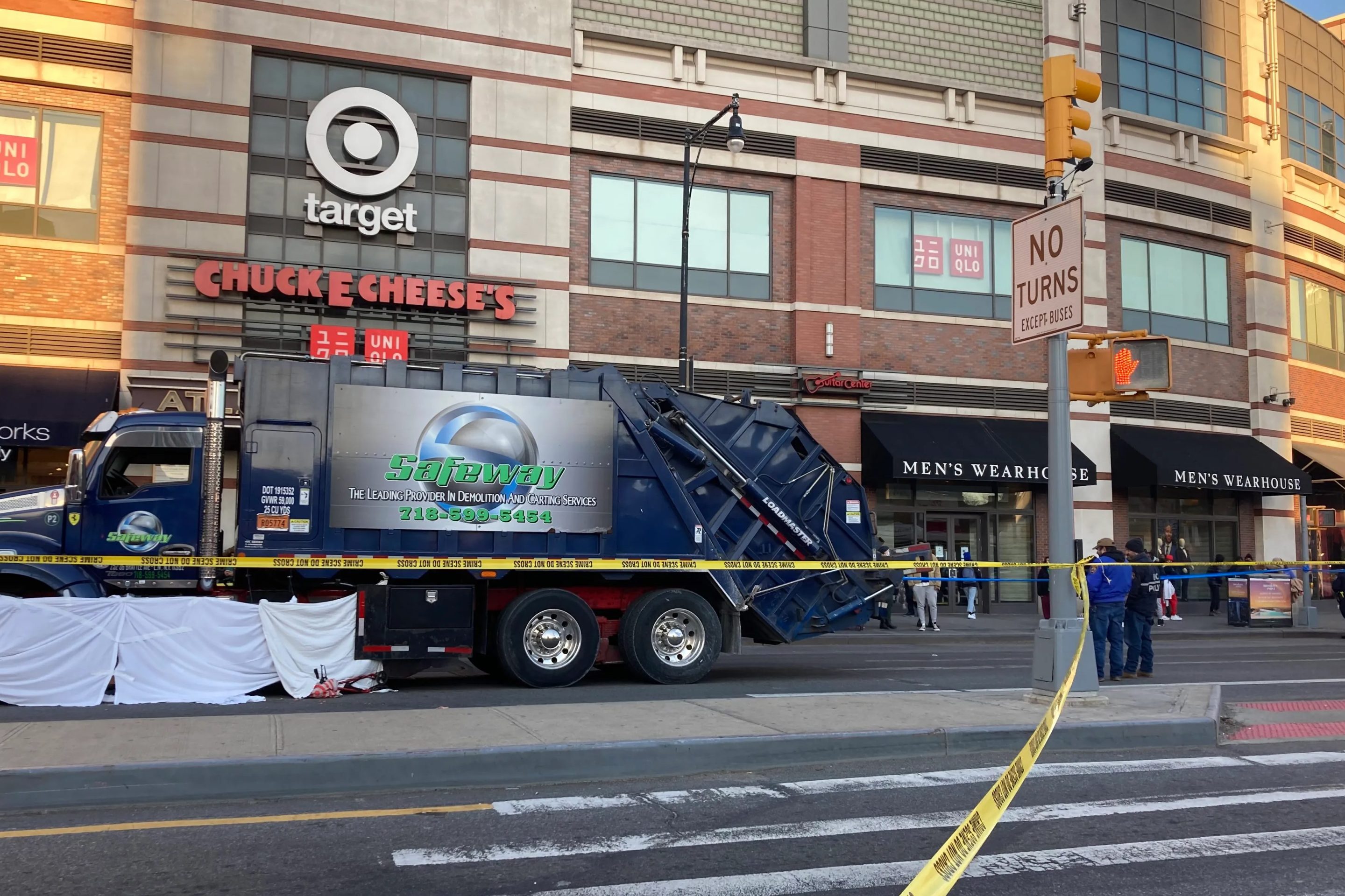
Waste Reforms Could Require Data on Crashes, Dangerous Driving
The proposal affects at least one trucking company with a deadly driving record.
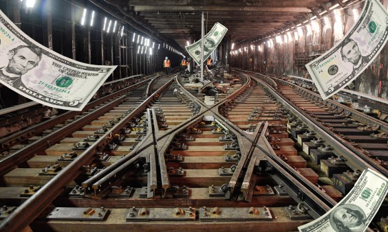
When it Comes to Federal Infrastructure Grants, Size Does Matter
Cities and municipalities with larger budgets and staff are more likely to win competitive federal infrastructure grants, the Urban Institute has found.
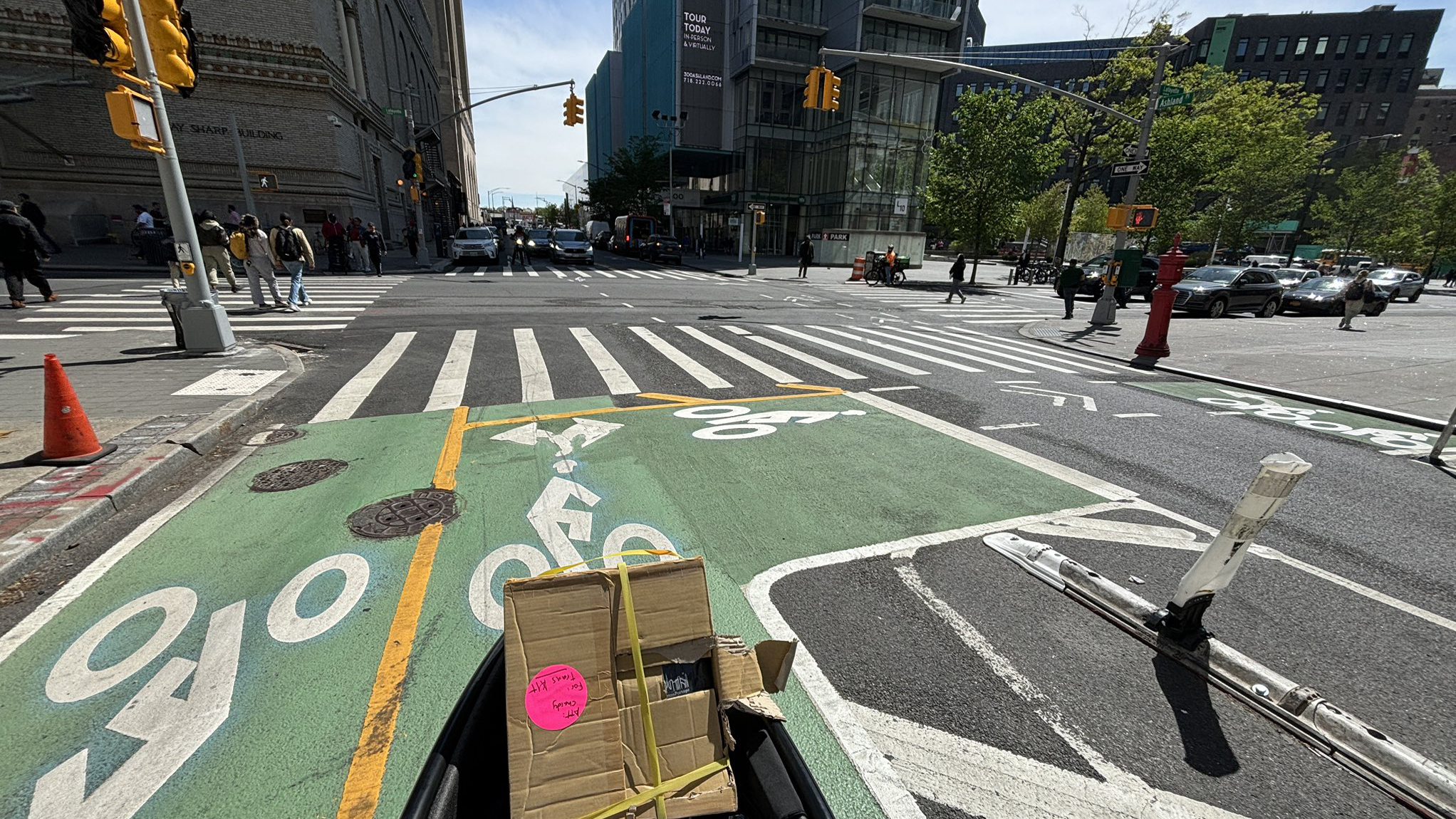
Tuesday’s Headlines: Real Estate Greed Against Good Bike Lane Design Edition
A real estate developer's opposition to the Ashland Place protected bike lane yields some baffling bike lane markings. Plus more news.
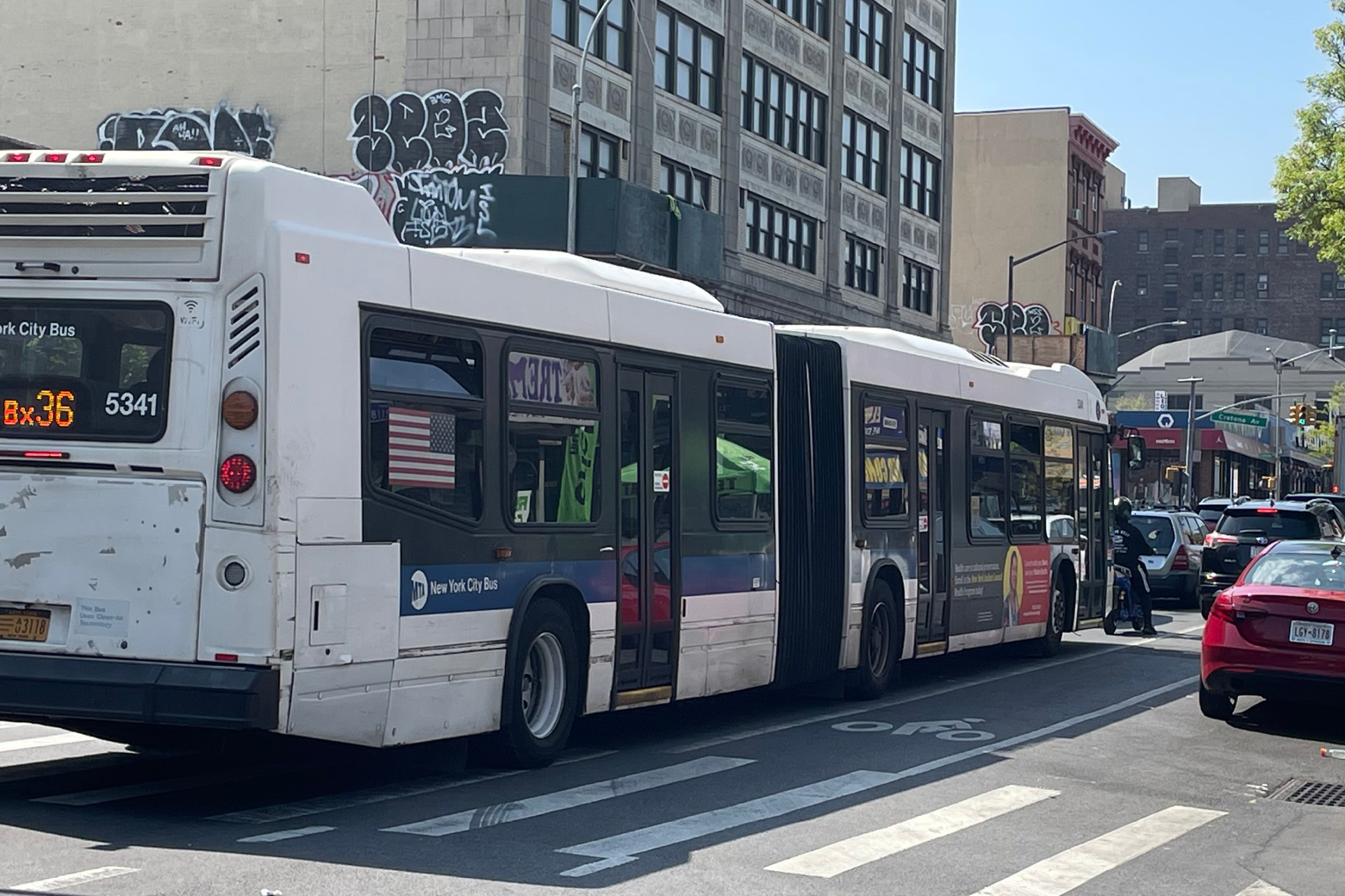
City Considers Fixes for Another Ridiculously Slow Cross-Bronx Bus
Potential bus improvements are on the table for the Bronx's Tremont Avenue, but the Adams administration's failures on nearby Fordham Road loom large.