Build it and they will run?
The protected bike lane on the roadbed of the Brooklyn Bridge is about to open, but the real news is what the Department of Transportation is doing just north of the bridge's Manhattan end — where a redesign of Foley Square has the potential to clean up one of the most notorious placard abuse zones in the city.
If the elite placard class abides by the changes, of course.
First, the background:
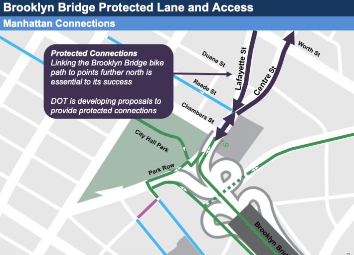
The DOT has long said that the Manhattan landing for Brooklyn Bridge bike path users would be a center-running bike path between the end of the bike lane and Chambers Street. But the agency left vague what cyclists would do if they wanted to continue northbound on Centre Street and into the maelstrom of Foley Square.
Original presentations from the spring [page 8 in this PDF] suggested that cyclists would be routed back to the east side of Centre Street (as pictured below):
But the facts are playing out differently on the ground. As our reporter (and several tipsters) noticed on Thursday, crews have almost completed a "porkchop" waiting zone for cyclists at the intersection of Centre and Chambers streets and have painted a bike lane up the west side of northbound Centre Street — an area that is marked "No standing," but is constantly filled with placard class scofflaws.
Let's break it all down:
Centre Street
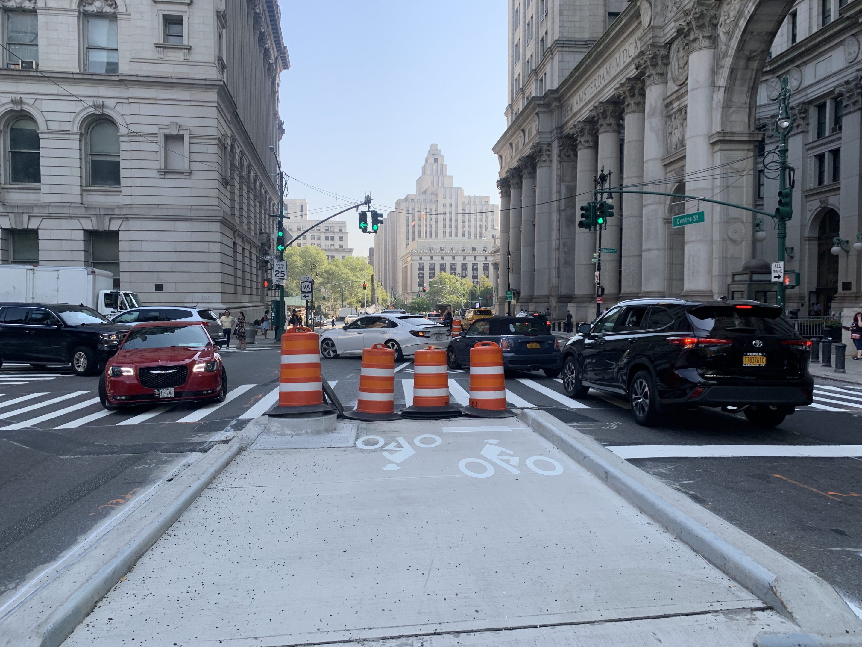
Here's the porkchop at Centre and Chambers streets from several angles, starting with the cyclists' experience after leaving the bridge bike path:
But there's one problem with the porkchop. Like any good DOT design, it's only as good as drivers' acceptance of it. In the case of Centre Street, the porkchop narrows the roadway (yay!), but also means that if a driver pulls to the "No standing" zone on the east side of Center between the bridge exit and Reade Street, the roadway goes from calm to dangerous, as this slideshow reveals:
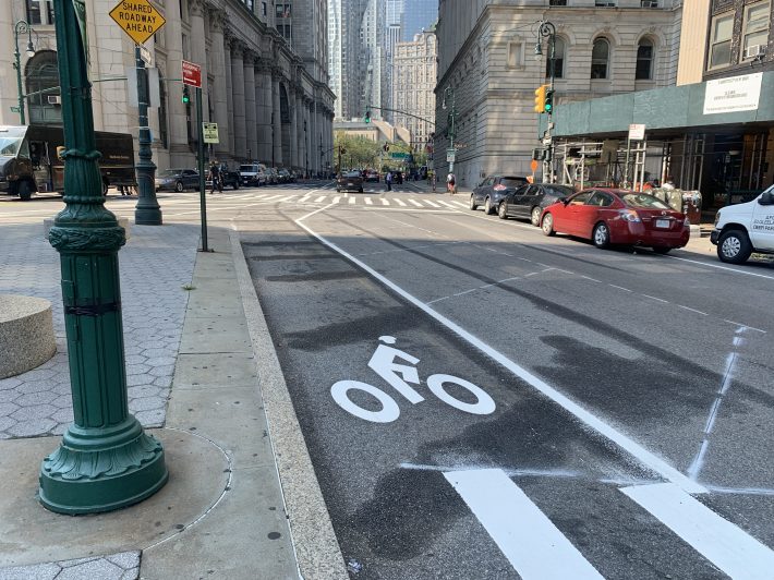
Here's the northbound protected bike lane taking shape on Centre Street:
Above Worth Street
Heading northbound up Centre Street, the Foley Square Placard Abuse Zone ends at Worth Street and becomes the Courthouse Official Placard Abuse Zone. The DOT presentation from the spring suggests that changes will continue north of Worth — it's in the document as "linking the Brooklyn Bridge bike path to points further north is essential to its success" — but for now, no new paint or lane markings are on the ground.
Both sides of Centre Street above Worth Street are placard abuse zones, with elite permit holders filling both curbside lanes. Double-parking is rampant and the roadway — a key link to the east-running bike lane on Grand Street and the Manhattan and Williamsburg bridges beyond it — is extremely unsafe. In 2020, there were 34 reported crashes just on the seven blocks of Centre Street between Worth and Grand streets, injuring 12 people.
Lafayette Street
Even bigger changes — in design and driver behavior — will have to come on Lafayette Street south of Worth Street, currently the West Foley Square Placard Abuse and Double Park Zone. Here's what the bike lane looked like today:
As you can see, there is effectively no bike lane on Lafayette Street, even though it is marked on the city's official bike map as the singular route to the Brooklyn Bridge from points north.
It is not entirely clear what the DOT's plans are for this segment of Lafayette. Just south of the placard abuse and double-park zone, workers have painted a new bike lane that leads south to the porkchop, but it is unclear if this sliver of safe space will be truly protected (currently, lines indicate some treatment is coming) or will itself become a placard abuse zone:
We reached out to DOT with some questions and will update this story if we get answers.