This fall, DOT and the MTA will unveil their plan to keep New Yorkers moving when the L train west of Bedford Avenue shuts down for repairs. Advocates are calling for on-street transitways, new bus service patterns, and safer bicycling conditions to make up for the loss of subway service across the East River and 14th Street.
But what if the L train went away and nothing took its place? A new mapping tool from Sidewalk Labs conveys how that would affect transit trips -- and, by implication, why a robust replacement plan is needed during the outage.
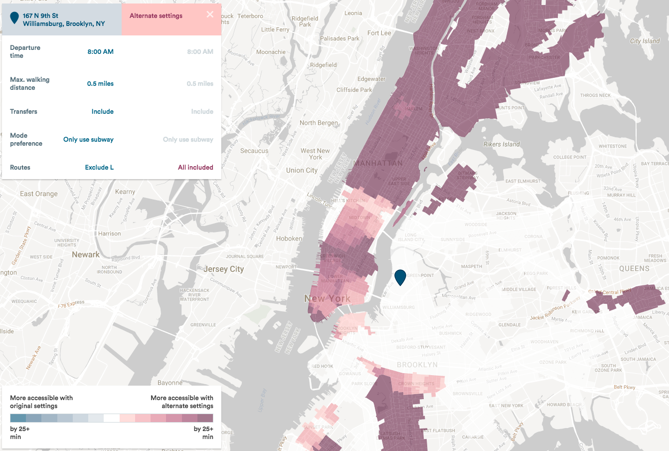
"NYC Transit Explorer" shows how far you can get via transit from any point in a given amount of time, as well as plan the fastest transit route between two places. It also includes an option to see how things change when you strip the western segment of the L train out of the system.
Here's the demo video explaining how to use it:
You can see just how wide-ranging the impact would be in Brooklyn. A City College student who lives near the Morgan Avenue L stop, for example, would see her trip to class increase from 53 minutes to 68 minutes. From Canarsie, getting to the East Side of Manhattan would take as much as 25 minutes longer.
Sidewalk Labs sees the map as a tool to convey the strengths and weaknesses of the transit system from any given location in the city.
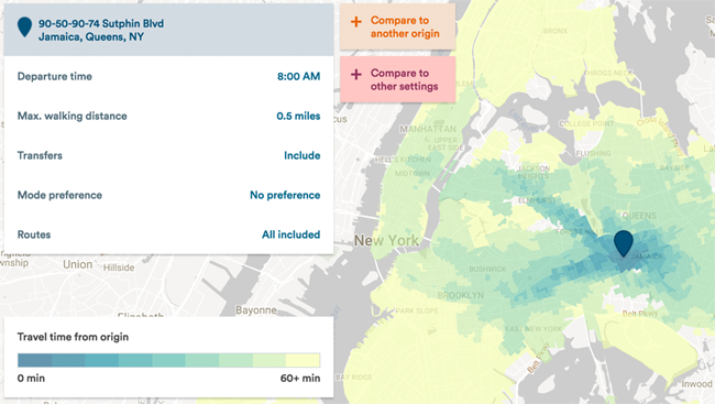
Drop a pin anywhere and see just how much of the city you can reach by transit in an hour or less. Here's the view from Jamaica:
"So many transit applications are built around this idea of getting you from point A to point B -- it’s all about getting to one place," said Dan Vanderkam, the software engineer who put the map together. "But the tools that people use typically don’t give you the system-wide picture that this visualization does."