Yesterday NYCDOT released the first Sustainable Streets Index [PDF], a scorecard to measure how well New York is progressing "towards achieving more sustainable mobility." This is the fruit of Local Law 23 (a.k.a. Intro 199), which passed earlier this year after former DOT Commissioner Iris Weinshall helped scuttle it at the end of her tenure.
The Times reported this weekend on the major conclusion of the report -- that the transit system absorbed the entire increase in travel within the city from 2003 to 2007. Vehicle traffic remained flat during that period, which saw the city gain 130,000 more residents and 200,000 more jobs. The report also notes that bicycling is the city's fastest growing mode, rising 70 percent since 2002.
While the Times wonders whether the leveling of car traffic argues against congestion pricing, the report provides a graphic representation of vehicle volumes straining against the limits of the street grid. It's a picture that should trouble legislators playing chicken with the MTA's finances and threatening to slash funds for the city's bike network. "Streets and bridges are saturated during peak travel times," says Transportation Alternatives director Paul White, who helped draft Intro 199. "What this
document does -- it lays the foundation for orchestrating a major modal shift further in the direction of transit, biking and
walking. The first step toward inducing that shift is measuring how people are getting around."
The index includes a raft of graphs charting ridership growth and vehicle traffic levels, and future versions will provide more robust measurements of bicycling and bus ridership:
The Sustainable Streets Index report will be expanded in three important ways next year, when NYCDOT will report:
- A new Citywide Traffic Index*, which will fill gaps in the public's current understanding of traffic levels,
- Performance indicators for key corridors where NYCDOT has made significant operational changes such as bike lanes and Bus Rapid Transit improvements, and
- Vehicle speeds determined using GPS technology.
*The Citywide Traffic Index will combine existing and new traffic counts to form a year-over-year time series that more precisely captures changes in travel patterns in the City. New traffic counts conducted for the Citywide Traffic Index will illuminate patterns of travel on streets and highways not currently measured.
Streetsblog put in a request with DOT to clarify what metrics would result from measuring vehicle speeds. According to the Times, the GPS units would be placed in cabs to determine vehicle speeds in Manhattan.
Stay in touch
Sign up for our free newsletter
More from Streetsblog New York City
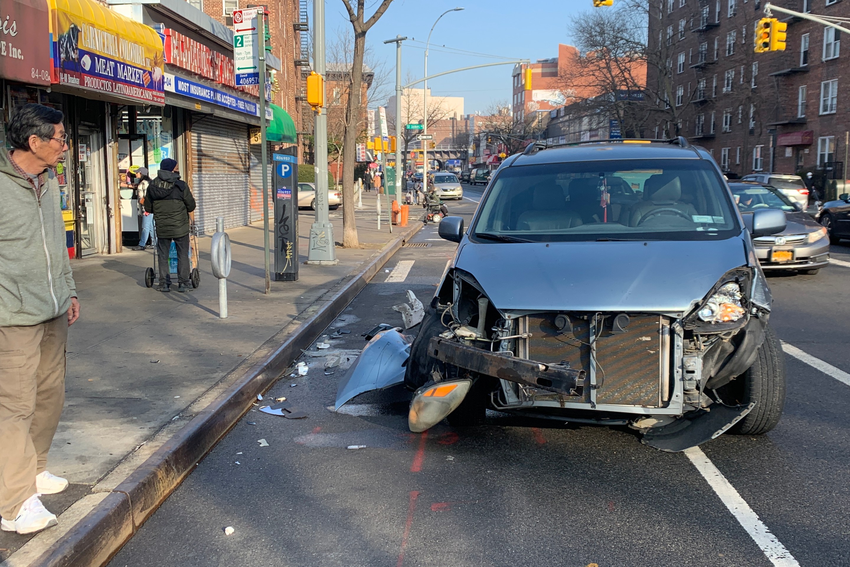
Report: Road Violence Hits Record in First Quarter of 2024
Sixty people died in the first three months of the year, 50 percent more than the first quarter of 2018, which was the safest opening three months of any Vision Zero year.
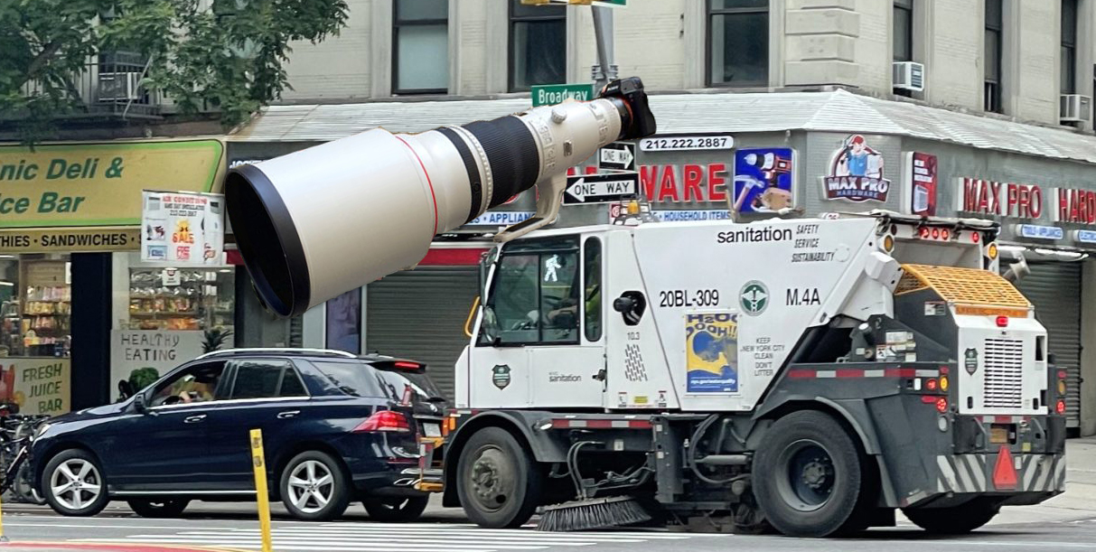
Street Sweepers Could Nab Illegal Parking Under State Bill
Smile for the street-sweeper!
Thursday’s Headlines: The Way of Water Edition
The "Blue Highways" campaign wants the mayor to convert a downtown heliport into a freight delivery hub. Plus more news.


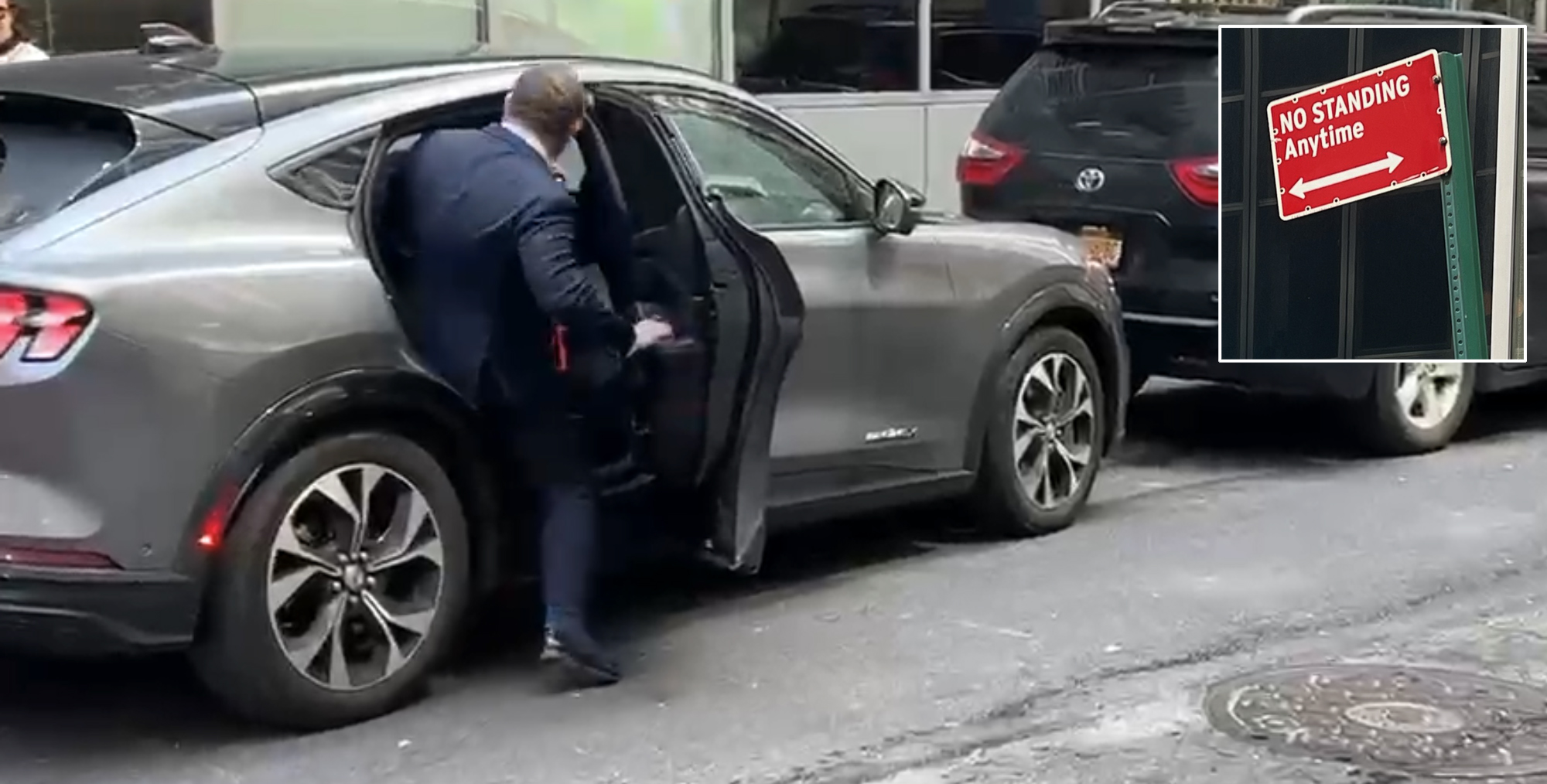
Gotcha-Heimer! Anti-Congestion Pricing Jersey Rep. With a City Speeding Ticket Drove to Manhattan on Wednesday
New Jersey's most vociferous opponent of congestion pricing parked illegally and once got a speeding ticket.